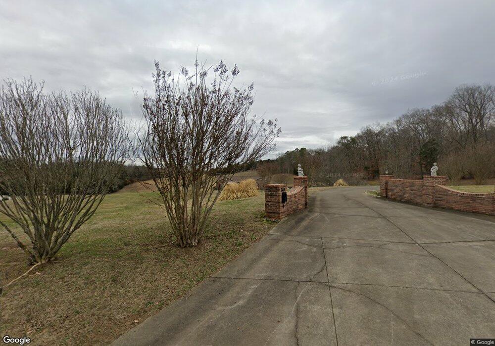
269 N Fork Branch Rd Rogersville, TN 37857
Estimated Value: $381,000 - $490,488
3
Beds
2
Baths
2,436
Sq Ft
$181/Sq Ft
Est. Value
About This Home
This home is located at 269 N Fork Branch Rd, Rogersville, TN 37857 and is currently estimated at $440,372, approximately $180 per square foot. 269 N Fork Branch Rd is a home located in Hawkins County with nearby schools including Bulls Gap School and Cherokee High School.
Ownership History
Date
Name
Owned For
Owner Type
Purchase Details
Closed on
Sep 10, 2010
Sold by
Trivette Mark A
Bought by
Jones Gary M
Current Estimated Value
Purchase Details
Closed on
Dec 29, 2004
Sold by
Kay and Nancy
Bought by
Michael Jones Gary and Michael Patricia
Purchase Details
Closed on
Aug 14, 2003
Sold by
Henry Drexwell W and Henry Edith S
Bought by
Jones Gary M
Home Financials for this Owner
Home Financials are based on the most recent Mortgage that was taken out on this home.
Original Mortgage
$107,000
Interest Rate
5.52%
Purchase Details
Closed on
Aug 18, 1998
Sold by
Arnott Samuel J and Arnott Margar
Bought by
Drexwell Henry
Purchase Details
Closed on
Jun 23, 1983
Bought by
Arnott Samuel J and Arnott Margar
Purchase Details
Closed on
Jan 31, 1975
Create a Home Valuation Report for This Property
The Home Valuation Report is an in-depth analysis detailing your home's value as well as a comparison with similar homes in the area
Home Values in the Area
Average Home Value in this Area
Purchase History
| Date | Buyer | Sale Price | Title Company |
|---|---|---|---|
| Jones Gary M | $29,900 | -- | |
| Michael Jones Gary | $23,000 | -- | |
| Jones Gary M | $162,000 | -- | |
| Drexwell Henry | $47,000 | -- | |
| Arnott Samuel J | -- | -- | |
| -- | -- | -- |
Source: Public Records
Mortgage History
| Date | Status | Borrower | Loan Amount |
|---|---|---|---|
| Previous Owner | Not Available | $107,000 |
Source: Public Records
Tax History Compared to Growth
Tax History
| Year | Tax Paid | Tax Assessment Tax Assessment Total Assessment is a certain percentage of the fair market value that is determined by local assessors to be the total taxable value of land and additions on the property. | Land | Improvement |
|---|---|---|---|---|
| 2024 | $2,519 | $98,600 | $10,375 | $88,225 |
| 2023 | $2,292 | $98,600 | $0 | $0 |
| 2022 | $2,285 | $98,600 | $10,375 | $88,225 |
| 2021 | $2,135 | $98,600 | $10,375 | $88,225 |
| 2020 | $1,908 | $98,500 | $10,375 | $88,125 |
| 2019 | $1,908 | $75,350 | $10,150 | $65,200 |
| 2018 | $1,908 | $75,350 | $10,150 | $65,200 |
| 2017 | $1,908 | $75,350 | $10,150 | $65,200 |
| 2016 | $1,908 | $75,350 | $10,150 | $65,200 |
| 2015 | $1,857 | $75,350 | $10,150 | $65,200 |
| 2014 | $1,570 | $63,675 | $8,950 | $54,725 |
Source: Public Records
Map
Nearby Homes
- 140 Roberts Rd
- 2586 Highway 66 S
- 334 S Fork Branch Rd
- 157 Chuck Rd
- Tbd Lashay Ln
- 299 Lauderback Gap Trail
- 104 Bacon Rd
- 403 Morningside Dr
- 000 Heck Hollow Rd
- Lot 1 Highway 70s
- Lot 2 Highway 70s
- Lot 3 Highway 70s
- Lot 4 Highway 70s
- 156 Reynolds Hills Dr
- Tbd Kite Rd
- 111 Poplar Dr
- 0 Seay Hollow Rd
- Tbd Seay Hollow Rd
- 887 Berry Rd
- Lot 2 Longtown Rd
- 233 N Fork Branch Rd
- 256 N Fork Branch Rd
- 0 N Fork Branch Rd
- 1b & 1c N Fork Branch Rd
- 301 N Fork Branch Rd
- 217 N Fork Branch Rd
- 200 N Fork Branch Rd
- 1102 Old Highway 66
- 1056 Old Highway 66
- 1054 Old Highway 66
- 300 N Fork Branch Rd
- 1122 Old Highway 66
- 1121 Old Highway 66
- 1061 Old Highway 66
- 1126 Old Highway 66
- 1057 Old Highway 66
- 1057 Old Hwy 66
- 189 N Fork Branch Rd
- 179 N Fork Branch Rd
- 1051 Old Highway 66
