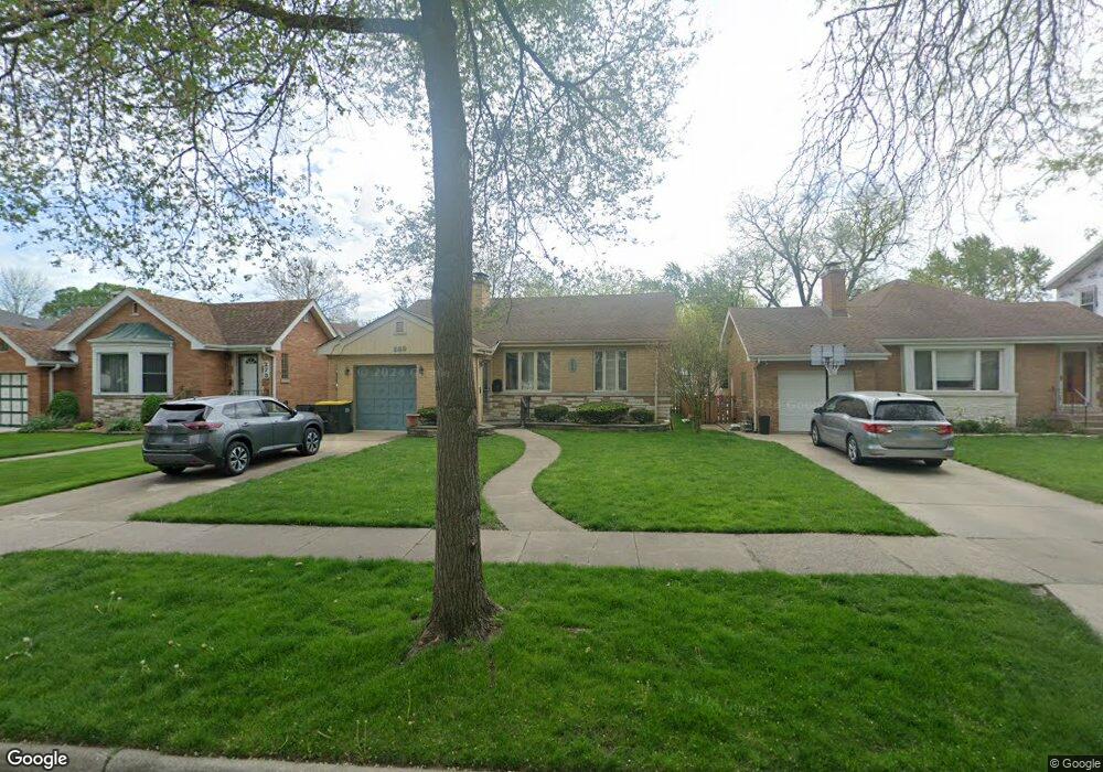
269 Olmsted Rd Riverside, IL 60546
Estimated Value: $433,000 - $537,000
2
Beds
2
Baths
1,047
Sq Ft
$440/Sq Ft
Est. Value
About This Home
This home is located at 269 Olmsted Rd, Riverside, IL 60546 and is currently estimated at $461,035, approximately $440 per square foot. 269 Olmsted Rd is a home located in Cook County with nearby schools including Central Elementary School, L J Hauser Jr High School, and Riverside Brookfield High School.
Ownership History
Date
Name
Owned For
Owner Type
Purchase Details
Closed on
Jul 30, 2002
Sold by
Curran Anthony B and Curran Madonna M
Bought by
Barbara L Egan Declaration Of Trust
Current Estimated Value
Purchase Details
Closed on
Jun 9, 1998
Sold by
First National Bank Of Evergreen Park
Bought by
Curran Anthony B and Curran Madonna M
Home Financials for this Owner
Home Financials are based on the most recent Mortgage that was taken out on this home.
Original Mortgage
$143,000
Interest Rate
7.22%
Purchase Details
Closed on
Mar 17, 1995
Sold by
Pinnacle Bank
Bought by
First National Bank Of Evergreen Park
Create a Home Valuation Report for This Property
The Home Valuation Report is an in-depth analysis detailing your home's value as well as a comparison with similar homes in the area
Home Values in the Area
Average Home Value in this Area
Purchase History
| Date | Buyer | Sale Price | Title Company |
|---|---|---|---|
| Barbara L Egan Declaration Of Trust | $300,000 | -- | |
| Curran Anthony B | $185,000 | -- | |
| First National Bank Of Evergreen Park | -- | -- |
Source: Public Records
Mortgage History
| Date | Status | Borrower | Loan Amount |
|---|---|---|---|
| Previous Owner | Curran Anthony B | $143,000 |
Source: Public Records
Tax History
| Year | Tax Paid | Tax Assessment Tax Assessment Total Assessment is a certain percentage of the fair market value that is determined by local assessors to be the total taxable value of land and additions on the property. | Land | Improvement |
|---|---|---|---|---|
| 2025 | $9,608 | $36,000 | $8,141 | $27,859 |
| 2024 | $9,608 | $36,000 | $8,141 | $27,859 |
| 2023 | $8,239 | $36,000 | $8,141 | $27,859 |
| 2022 | $8,239 | $27,666 | $7,123 | $20,543 |
| 2021 | $7,976 | $27,666 | $7,123 | $20,543 |
| 2020 | $8,449 | $29,319 | $7,123 | $22,196 |
| 2019 | $4,847 | $19,945 | $6,512 | $13,433 |
| 2018 | $4,701 | $19,945 | $6,512 | $13,433 |
| 2017 | $4,585 | $19,945 | $6,512 | $13,433 |
| 2016 | $5,171 | $18,963 | $5,698 | $13,265 |
| 2015 | $4,978 | $18,963 | $5,698 | $13,265 |
| 2014 | $5,636 | $21,068 | $5,698 | $15,370 |
| 2013 | $5,630 | $22,555 | $5,698 | $16,857 |
Source: Public Records
Map
Nearby Homes
- 280 Blackhawk Rd
- 248 Gage Rd
- 303 Lionel Rd
- 262 Lionel Rd
- 176 Riverside Rd
- 7336 39th St
- 7330 39th St
- 7335 Oakwood Ave Unit P-10
- 7335 Oakwood Ave Unit P-12
- 7335 Oakwood Ave Unit P-8
- 7335 Oakwood Ave Unit P-11
- 7335 Oakwood Ave Unit P-14
- 7316 40th St Unit 2E
- 7316 40th St Unit P-9
- 7316 40th St Unit P-10
- 7316 40th St Unit P-13
- 7048 35th St
- 3829 Wisconsin Ave
- 269 Shenstone Rd
- 7032 Pershing Rd
- 273 Olmsted Rd
- 265 Olmsted Rd
- 277 Olmsted Rd
- 259 Olmsted Rd
- 261 Olmsted Rd
- 281 Olmsted Rd
- 296 Blackhawk Rd
- 292 Blackhawk Rd
- 300 Blackhawk Rd
- 285 Olmsted Rd
- 288 Blackhawk Rd
- 304 Blackhawk Rd
- 284 Blackhawk Rd
- 289 Olmsted Rd
- 268 Olmsted Rd
- 264 Olmsted Rd
- 260 Olmsted Rd
- 272 Olmsted Rd
- 308 Blackhawk Rd
- 256 Olmsted Rd
Your Personal Tour Guide
Ask me questions while you tour the home.