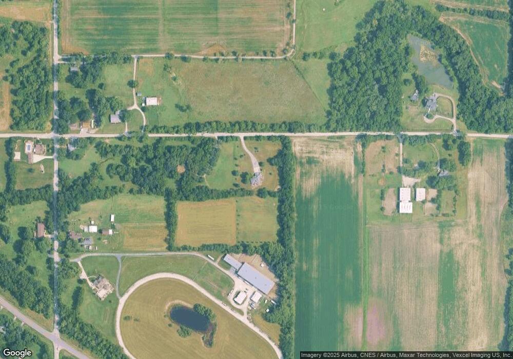
2695 E 129th Ave Crown Point, IN 46307
Leroy NeighborhoodEstimated Value: $488,000 - $599,000
4
Beds
3
Baths
2,398
Sq Ft
$230/Sq Ft
Est. Value
About This Home
This home is located at 2695 E 129th Ave, Crown Point, IN 46307 and is currently estimated at $551,663, approximately $230 per square foot. 2695 E 129th Ave is a home located in Lake County with nearby schools including Winfield Elementary School, Colonel John Wheeler Middle School, and Crown Point High School.
Ownership History
Date
Name
Owned For
Owner Type
Purchase Details
Closed on
Jan 20, 2023
Sold by
Matthew And Sheri Bruder Trust and Bruder Matthew W
Bought by
Bruder Matthew W and Bruder Sheri M
Current Estimated Value
Purchase Details
Closed on
Jan 17, 2023
Sold by
Matthew And Sheri Bruder Trust
Bought by
Bruder Matthew W and Bruder Sheri M
Purchase Details
Closed on
Jun 20, 2022
Sold by
Glenn E Halsey Trust
Bought by
Rizzo Karen Lee and Halsey Gregory G
Purchase Details
Closed on
May 13, 2013
Sold by
Bruder Matthew W and Bruder Sheri M
Bought by
Bruder Matthew W and Bruder Sherri M
Purchase Details
Closed on
Nov 27, 2012
Sold by
Bruder Matthew W and Bruder Sheri M
Bought by
Bruder Matthew W and Bruder Sheri M
Create a Home Valuation Report for This Property
The Home Valuation Report is an in-depth analysis detailing your home's value as well as a comparison with similar homes in the area
Home Values in the Area
Average Home Value in this Area
Purchase History
| Date | Buyer | Sale Price | Title Company |
|---|---|---|---|
| Bruder Matthew W | -- | None Listed On Document | |
| Bruder Matthew W | -- | -- | |
| Rizzo Karen Lee | -- | Stamper Peggy Jo | |
| Bruder Matthew W | -- | None Available | |
| Bruder Matthew W | -- | None Available |
Source: Public Records
Tax History
| Year | Tax Paid | Tax Assessment Tax Assessment Total Assessment is a certain percentage of the fair market value that is determined by local assessors to be the total taxable value of land and additions on the property. | Land | Improvement |
|---|---|---|---|---|
| 2025 | $4,610 | $545,500 | $41,200 | $504,300 |
| 2024 | $4,610 | $511,600 | $41,700 | $469,900 |
| 2023 | $4,566 | $461,900 | $40,600 | $421,300 |
| 2022 | $4,566 | $423,500 | $39,400 | $384,100 |
| 2021 | $4,346 | $422,900 | $38,800 | $384,100 |
| 2020 | $4,490 | $414,800 | $38,800 | $376,000 |
| 2019 | $4,447 | $402,200 | $39,600 | $362,600 |
| 2018 | $4,525 | $388,500 | $39,700 | $348,800 |
| 2017 | $4,364 | $371,700 | $40,400 | $331,300 |
| 2016 | $3,921 | $336,000 | $27,300 | $308,700 |
| 2014 | $3,492 | $321,900 | $27,500 | $294,400 |
| 2013 | $3,653 | $335,000 | $26,700 | $308,300 |
Source: Public Records
Map
Nearby Homes
- 13133 Carolina St
- 13125 Carolina St
- 13080 Carolina St
- 557 E 130th Ln
- 13089 Carolina St
- 13091 Carolina St
- 499 E 131st Place
- T-1356 Wyatt Plan at The Willows - Townhomes
- T-1415 Adler Plan at The Willows - Townhomes
- T-1647 Wren Plan at The Willows - Townhomes
- T-1356 Piper Plan at The Willows - Townhomes
- 12929 Delaware St
- 13115 Carolina St
- 13117 Carolina St
- 13070 Carolina St
- 7382 Brookhaven Dr
- 12617 Pennsylvania Place
- 11032 Lola Ln
- 2240 E 110th Ln
- Norfolk Plan at The Fountains
- 3001 E 129th Ave
- 12921 Iowa St
- 2520 E 129th Ave
- 12907 Iowa St
- 12829 Iowa St
- 12935 Iowa St
- 3019 E 129th Ave
- 3020 E 129th Ave
- 12817 Iowa St
- 12910 Iowa St
- 12920 Iowa St
- 12801 Iowa St
- 13112 Iowa St
- 3303 E 129th Ave
- 2227 E State Road 231
- 2221 E State Road 231
- 13118 Iowa St
- 2651 E State Road 231
- 2651 E St Rd 231
- 2209 E State Road 231
Your Personal Tour Guide
Ask me questions while you tour the home.
