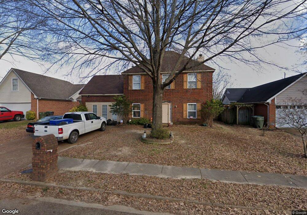
2696 Sage Meadow Dr Memphis, TN 38133
Estimated Value: $206,000 - $282,000
3
Beds
3
Baths
2,472
Sq Ft
$103/Sq Ft
Est. Value
About This Home
This home is located at 2696 Sage Meadow Dr, Memphis, TN 38133 and is currently estimated at $254,552, approximately $102 per square foot. 2696 Sage Meadow Dr is a home located in Shelby County with nearby schools including Kate Bond Elementary School, Kate Bond Middle School, and Cordova High School.
Ownership History
Date
Name
Owned For
Owner Type
Purchase Details
Closed on
Mar 11, 2014
Sold by
Brown Steve A and Brown Candela N
Bought by
Southern Property Investors
Current Estimated Value
Home Financials for this Owner
Home Financials are based on the most recent Mortgage that was taken out on this home.
Original Mortgage
$107,350
Outstanding Balance
$56,491
Interest Rate
4.3%
Mortgage Type
New Conventional
Estimated Equity
$198,061
Purchase Details
Closed on
Feb 11, 2014
Sold by
Brown Steve A and Brown Candela N
Bought by
Brown Steve A and Brown Candela N
Home Financials for this Owner
Home Financials are based on the most recent Mortgage that was taken out on this home.
Original Mortgage
$107,350
Outstanding Balance
$56,491
Interest Rate
4.3%
Mortgage Type
New Conventional
Estimated Equity
$198,061
Purchase Details
Closed on
Mar 31, 2010
Sold by
Brown Steve A and Brown Candela N
Bought by
Southern Property Investors
Purchase Details
Closed on
Mar 12, 2007
Sold by
Jpmorgan Chase Bank
Bought by
Brown Steve A and Brown Candella N
Home Financials for this Owner
Home Financials are based on the most recent Mortgage that was taken out on this home.
Original Mortgage
$95,000
Interest Rate
6.27%
Mortgage Type
Commercial
Purchase Details
Closed on
Aug 3, 2006
Sold by
Bland Katrina J and Bland Thomas K
Bought by
Jpmorgan Chase Bank
Purchase Details
Closed on
Jan 23, 2003
Sold by
Bland Katrina J and Bland Thomas K
Bought by
Jp Morgan Bank
Purchase Details
Closed on
Jul 31, 2002
Sold by
Miller John B and Miller Tonji T Pearson
Bought by
Bland Katrina J
Home Financials for this Owner
Home Financials are based on the most recent Mortgage that was taken out on this home.
Original Mortgage
$88,200
Interest Rate
8.62%
Purchase Details
Closed on
Jul 10, 1997
Sold by
Washam Michael W
Bought by
Miller John B and Pearson Tonji T
Home Financials for this Owner
Home Financials are based on the most recent Mortgage that was taken out on this home.
Original Mortgage
$100,421
Interest Rate
7.98%
Mortgage Type
FHA
Create a Home Valuation Report for This Property
The Home Valuation Report is an in-depth analysis detailing your home's value as well as a comparison with similar homes in the area
Home Values in the Area
Average Home Value in this Area
Purchase History
| Date | Buyer | Sale Price | Title Company |
|---|---|---|---|
| Southern Property Investors | -- | Edco Title & Closing Svcs In | |
| Brown Steve A | -- | Multiple | |
| Southern Property Investors | -- | Edco Title & Closing Service | |
| Brown Steve A | $92,000 | Resource Title Agency Of Tn | |
| Jpmorgan Chase Bank | $107,953 | None Available | |
| Jp Morgan Bank | $73,623 | -- | |
| Bland Katrina J | $126,000 | First American Title | |
| Miller John B | $99,900 | -- |
Source: Public Records
Mortgage History
| Date | Status | Borrower | Loan Amount |
|---|---|---|---|
| Open | Brown Steve A | $107,350 | |
| Previous Owner | Brown Steve A | $95,000 | |
| Previous Owner | Bland Katrina J | $88,200 | |
| Previous Owner | Miller John B | $100,421 |
Source: Public Records
Tax History Compared to Growth
Tax History
| Year | Tax Paid | Tax Assessment Tax Assessment Total Assessment is a certain percentage of the fair market value that is determined by local assessors to be the total taxable value of land and additions on the property. | Land | Improvement |
|---|---|---|---|---|
| 2025 | $1,590 | $71,525 | $8,750 | $62,775 |
| 2024 | $1,590 | $46,900 | $6,875 | $40,025 |
| 2023 | $2,857 | $46,900 | $6,875 | $40,025 |
| 2022 | $2,857 | $46,900 | $6,875 | $40,025 |
| 2021 | $2,890 | $46,900 | $6,875 | $40,025 |
| 2020 | $1,888 | $26,050 | $6,875 | $19,175 |
| 2019 | $1,888 | $26,050 | $6,875 | $19,175 |
| 2018 | $1,888 | $26,050 | $6,875 | $19,175 |
| 2017 | $1,071 | $26,050 | $6,875 | $19,175 |
| 2016 | $1,268 | $29,025 | $0 | $0 |
| 2014 | $1,268 | $29,025 | $0 | $0 |
Source: Public Records
Map
Nearby Homes
- 7685 Crystal Brook Cove
- 7551 Meadowland Dr
- 2412 Kate Bond Rd
- 2718 Kate Bond Rd
- 7828 Deerfield Trace
- 7723 Reese Rd
- 2554 Appling Glen Dr
- 2566 Austin Green Bay
- 2789 Arbor Lane Dr
- 2739 Lakeside Dr
- 2376 Pate Rd
- 6898 Talcott Ln
- 6878 Johnstown Ln
- 3116 Mannington Ln
- 2633 Sleepy Bend Cove
- BERRYHILL Rd
- 2518 Bassfield Dr
- 7183 Polder Dr
- 7374 U S Highway 64
- 3010 Santa Valley St
- 2704 Sage Meadow Dr
- 2688 Sage Meadow Dr
- 2684 Sage Meadow Dr
- 2710 Sage Meadow Dr
- 2695 Sage Meadow Dr
- 2703 Sage Meadow Dr
- 2689 Sage Meadow Dr
- 2676 Sage Meadow Dr
- 2716 Sage Meadow Dr
- 2709 Sage Meadow Dr
- 2683 Sage Meadow Dr
- 2717 Sage Meadow Dr
- 2679 Sage Meadow Dr
- 2670 Sage Meadow Dr
- 2722 Sage Meadow Dr
- 2741 Laurelcrest Cove
- 2738 Laurelcrest Cove
- 2723 Sage Meadow Dr
- 2673 Sage Meadow Dr
- 7630 Valley Mist Cove