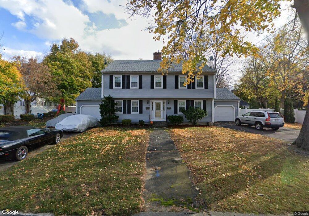
27 Ashland St Haverhill, MA 01830
Highlands NeighborhoodEstimated Value: $333,423 - $382,000
2
Beds
2
Baths
1,454
Sq Ft
$246/Sq Ft
Est. Value
About This Home
This home is located at 27 Ashland St, Haverhill, MA 01830 and is currently estimated at $358,356, approximately $246 per square foot. 27 Ashland St is a home located in Essex County with nearby schools including Dr. Paul Nettle Middle School.
Ownership History
Date
Name
Owned For
Owner Type
Purchase Details
Closed on
Dec 1, 1994
Sold by
Caruso Philip M and Caruso Theresa A
Bought by
Krocker Joseph M
Current Estimated Value
Purchase Details
Closed on
Oct 12, 1989
Sold by
Pineau Raymond
Bought by
Caruso Philip
Create a Home Valuation Report for This Property
The Home Valuation Report is an in-depth analysis detailing your home's value as well as a comparison with similar homes in the area
Home Values in the Area
Average Home Value in this Area
Purchase History
| Date | Buyer | Sale Price | Title Company |
|---|---|---|---|
| Krocker Joseph M | $62,000 | -- | |
| Caruso Philip | $126,000 | -- |
Source: Public Records
Mortgage History
| Date | Status | Borrower | Loan Amount |
|---|---|---|---|
| Open | Caruso Philip | $96,500 | |
| Closed | Caruso Philip | $139,000 | |
| Closed | Caruso Philip | $29,000 |
Source: Public Records
Tax History Compared to Growth
Tax History
| Year | Tax Paid | Tax Assessment Tax Assessment Total Assessment is a certain percentage of the fair market value that is determined by local assessors to be the total taxable value of land and additions on the property. | Land | Improvement |
|---|---|---|---|---|
| 2025 | $2,679 | $250,100 | $0 | $250,100 |
| 2024 | $2,439 | $229,200 | $0 | $229,200 |
| 2023 | $2,247 | $201,500 | $0 | $201,500 |
| 2022 | $2,236 | $175,800 | $0 | $175,800 |
| 2021 | $1,974 | $146,900 | $0 | $146,900 |
| 2020 | $1,813 | $133,300 | $0 | $133,300 |
| 2019 | $1,737 | $124,500 | $0 | $124,500 |
| 2018 | $1,717 | $120,400 | $0 | $120,400 |
| 2017 | $1,559 | $104,000 | $0 | $104,000 |
| 2016 | $1,597 | $104,000 | $0 | $104,000 |
| 2015 | $1,616 | $105,300 | $0 | $105,300 |
Source: Public Records
Map
Nearby Homes
- 20 Ashland St
- 7 Clinton St Unit 4
- 23 Arlington St
- 17 Arlington St
- 13-15 Arlington St
- 27 Webster St
- 8 Bartlett Ave Unit 5
- 48 Portland St
- 25 Portland St
- 16 Fountain St
- 17 Vine St
- 16 Dudley St
- 25-27 Dover St
- 4 Michael Anthony Rd
- 2 Michael Anthony Rd
- 8 Dustin St
- 151 Franklin St
- 34 7th Ave
- 5 Kimball St
- 192 Franklin St
- 25 Ashland St
- 31-33 Ashland Street 3
- 31 Ashland St Unit 6
- 31 Ashland St Unit 4
- 31 Ashland St Unit 1
- 31 Ashland St Unit 2
- 31 Ashland St Unit 1-33
- 31 Ashland St Unit 3
- 31 Ashland St Unit 3R
- 31 Ashland St Unit 7
- 20 Ashland St Unit 1
- 44 Arlington St
- 40 Arlington St
- 48 Arlington St Unit B
- 48 Arlington St Unit A
- 48 Arlington St Unit 48B
- 42 Arlington St
- 34 Arlington St
- 46 Arlington St Unit B
- 46 Arlington St Unit A