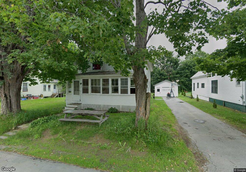
27 Baker St Bingham, ME 04920
Estimated Value: $114,757 - $168,000
3
Beds
1
Bath
1,131
Sq Ft
$130/Sq Ft
Est. Value
About This Home
This home is located at 27 Baker St, Bingham, ME 04920 and is currently estimated at $146,939, approximately $129 per square foot. 27 Baker St is a home located in Somerset County with nearby schools including Moscow Elementary School, Quimby Middle School, and Upper Kennebec Valley Middle / Senior High School.
Ownership History
Date
Name
Owned For
Owner Type
Purchase Details
Closed on
Apr 25, 2008
Sold by
Us Bank Na
Bought by
Cirell James
Current Estimated Value
Purchase Details
Closed on
Jun 9, 2005
Sold by
Newton Donald E and Newton Linda M
Bought by
Mayhew Isaac
Home Financials for this Owner
Home Financials are based on the most recent Mortgage that was taken out on this home.
Original Mortgage
$63,935
Outstanding Balance
$36,936
Interest Rate
8%
Mortgage Type
Commercial
Estimated Equity
$110,003
Create a Home Valuation Report for This Property
The Home Valuation Report is an in-depth analysis detailing your home's value as well as a comparison with similar homes in the area
Purchase History
| Date | Buyer | Sale Price | Title Company |
|---|---|---|---|
| Cirell James | -- | -- | |
| Mayhew Isaac | -- | -- |
Source: Public Records
Mortgage History
| Date | Status | Borrower | Loan Amount |
|---|---|---|---|
| Open | Mayhew Isaac | $63,935 |
Source: Public Records
Tax History
| Year | Tax Paid | Tax Assessment Tax Assessment Total Assessment is a certain percentage of the fair market value that is determined by local assessors to be the total taxable value of land and additions on the property. | Land | Improvement |
|---|---|---|---|---|
| 2025 | $1,414 | $128,590 | $13,500 | $115,090 |
| 2024 | $1,391 | $131,250 | $13,500 | $117,750 |
| 2021 | $1,002 | $57,610 | $10,600 | $47,010 |
| 2020 | $1,391 | $57,610 | $10,600 | $47,010 |
| 2019 | $939 | $57,610 | $10,600 | $47,010 |
| 2018 | $939 | $57,610 | $10,600 | $47,010 |
| 2017 | $922 | $57,610 | $10,600 | $47,010 |
| 2016 | $1,008 | $57,610 | $10,600 | $47,010 |
| 2015 | $1,187 | $57,610 | $10,600 | $47,010 |
| 2014 | $1,210 | $57,610 | $10,600 | $47,010 |
| 2013 | $1,164 | $57,610 | $10,600 | $47,010 |
Source: Public Records
Map
Nearby Homes
- 317 Main St
- 12 Preble St
- 9 Collins St
- 11 Collins St
- 262 Main St
- 000 Pleasant Ridge Rd Unit Parcel C
- 7 James St
- 44 Murray St
- Pleasant Ridge Road Unit: Parcel C
- 21 Bluff Rd
- 203 Main St
- 2 Durgin St
- 86 Canada Rd
- 90 Canada Rd
- 2416 Kennebec River Rd
- 90 Cassidy Rd
- 025-026
- 256 Jackson Pond Rd
- 515 Stream Rd
- lot 3 Maine 16
Your Personal Tour Guide
Ask me questions while you tour the home.