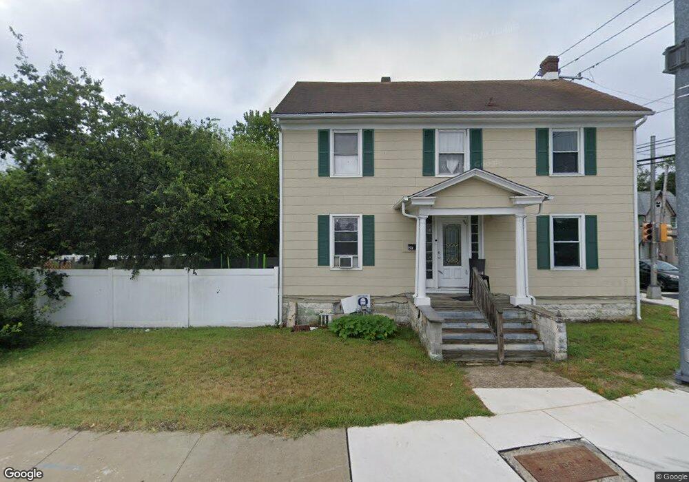
27 Boulevard Route 50 Mays Landing, NJ 08330
Estimated Value: $218,000 - $382,000
--
Bed
--
Bath
1,888
Sq Ft
$147/Sq Ft
Est. Value
About This Home
This home is located at 27 Boulevard Route 50, Mays Landing, NJ 08330 and is currently estimated at $277,599, approximately $147 per square foot. 27 Boulevard Route 50 is a home located in Atlantic County with nearby schools including Joseph Shaner School, George L. Hess Educational Complex, and William Davies Middle School.
Ownership History
Date
Name
Owned For
Owner Type
Purchase Details
Closed on
Jan 1, 2013
Sold by
Kneble Frederick J and Kneble Nancy L
Bought by
Kneble Frederick J and Kneble Nancy L
Current Estimated Value
Purchase Details
Closed on
Jan 16, 2004
Sold by
Frederiksen Eric F and Fredericksen Caroline
Bought by
Andreadis Nick and Andreadis Frances
Purchase Details
Closed on
Oct 26, 1995
Sold by
Federal National Mortgage Association
Bought by
Kneble Frederick and Kneble Nancy
Purchase Details
Closed on
Jun 29, 1995
Sold by
Mcgettigan James
Bought by
Federal National Mortgage Association
Purchase Details
Closed on
Jan 15, 1991
Sold by
Tunney Tunney C and Tunney Barry,Mary
Bought by
Fischback Carl
Purchase Details
Closed on
Oct 27, 1988
Sold by
New Jersey State Of Dpt Transporttn
Bought by
Tunney Tunney C and Tunney Barry,Mary
Create a Home Valuation Report for This Property
The Home Valuation Report is an in-depth analysis detailing your home's value as well as a comparison with similar homes in the area
Home Values in the Area
Average Home Value in this Area
Purchase History
| Date | Buyer | Sale Price | Title Company |
|---|---|---|---|
| Kneble Frederick J | -- | None Available | |
| Andreadis Nick | $189,000 | Fidelity National Title | |
| Kneble Frederick | $61,400 | -- | |
| Federal National Mortgage Association | -- | -- | |
| Fischback Carl | $65,000 | -- | |
| Tunney Tunney C | $300 | -- |
Source: Public Records
Tax History Compared to Growth
Tax History
| Year | Tax Paid | Tax Assessment Tax Assessment Total Assessment is a certain percentage of the fair market value that is determined by local assessors to be the total taxable value of land and additions on the property. | Land | Improvement |
|---|---|---|---|---|
| 2025 | $3,994 | $116,400 | $31,800 | $84,600 |
| 2024 | $3,994 | $116,400 | $31,800 | $84,600 |
| 2023 | $3,755 | $116,400 | $31,800 | $84,600 |
| 2022 | $3,755 | $116,400 | $31,800 | $84,600 |
| 2021 | $3,747 | $116,400 | $31,800 | $84,600 |
| 2020 | $3,747 | $116,400 | $31,800 | $84,600 |
| 2019 | $3,756 | $116,400 | $31,800 | $84,600 |
| 2018 | $3,625 | $116,400 | $31,800 | $84,600 |
| 2017 | $3,568 | $116,400 | $31,800 | $84,600 |
| 2016 | $3,468 | $116,400 | $31,800 | $84,600 |
| 2015 | $3,350 | $116,400 | $31,800 | $84,600 |
| 2014 | $3,428 | $130,500 | $38,200 | $92,300 |
Source: Public Records
Map
Nearby Homes
- 6126 Longwood Ave
- 80 Mill St
- 6140 Robin Dr
- Rt 50 and Old Mays Landing Rd
- 6251 Old Harding Hwy
- 204 Route 50
- 15 Lowell St
- 535 Park Rd
- 6206 Roberts Ave
- 565 Park Rd
- 0 3rd St
- 0 Harding Hwy Unit 597638
- 0 Harding Hwy Unit NJAC2019438
- 5745 2nd St
- 526 Bainbridge Ave
- 225 Old River Rd
- 6302 Palmer Ave
- 1305 Matthews Ave
- 246 Old River Rd
- 1 Lafayette Ave
- 6102 Harding Hwy
- 25 Boulevard Route 50
- 6104 Harding Hwy
- 1 Mill St
- 6106 Harding Hwy
- 6105 Harding Hwy
- 6107 Harding Hwy
- 3 Mill St
- 23 Boulevard Route 50
- 6109 Harding Hwy
- 6108 Harding Hwy
- 6 Mill St
- 6047 Harding Hwy
- 5 Mill St
- 6138 Longwood Ave
- 6045 Harding Hwy
- 6136 Longwood Ave
- 20 Blvd Route 50
- 20 Route 50
- 1 Camac Ave