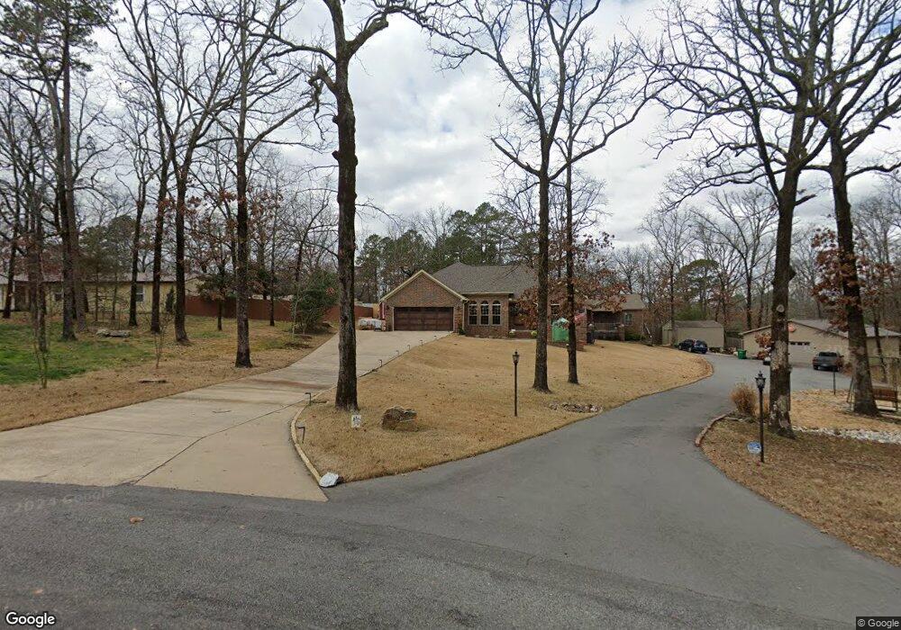
27 Camelia Cir Little Rock, AR 72210
Western Little Rock NeighborhoodEstimated Value: $306,000 - $397,000
3
Beds
2
Baths
1,823
Sq Ft
$194/Sq Ft
Est. Value
About This Home
This home is located at 27 Camelia Cir, Little Rock, AR 72210 and is currently estimated at $353,496, approximately $193 per square foot. 27 Camelia Cir is a home located in Pulaski County with nearby schools including Lawson Elementary School, Joe T. Robinson Middle School, and Joe T. Robinson High School.
Ownership History
Date
Name
Owned For
Owner Type
Purchase Details
Closed on
May 30, 2017
Sold by
Jett George C and Jett Judy A
Bought by
Zoellner David and Zoellner Cheryl
Current Estimated Value
Purchase Details
Closed on
Aug 21, 2009
Sold by
Pistorius Drew
Bought by
Pistorius Terri
Home Financials for this Owner
Home Financials are based on the most recent Mortgage that was taken out on this home.
Original Mortgage
$151,404
Interest Rate
5.1%
Mortgage Type
FHA
Create a Home Valuation Report for This Property
The Home Valuation Report is an in-depth analysis detailing your home's value as well as a comparison with similar homes in the area
Home Values in the Area
Average Home Value in this Area
Purchase History
| Date | Buyer | Sale Price | Title Company |
|---|---|---|---|
| Zoellner David | $210,000 | Pulaski County Title | |
| Pistorius Terri | -- | West Little Rock Title Co |
Source: Public Records
Mortgage History
| Date | Status | Borrower | Loan Amount |
|---|---|---|---|
| Previous Owner | Pistorius Terri | $151,404 |
Source: Public Records
Tax History Compared to Growth
Tax History
| Year | Tax Paid | Tax Assessment Tax Assessment Total Assessment is a certain percentage of the fair market value that is determined by local assessors to be the total taxable value of land and additions on the property. | Land | Improvement |
|---|---|---|---|---|
| 2025 | $1,771 | $58,960 | $12,000 | $46,960 |
| 2024 | $1,823 | $58,960 | $12,000 | $46,960 |
| 2023 | $1,823 | $72,928 | $12,000 | $60,928 |
| 2022 | $1,978 | $72,928 | $12,000 | $60,928 |
| 2021 | $1,755 | $32,400 | $5,900 | $26,500 |
| 2020 | $1,380 | $32,400 | $5,900 | $26,500 |
| 2019 | $1,380 | $32,400 | $5,900 | $26,500 |
| 2018 | $1,405 | $32,400 | $5,900 | $26,500 |
| 2017 | $1,403 | $32,400 | $5,900 | $26,500 |
| 2016 | $1,566 | $30,820 | $6,000 | $24,820 |
| 2015 | $1,566 | $30,820 | $6,000 | $24,820 |
| 2014 | $1,566 | $30,820 | $6,000 | $24,820 |
Source: Public Records
Map
Nearby Homes
- 18821 Lochridge Dr
- 16011 Burleigh Ct
- 15109 Angus Ct
- 15108 Angus Ct
- 16025 Burleigh Ct
- 18712 Lochridge Dr
- 3601 Jack Mann Rd
- 20201 Running Creek Dr
- 3209 Jack Mann Rd
- 4718 McHenry Creek Cir
- 20700 Lisa Dr
- 17419 Elvin Rd
- Lot 7 Waterview Estates
- 18100 Raines Rd
- 18100 - 003 Raines Rd
- 19229 Colonel Glenn Rd
- 2341 Still Hollow Trail
- 000
- 18510 Crystal Valley Rd
- 00 Raines Sullivan
