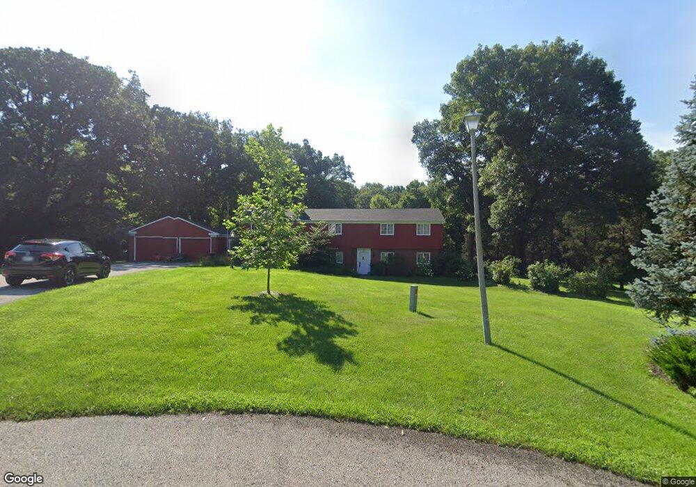
27 Colony Dr Muscatine, IA 52761
Estimated Value: $319,000 - $385,000
4
Beds
4
Baths
2,611
Sq Ft
$136/Sq Ft
Est. Value
About This Home
This home is located at 27 Colony Dr, Muscatine, IA 52761 and is currently estimated at $355,239, approximately $136 per square foot. 27 Colony Dr is a home located in Muscatine County with nearby schools including Grant Elementary School, Central Middle School, and Muscatine High School.
Ownership History
Date
Name
Owned For
Owner Type
Purchase Details
Closed on
Jul 31, 2014
Sold by
Allbee Harvey G and Allbee Jo Ann
Bought by
Conard Matthew W and Conard Jennifer A
Current Estimated Value
Home Financials for this Owner
Home Financials are based on the most recent Mortgage that was taken out on this home.
Original Mortgage
$197,600
Outstanding Balance
$150,681
Interest Rate
4.19%
Mortgage Type
New Conventional
Estimated Equity
$204,558
Create a Home Valuation Report for This Property
The Home Valuation Report is an in-depth analysis detailing your home's value as well as a comparison with similar homes in the area
Home Values in the Area
Average Home Value in this Area
Purchase History
| Date | Buyer | Sale Price | Title Company |
|---|---|---|---|
| Conard Matthew W | $247,000 | None Available |
Source: Public Records
Mortgage History
| Date | Status | Borrower | Loan Amount |
|---|---|---|---|
| Open | Conard Matthew W | $197,600 |
Source: Public Records
Tax History Compared to Growth
Tax History
| Year | Tax Paid | Tax Assessment Tax Assessment Total Assessment is a certain percentage of the fair market value that is determined by local assessors to be the total taxable value of land and additions on the property. | Land | Improvement |
|---|---|---|---|---|
| 2025 | $5,200 | $298,950 | $79,500 | $219,450 |
| 2024 | $5,200 | $297,040 | $79,500 | $217,540 |
| 2023 | $4,696 | $280,253 | $79,500 | $200,753 |
| 2022 | $4,552 | $252,440 | $75,000 | $177,440 |
| 2021 | $4,552 | $232,040 | $75,000 | $157,040 |
| 2020 | $4,768 | $235,740 | $75,000 | $160,740 |
| 2019 | $4,910 | $230,800 | $0 | $0 |
| 2018 | $4,464 | $213,580 | $0 | $0 |
| 2017 | $4,464 | $213,550 | $0 | $0 |
| 2016 | $4,632 | $213,550 | $0 | $0 |
| 2015 | $4,632 | $203,940 | $0 | $0 |
| 2014 | $4,444 | $193,940 | $0 | $0 |
Source: Public Records
Map
Nearby Homes
- 35 Colony Dr
- 3 Wilson Dr
- 297 Burnside Ave
- 205 Amherst Ave
- 310 Wood Creek Ln
- 606 Leroy St
- 709 Leroy St
- 1807 Mulberry Ave
- 108 Middle Rd
- 1014 Wier St
- 602 W Fulliam Ave
- 1506 Buell St
- 241 Dillaway St
- 2126 Bidwell Rd
- PARCEL ID 0834280023 Dillaway St
- 2106 Clarabek St
- 2108 Clarabek St
- 1251 Vista Ct
- 2020 Bidwell Rd
- 2018 W Bay Dr
- 31 Colony Dr
- 23 Colony Dr
- 24 Colony Dr
- 2319 Stonebrook Dr
- 2316 Stonebrook Dr
- 34 Colony Dr
- 19 Colony Dr
- 2315 Stonebrook Dr
- 15 Colony Dr
- 20 Colony Dr
- 2310 Stonebrook Dr
- 39 Colony Dr
- 45 Colony Dr
- 115 Sunset Dr
- 2311 Stonebrook Dr
- 11 Colony Dr
- 2301 Stonebrook Dr
- 101 Sterling Woods Ct
- 112 Sunset Dr
- 0 Byron Lane Parcel #0827401007