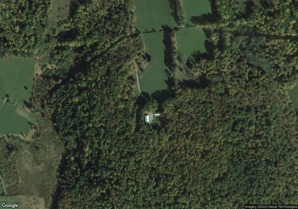
27 Cox Ln Forest City, PA 18421
Estimated Value: $323,000 - $716,000
3
Beds
3
Baths
1,756
Sq Ft
$298/Sq Ft
Est. Value
About This Home
This home is located at 27 Cox Ln, Forest City, PA 18421 and is currently estimated at $523,680, approximately $298 per square foot. 27 Cox Ln is a home located in Wayne County with nearby schools including Forest City Regional Elementary School and Forest City Regional High School.
Ownership History
Date
Name
Owned For
Owner Type
Purchase Details
Closed on
Sep 8, 2023
Sold by
Smith Jeffrey A and Siudut Zoya
Bought by
Eisenbach Charles F and Eisenbach Kimbley
Current Estimated Value
Home Financials for this Owner
Home Financials are based on the most recent Mortgage that was taken out on this home.
Original Mortgage
$488,000
Outstanding Balance
$477,533
Interest Rate
6.9%
Mortgage Type
New Conventional
Estimated Equity
$46,147
Purchase Details
Closed on
Oct 23, 2007
Sold by
Mccullough John E and Mccullough Gloria A
Bought by
Smith Jeffrey A and Siudut Zoya
Home Financials for this Owner
Home Financials are based on the most recent Mortgage that was taken out on this home.
Original Mortgage
$200,000
Interest Rate
5.75%
Mortgage Type
Adjustable Rate Mortgage/ARM
Create a Home Valuation Report for This Property
The Home Valuation Report is an in-depth analysis detailing your home's value as well as a comparison with similar homes in the area
Home Values in the Area
Average Home Value in this Area
Purchase History
| Date | Buyer | Sale Price | Title Company |
|---|---|---|---|
| Eisenbach Charles F | $610,000 | None Listed On Document | |
| Smith Jeffrey A | $380,000 | None Available |
Source: Public Records
Mortgage History
| Date | Status | Borrower | Loan Amount |
|---|---|---|---|
| Open | Eisenbach Charles F | $488,000 | |
| Previous Owner | Smith Jeffrey A | $200,000 |
Source: Public Records
Tax History Compared to Growth
Tax History
| Year | Tax Paid | Tax Assessment Tax Assessment Total Assessment is a certain percentage of the fair market value that is determined by local assessors to be the total taxable value of land and additions on the property. | Land | Improvement |
|---|---|---|---|---|
| 2025 | $4,385 | $270,600 | $69,900 | $200,700 |
| 2024 | $4,265 | $270,600 | $69,900 | $200,700 |
| 2023 | $5,875 | $270,600 | $69,900 | $200,700 |
| 2022 | $6,568 | $281,800 | $118,800 | $163,000 |
| 2021 | $6,500 | $281,800 | $118,800 | $163,000 |
| 2020 | $6,371 | $281,800 | $118,800 | $163,000 |
| 2019 | $6,058 | $281,800 | $118,800 | $163,000 |
| 2018 | $6,041 | $281,800 | $118,800 | $163,000 |
| 2017 | $5,704 | $281,800 | $118,800 | $163,000 |
| 2016 | $4,184 | $281,800 | $118,800 | $163,000 |
| 2014 | $4,191 | $281,800 | $118,800 | $163,000 |
Source: Public Records
Map
Nearby Homes
- 259 Ayoub Rd
- 55 Peterson Rd
- 1795 Belmont Turnpike
- 755 Great Bend Turnpike
- 540 Pleasant Mount Dr
- 145 Pleasant View Dr
- 2051 Belmont Turnpike
- 44 Franks Old Rd
- Lot 4 Skinny Dip Ln
- 1019 Creek Dr
- 76 S Shore Rd
- 36 Stone Bridge Ln
- 58 S Shore Rd
- 1701 Great Bend Turnpike
- 0 Dyberry Dr
- 76 Crossroad
- 6 Silhouette Ln
- 233 N Smith Rd
- 0 Town Hill Rd
- 429 Flat Rock Rd
- 27 Cox Ln
- 3 Upper Odell Rd
- 2 Upper Odell Rd
- 20 Odell Rd
- 69 Upper Odell Rd
- 50 Upper Odell Rd
- 2135 Bethany Turnpike
- 0 Riverdale Rd
- 2119 Bethany Turnpike
- 2151 Bethany Turnpike
- 2113 Bethany Turnpike
- 112 Lower Odell Rd
- 2139 Bethany Turnpike
- 2129 Bethany Turnpike
- 2163 Bethany Turnpike
- 2155 Bethany Turnpike
- 2201 Bethany Turnpike
- 2138 Bethany Turnpike
- 2169 Bethany Turnpike
- 56 Riverdale Rd
