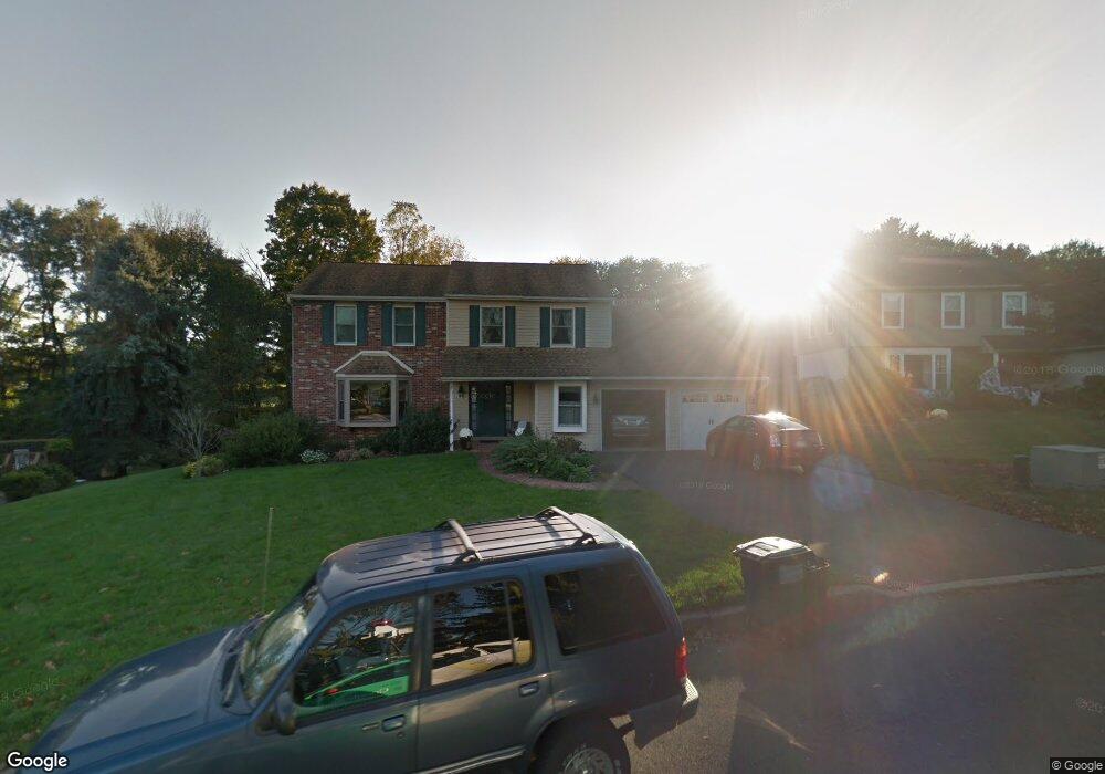
27 Cricket Dr Southampton, PA 18966
Estimated Value: $695,000 - $787,000
4
Beds
3
Baths
2,742
Sq Ft
$269/Sq Ft
Est. Value
About This Home
This home is located at 27 Cricket Dr, Southampton, PA 18966 and is currently estimated at $736,593, approximately $268 per square foot. 27 Cricket Dr is a home located in Bucks County with nearby schools including Rolling Hills Elementary School, Richboro Middle School, and Council Rock High School - South.
Ownership History
Date
Name
Owned For
Owner Type
Purchase Details
Closed on
May 24, 1996
Sold by
Worthen Kenneth G and Worthen Betsy Ann
Bought by
Worthen Kenneth G and Worthen Betsy Ann
Current Estimated Value
Home Financials for this Owner
Home Financials are based on the most recent Mortgage that was taken out on this home.
Original Mortgage
$153,750
Interest Rate
7.71%
Purchase Details
Closed on
Jul 15, 1988
Bought by
Stahl Betsy Ann
Create a Home Valuation Report for This Property
The Home Valuation Report is an in-depth analysis detailing your home's value as well as a comparison with similar homes in the area
Home Values in the Area
Average Home Value in this Area
Purchase History
| Date | Buyer | Sale Price | Title Company |
|---|---|---|---|
| Worthen Kenneth G | -- | -- | |
| Stahl Betsy Ann | $212,000 | -- |
Source: Public Records
Mortgage History
| Date | Status | Borrower | Loan Amount |
|---|---|---|---|
| Closed | Worthen Kenneth G | $153,750 |
Source: Public Records
Tax History Compared to Growth
Tax History
| Year | Tax Paid | Tax Assessment Tax Assessment Total Assessment is a certain percentage of the fair market value that is determined by local assessors to be the total taxable value of land and additions on the property. | Land | Improvement |
|---|---|---|---|---|
| 2025 | $7,966 | $41,360 | $12,600 | $28,760 |
| 2024 | $7,966 | $41,360 | $12,600 | $28,760 |
| 2023 | $7,508 | $41,360 | $12,600 | $28,760 |
| 2022 | $7,439 | $41,360 | $12,600 | $28,760 |
| 2021 | $7,204 | $41,360 | $12,600 | $28,760 |
| 2020 | $7,042 | $41,360 | $12,600 | $28,760 |
| 2019 | $6,740 | $41,360 | $12,600 | $28,760 |
| 2018 | $6,621 | $41,360 | $12,600 | $28,760 |
| 2017 | $6,365 | $41,360 | $12,600 | $28,760 |
| 2016 | $6,365 | $41,360 | $12,600 | $28,760 |
| 2015 | -- | $41,360 | $12,600 | $28,760 |
| 2014 | -- | $41,360 | $12,600 | $28,760 |
Source: Public Records
Map
Nearby Homes
- 23 Brianna Rd
- 151 Knox Ct
- 327 Hale Dr Unit 801A
- 21 Tree Bark Ln
- 180 Independence Dr
- 102 Keenan Ln
- 501 Potters Ct
- 41019 Coopers Place Unit 9
- 163 Leedom Way Unit 25
- 80 Hershey Ct
- 21 Joanne Rd
- 10014 Beacon Hill Dr Unit 7
- 210 E Hanover St
- 281 E Village Rd
- 28 Peter Dr
- 104 Cornell Rd
- 501 Heritage Place Unit 1
- 31 Hillcroft Way
- 9015 Heritage Dr Unit 8
- 60 Signal Hill Rd
- 31 Cricket Dr
- 19 Cricket Dr
- 15 Cricket Dr
- 35 Cricket Dr
- 16 Cricket Dr
- 18 Stardust Dr
- 24 Stardust Dr
- 40 Cricket Dr
- 28 Cricket Dr
- 11 Cricket Dr
- 37 Summer Dr
- 34 Cricket Dr
- 26 Stardust Dr
- 12 Stardust Dr
- 43 Summer Dr
- 33 Summer Dr
- 802 Barry Ct Unit 729B
- 804 Barry Ct Unit 729A
- 808 Barry Ct Unit 730B
- 806 Barry Ct Unit 730A