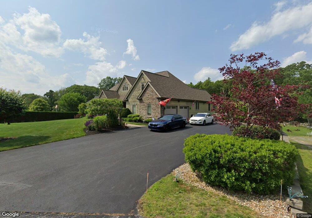
27 Darney Dr Stoughton, MA 02072
Estimated Value: $930,000 - $1,145,000
4
Beds
3
Baths
3,080
Sq Ft
$337/Sq Ft
Est. Value
About This Home
This home is located at 27 Darney Dr, Stoughton, MA 02072 and is currently estimated at $1,036,474, approximately $336 per square foot. 27 Darney Dr is a home located in Norfolk County with nearby schools including Joseph H. Gibbons Elementary School, Dr. Robert G. O'Donnell Middle School, and Stoughton High School.
Ownership History
Date
Name
Owned For
Owner Type
Purchase Details
Closed on
Nov 13, 2019
Sold by
Andrade Richard R and Andrade Theresa M
Bought by
Andrade Theresa M
Current Estimated Value
Purchase Details
Closed on
Oct 7, 2015
Sold by
Garcia Joseph A and Garcia Michelle
Bought by
Andrade Richard R and Andrade Theresa M
Home Financials for this Owner
Home Financials are based on the most recent Mortgage that was taken out on this home.
Original Mortgage
$417,000
Interest Rate
3.88%
Mortgage Type
New Conventional
Create a Home Valuation Report for This Property
The Home Valuation Report is an in-depth analysis detailing your home's value as well as a comparison with similar homes in the area
Home Values in the Area
Average Home Value in this Area
Purchase History
| Date | Buyer | Sale Price | Title Company |
|---|---|---|---|
| Andrade Theresa M | -- | None Available | |
| Andrade Richard R | $640,000 | -- |
Source: Public Records
Mortgage History
| Date | Status | Borrower | Loan Amount |
|---|---|---|---|
| Previous Owner | Andrade Richard R | $417,000 |
Source: Public Records
Tax History Compared to Growth
Tax History
| Year | Tax Paid | Tax Assessment Tax Assessment Total Assessment is a certain percentage of the fair market value that is determined by local assessors to be the total taxable value of land and additions on the property. | Land | Improvement |
|---|---|---|---|---|
| 2025 | $11,557 | $933,500 | $298,400 | $635,100 |
| 2024 | $11,471 | $901,100 | $272,900 | $628,200 |
| 2023 | $10,789 | $796,200 | $230,500 | $565,700 |
| 2022 | $10,084 | $699,800 | $200,700 | $499,100 |
| 2021 | $10,655 | $705,600 | $198,000 | $507,600 |
| 2020 | $10,506 | $705,600 | $198,000 | $507,600 |
| 2019 | $10,175 | $663,300 | $198,000 | $465,300 |
| 2018 | $9,249 | $624,500 | $202,400 | $422,100 |
| 2017 | $8,762 | $604,700 | $202,400 | $402,300 |
| 2016 | $8,323 | $556,000 | $198,000 | $358,000 |
| 2015 | $8,346 | $551,600 | $193,600 | $358,000 |
| 2014 | $8,114 | $515,500 | $193,600 | $321,900 |
Source: Public Records
Map
Nearby Homes
- 1600 West St
- 93 Palisades Cir
- 175 N Main St
- Lot 4 West St
- 2 Palace Ct
- 93 McEachron Dr
- 4 Eagle Rock Rd
- 12 Holmes St
- 14 Marshall Rd
- 57 Whitney Ave
- 15 King Ave
- 86 Union St
- 110 Union St
- Lot 1 Winterberry Ln
- LOT 4 Winterberry Ln
- Lot 2 Winterberry Ln
- 74 Eisenhower Dr
- 250 Morton St
- 8 Hobart Way
- 48 Sofia Rd