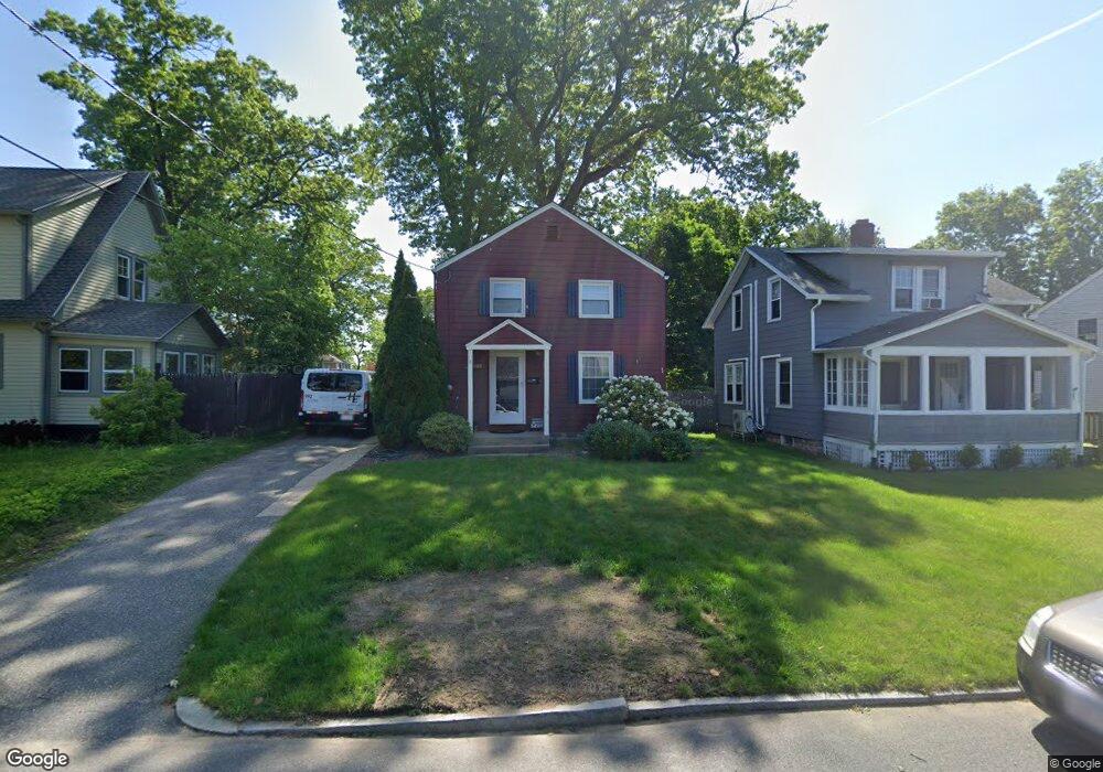
27 Derryfield Ave Springfield, MA 01118
East Forest Park NeighborhoodEstimated Value: $257,000 - $305,000
3
Beds
1
Bath
1,008
Sq Ft
$279/Sq Ft
Est. Value
About This Home
This home is located at 27 Derryfield Ave, Springfield, MA 01118 and is currently estimated at $280,932, approximately $278 per square foot. 27 Derryfield Ave is a home located in Hampden County with nearby schools including Mary A. Dryden Veterans Memorial School, M Marcus Kiley Middle, and Springfield High School of Science and Technology.
Ownership History
Date
Name
Owned For
Owner Type
Purchase Details
Closed on
Oct 27, 2000
Sold by
Flood Laura M
Bought by
Diaz Elvis
Current Estimated Value
Home Financials for this Owner
Home Financials are based on the most recent Mortgage that was taken out on this home.
Original Mortgage
$91,922
Outstanding Balance
$33,751
Interest Rate
7.83%
Mortgage Type
Purchase Money Mortgage
Estimated Equity
$247,181
Purchase Details
Closed on
Apr 18, 1997
Sold by
Fisher Jill C and Palmer Paul S
Bought by
Flood Laura M
Home Financials for this Owner
Home Financials are based on the most recent Mortgage that was taken out on this home.
Original Mortgage
$61,200
Interest Rate
7.76%
Mortgage Type
Purchase Money Mortgage
Purchase Details
Closed on
Jan 18, 1991
Sold by
Henning Robert S and Julian Joanne M
Bought by
Anderson Jill C and Palmer Paul S
Home Financials for this Owner
Home Financials are based on the most recent Mortgage that was taken out on this home.
Original Mortgage
$68,800
Interest Rate
9.68%
Mortgage Type
Purchase Money Mortgage
Create a Home Valuation Report for This Property
The Home Valuation Report is an in-depth analysis detailing your home's value as well as a comparison with similar homes in the area
Home Values in the Area
Average Home Value in this Area
Purchase History
| Date | Buyer | Sale Price | Title Company |
|---|---|---|---|
| Diaz Elvis | $93,000 | -- | |
| Flood Laura M | $76,500 | -- | |
| Anderson Jill C | $86,000 | -- |
Source: Public Records
Mortgage History
| Date | Status | Borrower | Loan Amount |
|---|---|---|---|
| Open | Anderson Jill C | $91,922 | |
| Previous Owner | Anderson Jill C | $61,200 | |
| Previous Owner | Anderson Jill C | $68,800 |
Source: Public Records
Tax History
| Year | Tax Paid | Tax Assessment Tax Assessment Total Assessment is a certain percentage of the fair market value that is determined by local assessors to be the total taxable value of land and additions on the property. | Land | Improvement |
|---|---|---|---|---|
| 2025 | $3,890 | $248,100 | $46,900 | $201,200 |
| 2024 | $3,437 | $214,000 | $46,900 | $167,100 |
| 2023 | $3,456 | $202,700 | $44,700 | $158,000 |
| 2022 | $3,469 | $184,300 | $44,700 | $139,600 |
| 2021 | $3,272 | $173,100 | $40,600 | $132,500 |
| 2020 | $3,111 | $159,300 | $40,600 | $118,700 |
| 2019 | $3,104 | $157,700 | $40,600 | $117,100 |
| 2018 | $3,092 | $157,100 | $40,600 | $116,500 |
| 2017 | $2,902 | $147,600 | $40,600 | $107,000 |
| 2016 | $2,784 | $141,600 | $40,600 | $101,000 |
| 2015 | $2,687 | $136,600 | $40,600 | $96,000 |
Source: Public Records
Map
Nearby Homes
- 509 Plumtree Rd
- 37 Chesterfield Ave
- 75 Gillette Cir
- 384 Abbott St
- 7 Ashbrook St
- 647 Plumtree Rd
- 101 Regal St
- 54 S Shore Dr
- 79 Arvilla St
- 79 Roosevelt Ave
- 170 Plumtree Rd
- 134 Eddywood St
- 19 Manor Ct Unit 19
- 55 Allen St
- 118 Pilgrim Rd
- 236 Pondview Dr
- 1088 Sumner Ave
- 125 Manor Ct Unit 125
- 13 Bither St
- 30 W Hill Rd
- 23 Derryfield Ave
- 37 Derryfield Ave
- 19 Derryfield Ave
- 20 Pennsylvania Ave
- 14 Pennsylvania Ave
- 26 Pennsylvania Ave
- 43 Derryfield Ave
- 480 Plumtree Rd Unit SF
- 480 Plumtree Rd
- 480 Plumtree Rd Unit 1
- 480 Plumtree Rd Unit Single Res
- 30 Derryfield Ave
- 474 Plumtree Rd
- 24 Derryfield Ave
- 36 Derryfield Ave
- 11 Derryfield Ave
- 49 Derryfield Ave
- 486 Plumtree Rd
- 44 Derryfield Ave
- 14 Derryfield Ave
Your Personal Tour Guide
Ask me questions while you tour the home.