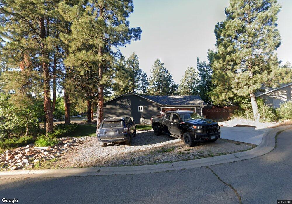
27 Hawthorne Cir Durango, CO 81303
Durango West NeighborhoodEstimated Value: $490,441 - $614,000
3
Beds
2
Baths
1,680
Sq Ft
$328/Sq Ft
Est. Value
About This Home
This home is located at 27 Hawthorne Cir, Durango, CO 81303 and is currently estimated at $551,860, approximately $328 per square foot. 27 Hawthorne Cir is a home located in La Plata County with nearby schools including Park Elementary School, Escalante Middle School, and Durango High School.
Ownership History
Date
Name
Owned For
Owner Type
Purchase Details
Closed on
Mar 19, 2008
Sold by
Roodf Michael C and Roof Jodi L
Bought by
Roof Michael C and Roof Jodi Lynne
Current Estimated Value
Home Financials for this Owner
Home Financials are based on the most recent Mortgage that was taken out on this home.
Original Mortgage
$236,000
Outstanding Balance
$146,471
Interest Rate
5.67%
Mortgage Type
New Conventional
Estimated Equity
$405,389
Purchase Details
Closed on
Aug 21, 2007
Sold by
Baumchen George H and Baumchen Libby J
Bought by
Roof Michael C and Roof Jodi L
Home Financials for this Owner
Home Financials are based on the most recent Mortgage that was taken out on this home.
Original Mortgage
$232,000
Interest Rate
6.64%
Mortgage Type
New Conventional
Purchase Details
Closed on
Dec 5, 2001
Bought by
Roof Michael C and Roof Jodi Lynne
Create a Home Valuation Report for This Property
The Home Valuation Report is an in-depth analysis detailing your home's value as well as a comparison with similar homes in the area
Home Values in the Area
Average Home Value in this Area
Purchase History
| Date | Buyer | Sale Price | Title Company |
|---|---|---|---|
| Roof Michael C | -- | Colorado Land Title Co | |
| Roof Michael C | $290,000 | Colorado Land Title Co | |
| Roof Michael C | $26,000 | -- |
Source: Public Records
Mortgage History
| Date | Status | Borrower | Loan Amount |
|---|---|---|---|
| Open | Roof Michael C | $236,000 | |
| Closed | Roof Michael C | $232,000 |
Source: Public Records
Tax History Compared to Growth
Tax History
| Year | Tax Paid | Tax Assessment Tax Assessment Total Assessment is a certain percentage of the fair market value that is determined by local assessors to be the total taxable value of land and additions on the property. | Land | Improvement |
|---|---|---|---|---|
| 2025 | $1,336 | $31,420 | $4,130 | $27,290 |
| 2024 | $1,144 | $27,250 | $3,140 | $24,110 |
| 2023 | $1,144 | $30,940 | $3,570 | $27,370 |
| 2022 | $910 | $32,090 | $3,700 | $28,390 |
| 2021 | $915 | $22,050 | $3,590 | $18,460 |
| 2020 | $909 | $22,590 | $3,380 | $19,210 |
| 2019 | $871 | $22,590 | $3,380 | $19,210 |
| 2018 | $802 | $20,820 | $3,400 | $17,420 |
| 2017 | $785 | $20,820 | $3,400 | $17,420 |
| 2016 | $707 | $20,320 | $3,760 | $16,560 |
| 2015 | $1,061 | $20,320 | $3,760 | $16,560 |
| 2014 | -- | $17,590 | $3,760 | $13,830 |
| 2013 | -- | $17,590 | $3,760 | $13,830 |
Source: Public Records
Map
Nearby Homes
- 30 Hawthorne Ct
- 220 Canyon Creek Trail
- 66 Trail Wood Dr
- 178 Canyon Creek Trail
- 161 Canyon Creek Trail
- 131 Holly Hock Trail
- 295 Wood Crest Dr
- 678 N Lakeside Dr
- 222 Pine Ridge Loop Unit A4
- 554 Oak Dr
- 1100 Cr125
- 49 Hunter Ct
- 23 Hunter Ct
- 841 Oak Dr
- 21121 Highway 140
- 748 S Lakeside Dr
- 717 Zane Dr
- 11846 W Hwy 160
- 11846 Us 160
- 621 Shenandoah Rd
- 0 Hawthorne Ct Unit 642308
- 0 Hawthorne Ct Unit 713782
- 0 Hawthorne Ct Unit 720703
- 31 Hawthorne Cir
- 22 Locust Ct
- 13 Hawthorne Cir
- 10 Locust Ct
- 28 Locust Ct
- 34 Hawthorne Cir
- 30 Hawthorne Cir
- 16 Hawthorne Cir
- 16 Hawthorne Ct
- 58 Westridge Rd
- 58 Westridge Rd Unit Westridge Subdivisio
- 42 Westridge Rd
- 42 Westridge Rd Unit 42 Westridge Road
- 0 Locust Ct Unit 739380
- 0 Locust Ct Unit 733630
- 0 Locust Ct Unit 658923
- 0 Locust Ct Unit 661793