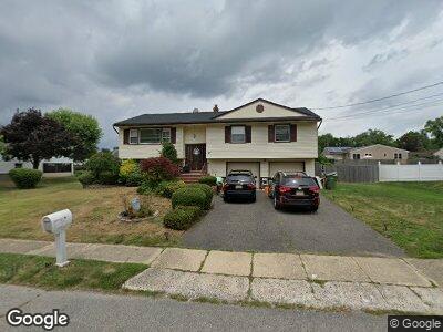
27 Heath Dr Neptune, NJ 07753
Neptune NeighborhoodEstimated Value: $553,615 - $612,000
3
Beds
2
Baths
1,874
Sq Ft
$308/Sq Ft
Est. Value
About This Home
This home is located at 27 Heath Dr, Neptune, NJ 07753 and is currently estimated at $577,654, approximately $308 per square foot. 27 Heath Dr is a home located in Monmouth County with nearby schools including Neptune High School and Ilan High School.
Ownership History
Date
Name
Owned For
Owner Type
Purchase Details
Closed on
Mar 23, 2018
Sold by
Monmouth County Sheriff
Bought by
Us Bank Na
Current Estimated Value
Purchase Details
Closed on
Sep 21, 2000
Sold by
Nembhard Sheila
Bought by
Edmonds Candy and Glenn Keith
Home Financials for this Owner
Home Financials are based on the most recent Mortgage that was taken out on this home.
Original Mortgage
$126,400
Interest Rate
7.94%
Create a Home Valuation Report for This Property
The Home Valuation Report is an in-depth analysis detailing your home's value as well as a comparison with similar homes in the area
Home Values in the Area
Average Home Value in this Area
Purchase History
| Date | Buyer | Sale Price | Title Company |
|---|---|---|---|
| Us Bank Na | $1,000 | -- | |
| Edmonds Candy | $158,000 | -- |
Source: Public Records
Mortgage History
| Date | Status | Borrower | Loan Amount |
|---|---|---|---|
| Previous Owner | Glenn Keith M | $150,000 | |
| Previous Owner | Edmonds Candy | $126,400 |
Source: Public Records
Tax History Compared to Growth
Tax History
| Year | Tax Paid | Tax Assessment Tax Assessment Total Assessment is a certain percentage of the fair market value that is determined by local assessors to be the total taxable value of land and additions on the property. | Land | Improvement |
|---|---|---|---|---|
| 2024 | $8,060 | $522,000 | $257,900 | $264,100 |
| 2023 | $8,060 | $446,300 | $191,600 | $254,700 |
| 2022 | $8,120 | $400,300 | $151,600 | $248,700 |
| 2021 | $6,701 | $384,300 | $164,800 | $219,500 |
| 2020 | $7,006 | $330,800 | $122,800 | $208,000 |
| 2019 | $6,701 | $312,400 | $122,800 | $189,600 |
| 2018 | $6,879 | $317,000 | $128,800 | $188,200 |
| 2017 | $6,827 | $302,200 | $128,800 | $173,400 |
| 2016 | $6,670 | $294,500 | $123,800 | $170,700 |
| 2015 | $6,336 | $284,500 | $118,000 | $166,500 |
| 2014 | $6,117 | $225,800 | $108,000 | $117,800 |
Source: Public Records
Map
Nearby Homes
- 28 Ash Dr
- 200 Iris Dr
- 9 Ash Dr
- 2920 W Bangs Ave
- 703 Marsha Dr
- 309 Deal Ave
- 456 Lexington Ave Unit 456
- 720 Doris Terrace
- 712 W Lawn Dr
- 3205 W Bangs Ave
- 401 Slocum Ave
- 726 Stephen Terrace
- 728 Wayside Rd
- 112 Louisville Ave
- 139 Louisville Ave
- 425 Slocum Ave
- 3581 Shafto Rd
- 13 Brook Dr
- 710 Reef Dr
- 1000 Corlies Ave