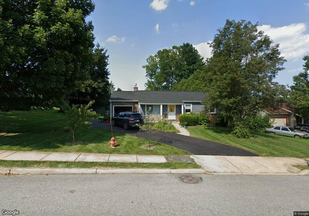
27 Hoover Rd Lancaster, PA 17603
Meadia Heights NeighborhoodEstimated Value: $300,000 - $397,000
4
Beds
3
Baths
2,448
Sq Ft
$148/Sq Ft
Est. Value
About This Home
This home is located at 27 Hoover Rd, Lancaster, PA 17603 and is currently estimated at $362,896, approximately $148 per square foot. 27 Hoover Rd is a home located in Lancaster County with nearby schools including Elizabeth R Martin Elementary School, Wheatland Middle School, and McCaskey High School.
Ownership History
Date
Name
Owned For
Owner Type
Purchase Details
Closed on
Feb 8, 2010
Sold by
Us Bank National Association
Bought by
Heinley Laurel E
Current Estimated Value
Home Financials for this Owner
Home Financials are based on the most recent Mortgage that was taken out on this home.
Original Mortgage
$84,520
Interest Rate
4.94%
Mortgage Type
New Conventional
Purchase Details
Closed on
Jul 29, 2009
Sold by
Rychalsky Bernadette J
Bought by
Us Bank National Association
Purchase Details
Closed on
Aug 14, 2000
Sold by
Richardson Randall E and Richardson Christine E
Bought by
Conner Andrew H and Conner Pamela M
Home Financials for this Owner
Home Financials are based on the most recent Mortgage that was taken out on this home.
Original Mortgage
$101,700
Interest Rate
8.13%
Create a Home Valuation Report for This Property
The Home Valuation Report is an in-depth analysis detailing your home's value as well as a comparison with similar homes in the area
Home Values in the Area
Average Home Value in this Area
Purchase History
| Date | Buyer | Sale Price | Title Company |
|---|---|---|---|
| Heinley Laurel E | $149,250 | None Available | |
| Us Bank National Association | $5,163 | None Available | |
| Conner Andrew H | $107,100 | -- |
Source: Public Records
Mortgage History
| Date | Status | Borrower | Loan Amount |
|---|---|---|---|
| Previous Owner | Heinley Laurel E | $84,520 | |
| Previous Owner | Conner Andrew H | $101,700 |
Source: Public Records
Tax History
| Year | Tax Paid | Tax Assessment Tax Assessment Total Assessment is a certain percentage of the fair market value that is determined by local assessors to be the total taxable value of land and additions on the property. | Land | Improvement |
|---|---|---|---|---|
| 2025 | $4,981 | $172,700 | $43,300 | $129,400 |
| 2024 | $4,981 | $172,700 | $43,300 | $129,400 |
| 2023 | $4,866 | $172,700 | $43,300 | $129,400 |
| 2022 | $4,576 | $172,700 | $43,300 | $129,400 |
| 2021 | $4,437 | $172,700 | $43,300 | $129,400 |
| 2020 | $4,437 | $172,700 | $43,300 | $129,400 |
| 2019 | $4,343 | $172,700 | $43,300 | $129,400 |
| 2018 | $5,540 | $172,700 | $43,300 | $129,400 |
| 2017 | $4,185 | $128,000 | $30,600 | $97,400 |
| 2016 | $4,108 | $128,000 | $30,600 | $97,400 |
| 2015 | $555 | $128,000 | $30,600 | $97,400 |
| 2014 | $3,415 | $128,000 | $30,600 | $97,400 |
Source: Public Records
Map
Nearby Homes
- 1596 New Danville Pike
- 17 Pickford Dr
- 371 Dickens Dr
- 270 Kentshire Dr
- 268 Kentshire Dr
- 337 Eckman Rd
- 6 Myrtlewood Ct
- 1953 Willow Street Pike
- 1827 Divot Ct
- 206 Meadia Ave
- 217 Weatherfield Place
- 825 S Pearl St
- 121 Hillard
- 118 Hillard
- 110 Hillard
- 636 Bean Hill Rd
- 706 Fairview Ave
- 846 Marjory Terrace
- 870 Hilton Dr
- 449 Hershey Ave
- 29 Hoover Rd
- 25 Hoover Rd
- 26 Turnbridge Dr
- 28 Turnbridge Dr
- 24 Turnbridge Dr
- 31 Hoover Rd
- 30 Turnbridge Dr
- 22 Turnbridge Dr
- 21 Hoover Rd
- 32 Turnbridge Dr
- 20 Turnbridge Dr
- 22 Hoover Rd
- 34 Turnbridge Dr
- 18 Turnbridge Dr
- 20 Hoover Rd
- 33 Hoover Rd
- 36 Turnbridge Dr
- 24 Hoover Rd
- 16 Turnbridge Dr
- 17 Hoover Rd
Your Personal Tour Guide
Ask me questions while you tour the home.