Estimated Value: $758,000 - $921,000
3
Beds
3
Baths
2,392
Sq Ft
$339/Sq Ft
Est. Value
About This Home
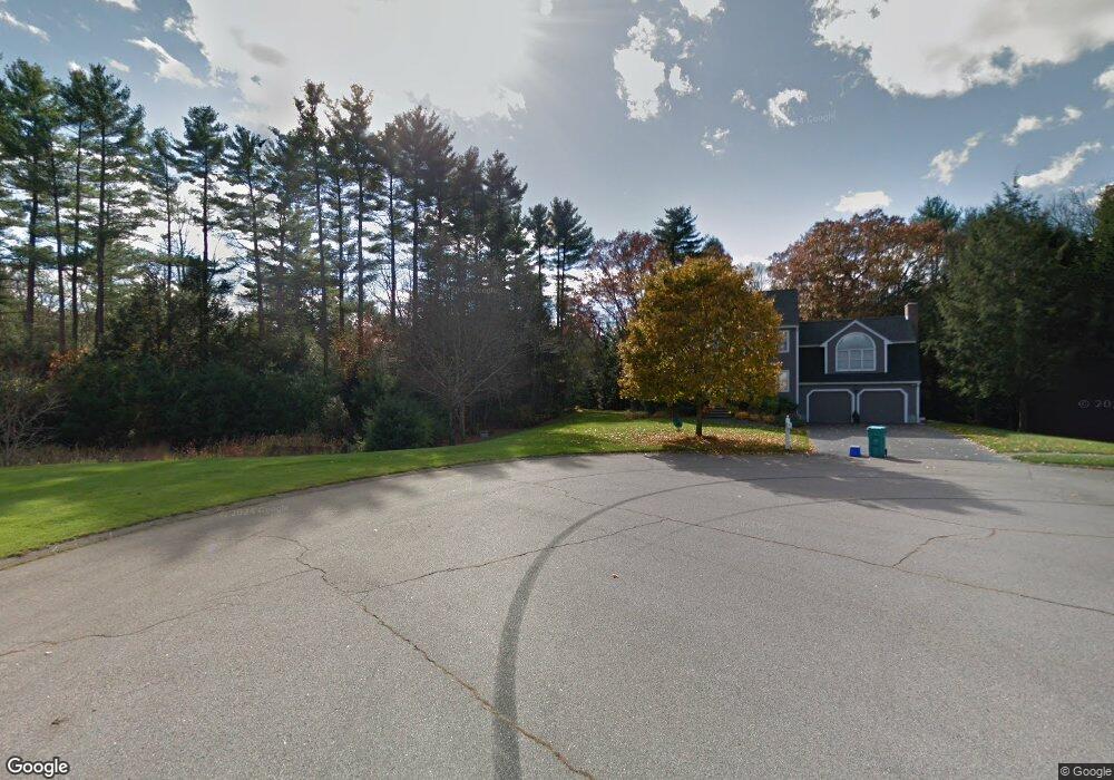
This home is located at 27 Josiah Dr, Upton, MA 01568 and is currently estimated at $810,959, approximately $339 per square foot. 27 Josiah Dr is a home located in Worcester County with nearby schools including Nipmuc Regional High School and Touchstone Community School.
Ownership History
Date
Name
Owned For
Owner Type
Purchase Details
Closed on
Jun 16, 2016
Sold by
Lapointe Jeffrey
Bought by
Lapointe Jeffrey and Lapointe Taryn E
Current Estimated Value
Purchase Details
Closed on
Apr 27, 2007
Sold by
Sebastianelli David and Dicarlo Marisa L
Bought by
Lapointe Jeffrey and Donnelly Taryn
Home Financials for this Owner
Home Financials are based on the most recent Mortgage that was taken out on this home.
Original Mortgage
$372,000
Interest Rate
6.18%
Mortgage Type
Purchase Money Mortgage
Purchase Details
Closed on
Aug 31, 2001
Sold by
Casey Michael A
Bought by
Sebastianelli David and Dicarlo Marisa L
Home Financials for this Owner
Home Financials are based on the most recent Mortgage that was taken out on this home.
Original Mortgage
$275,000
Interest Rate
7.06%
Mortgage Type
Purchase Money Mortgage
Purchase Details
Closed on
Apr 20, 1995
Sold by
Wgb Construction Co
Bought by
Casey Michael
Create a Home Valuation Report for This Property
The Home Valuation Report is an in-depth analysis detailing your home's value as well as a comparison with similar homes in the area
Home Values in the Area
Average Home Value in this Area
Purchase History
| Date | Buyer | Sale Price | Title Company |
|---|---|---|---|
| Lapointe Jeffrey | -- | -- | |
| Lapointe Jeffrey | $465,000 | -- | |
| Sebastianelli David | $365,000 | -- | |
| Casey Michael | $224,900 | -- |
Source: Public Records
Mortgage History
| Date | Status | Borrower | Loan Amount |
|---|---|---|---|
| Previous Owner | Lapointe Jeffrey | $372,000 | |
| Previous Owner | Casey Michael | $273,000 | |
| Previous Owner | Casey Michael | $275,000 | |
| Previous Owner | Casey Michael | $50,000 |
Source: Public Records
Tax History
| Year | Tax Paid | Tax Assessment Tax Assessment Total Assessment is a certain percentage of the fair market value that is determined by local assessors to be the total taxable value of land and additions on the property. | Land | Improvement |
|---|---|---|---|---|
| 2025 | $9,702 | $737,800 | $297,200 | $440,600 |
| 2024 | $9,506 | $694,900 | $289,200 | $405,700 |
| 2023 | $7,162 | $516,400 | $215,600 | $300,800 |
| 2022 | $8,616 | $513,800 | $215,600 | $298,200 |
| 2021 | $8,941 | $538,600 | $250,800 | $287,800 |
| 2020 | $9,242 | $536,700 | $240,400 | $296,300 |
| 2019 | $8,880 | $513,000 | $209,200 | $303,800 |
| 2018 | $8,477 | $492,000 | $196,400 | $295,600 |
| 2017 | $8,426 | $464,000 | $187,600 | $276,400 |
| 2016 | $8,291 | $446,700 | $153,200 | $293,500 |
| 2015 | $7,490 | $441,900 | $153,200 | $288,700 |
| 2014 | $7,258 | $428,200 | $145,200 | $283,000 |
Source: Public Records
Map
Nearby Homes
- 72 Main St
- 13 Plain St
- 3 Driscoll Ln
- 74 Warren St
- 6 Fieldstone Dr Unit 6
- 7 Fieldstone Dr Unit 7
- 63 Rockwood Ln Unit 63
- 6 Wood St
- 8 Maple St
- 10 Mechanic St
- 11 W Main St
- 31 Elm St
- 13 Jonathans Way
- 130 High St
- 1825 Quaker St
- Lot 108 W Main St
- 27 James Rd Unit 1
- 27 James Rd Unit 2
- 7 Sawmill Brook Ln
- 6 Sawmill Brook Ln
- 25 Josiah Dr
- 28 Josiah Dr
- 23 Josiah Dr
- 26 Josiah Dr
- 15 Henrys Path
- 13 Henrys Path
- 24 Josiah Dr
- 11 Henrys Path
- 16 Henrys Path
- 8 Colonial Dr
- 6 Colonial Dr
- 8 Colonial Dr Unit 8
- 6 Colonial Dr Unit 6
- 7 Colonial Dr
- 5 Colonial Dr
- 5 Colonial Dr Unit 5
- 7 Colonial Dr Unit 7
- 14 Henrys Path
- 22 Josiah Dr
- 11 W River St
Your Personal Tour Guide
Ask me questions while you tour the home.