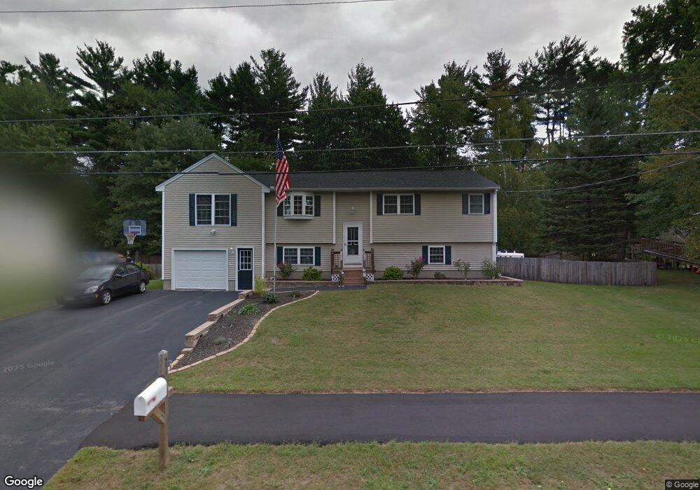
27 Kim Rd Salem, NH 03079
Salem Center NeighborhoodEstimated Value: $568,000 - $638,000
4
Beds
2
Baths
1,566
Sq Ft
$389/Sq Ft
Est. Value
About This Home
This home is located at 27 Kim Rd, Salem, NH 03079 and is currently estimated at $609,002, approximately $388 per square foot. 27 Kim Rd is a home located in Rockingham County with nearby schools including William E. Lancaster School, Woodbury School, and Salem High School.
Ownership History
Date
Name
Owned For
Owner Type
Purchase Details
Closed on
Oct 23, 2014
Sold by
Nh Hoiusing Finance Au
Bought by
Department Of Housing & Urban Dev
Current Estimated Value
Purchase Details
Closed on
Jul 3, 2001
Sold by
Demellia John S and Demellia Brenda R
Bought by
Mcdonald Jeffrey A
Home Financials for this Owner
Home Financials are based on the most recent Mortgage that was taken out on this home.
Original Mortgage
$164,936
Interest Rate
7.14%
Mortgage Type
Purchase Money Mortgage
Create a Home Valuation Report for This Property
The Home Valuation Report is an in-depth analysis detailing your home's value as well as a comparison with similar homes in the area
Home Values in the Area
Average Home Value in this Area
Purchase History
| Date | Buyer | Sale Price | Title Company |
|---|---|---|---|
| Department Of Housing & Urban Dev | -- | -- | |
| Mcdonald Jeffrey A | $189,900 | -- |
Source: Public Records
Mortgage History
| Date | Status | Borrower | Loan Amount |
|---|---|---|---|
| Previous Owner | Mcdonald Jeffrey A | $218,400 | |
| Previous Owner | Mcdonald Jeffrey A | $220,000 | |
| Previous Owner | Mcdonald Jeffrey A | $20,000 | |
| Previous Owner | Mcdonald Jeffrey A | $164,936 |
Source: Public Records
Tax History Compared to Growth
Tax History
| Year | Tax Paid | Tax Assessment Tax Assessment Total Assessment is a certain percentage of the fair market value that is determined by local assessors to be the total taxable value of land and additions on the property. | Land | Improvement |
|---|---|---|---|---|
| 2024 | $7,853 | $446,200 | $159,900 | $286,300 |
| 2023 | $7,568 | $446,200 | $159,900 | $286,300 |
| 2022 | $7,162 | $446,200 | $159,900 | $286,300 |
| 2021 | $7,130 | $446,200 | $159,900 | $286,300 |
| 2020 | $6,516 | $295,900 | $114,200 | $181,700 |
| 2019 | $6,504 | $295,900 | $114,200 | $181,700 |
| 2018 | $6,394 | $295,900 | $114,200 | $181,700 |
| 2017 | $6,167 | $295,900 | $114,200 | $181,700 |
| 2016 | $6,045 | $295,900 | $114,200 | $181,700 |
| 2015 | $5,685 | $265,800 | $117,500 | $148,300 |
| 2014 | $5,526 | $265,800 | $117,500 | $148,300 |
| 2013 | $5,438 | $265,800 | $117,500 | $148,300 |
Source: Public Records
Map
Nearby Homes
- 8 Alta Ave
- 4 Therriault Ave
- 10 Sally Sweets Way Unit V104
- 49 Millville St
- 6 Douglas Dr
- 89 End St
- 55A Millville Cir
- 1 Kimball Ave
- 27 General Pulaski Dr
- 20 Stanwood Rd
- 40 Stanwood Rd Unit 9
- 30 Scotland Ave
- 12 Braemoor Woods Rd Unit 206
- 11 Sullivan Ct
- 51 Bluff St
- 17 Clinton St
- 1 Ballard Ln
- 35 Fraser Dr
- 8 Arcadia Ln
- 75 S Policy St Unit 45
- 29 Kim Rd
- 25 Kim Rd
- 23 Kim Rd
- 26 Kim Rd
- 1 Meisner Cir
- 28 Kim Rd
- 24 Kim Rd
- 44 Meisner Rd
- 2 Meisner Cir Rr 247 Unit 8
- 2 Meisner Cir Rr 248 Unit 10
- 21 Kim Rd
- 22 Kim Rd
- 42 Meisner Rd
- 7 Meisner Cir Unit 42
- 7 Meisner Cir Unit 37
- 7 Meisner Cir Unit 40
- 33 Meisner Rd
- 35 Meisner Rd
- 40 Meisner Rd
- 9 Meisner Cir Unit 9