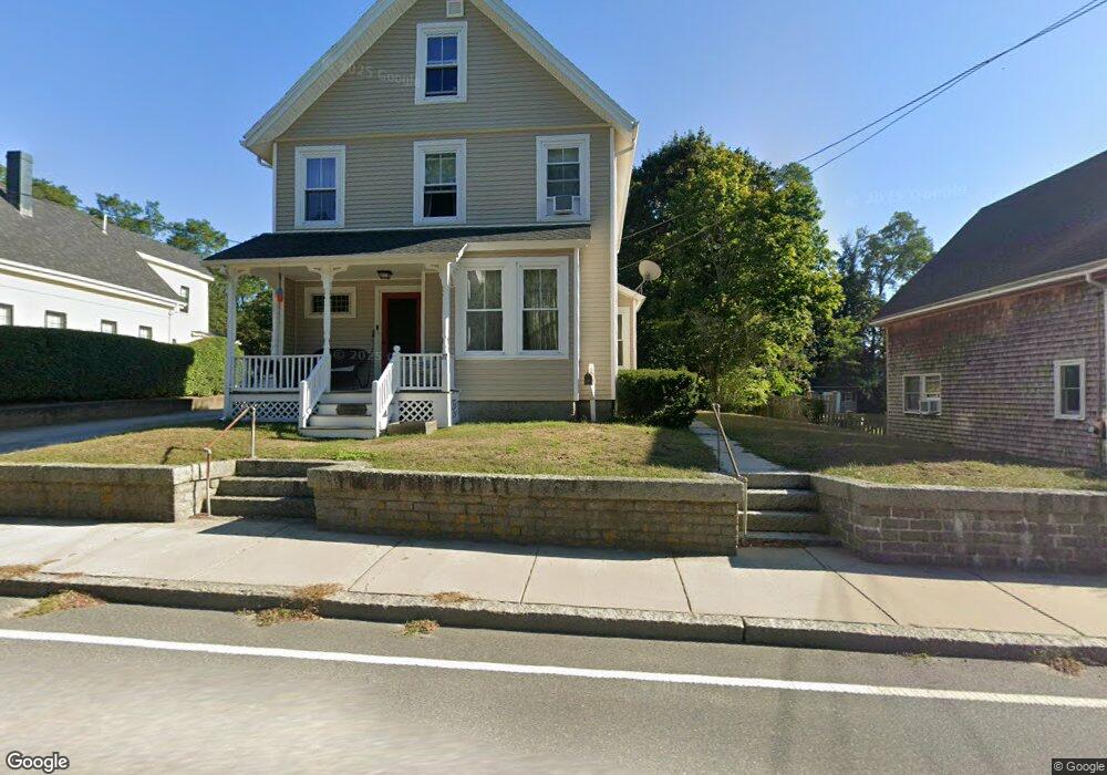
27 Langsford St Gloucester, MA 01930
Estimated Value: $814,252 - $1,178,000
3
Beds
1
Bath
1,816
Sq Ft
$556/Sq Ft
Est. Value
About This Home
This home is located at 27 Langsford St, Gloucester, MA 01930 and is currently estimated at $1,010,063, approximately $556 per square foot. 27 Langsford St is a home located in Essex County with nearby schools including Plum Cove School, Ralph B O'maley Middle School, and Gloucester High School.
Ownership History
Date
Name
Owned For
Owner Type
Purchase Details
Closed on
Mar 26, 2010
Sold by
Morey Anne L and Morey-Abbott Lisa
Bought by
Abbott Thomas A and Abbott Lisa A
Current Estimated Value
Home Financials for this Owner
Home Financials are based on the most recent Mortgage that was taken out on this home.
Original Mortgage
$100,000
Outstanding Balance
$66,150
Interest Rate
5.02%
Mortgage Type
Purchase Money Mortgage
Estimated Equity
$943,913
Purchase Details
Closed on
Nov 24, 2004
Sold by
Morey Anne L and Morey George W
Bought by
Morey George W
Create a Home Valuation Report for This Property
The Home Valuation Report is an in-depth analysis detailing your home's value as well as a comparison with similar homes in the area
Purchase History
| Date | Buyer | Sale Price | Title Company |
|---|---|---|---|
| Abbott Thomas A | $50,000 | -- | |
| Morey George W | -- | -- | |
| Morey George W | -- | -- |
Source: Public Records
Mortgage History
| Date | Status | Borrower | Loan Amount |
|---|---|---|---|
| Open | Morey George W | $30,000 | |
| Closed | Morey George W | $25,000 | |
| Open | Morey George W | $100,000 |
Source: Public Records
Tax History
| Year | Tax Paid | Tax Assessment Tax Assessment Total Assessment is a certain percentage of the fair market value that is determined by local assessors to be the total taxable value of land and additions on the property. | Land | Improvement |
|---|---|---|---|---|
| 2025 | $6,416 | $660,100 | $244,500 | $415,600 |
| 2024 | $6,309 | $648,400 | $232,800 | $415,600 |
| 2023 | $5,747 | $542,700 | $207,900 | $334,800 |
| 2022 | $5,518 | $470,400 | $176,700 | $293,700 |
| 2021 | $5,329 | $428,400 | $160,700 | $267,700 |
| 2020 | $5,280 | $428,200 | $160,700 | $267,500 |
| 2019 | $5,090 | $401,100 | $160,700 | $240,400 |
| 2018 | $4,942 | $382,200 | $160,700 | $221,500 |
| 2017 | $4,791 | $363,200 | $153,000 | $210,200 |
| 2016 | $4,664 | $342,700 | $153,500 | $189,200 |
| 2015 | $4,484 | $328,500 | $153,500 | $175,000 |
Source: Public Records
Map
Nearby Homes
- 10 Emerald St
- 43 High St Unit B
- 7 Colburn St
- 13 Phillips Ave
- 32 Haven Ave
- 5 Smith St Unit R
- 672 Washington St
- 1 Charte Ct
- 1 Main St Unit R
- 1 Main St Unit C
- 1 Main St Unit D
- 177 Main St
- 16 Hodgkins Rd Unit 2
- 27 Hodgkins Rd
- 4 Norwood Ave
- 226 Atlantic St
- 34R Summer St
- 2 Finch Ln
- 167 Atlantic St
- 13 Honeysuckle Rd
- 25 Langsford St
- 29A Langsford St
- 29 Langsford St
- 23 Langsford St
- 21 Langsford St
- 31 Langsford St
- 1110 Washington St
- 24 Langsford St
- 19 Langsford St
- 1112 Washington St
- 14 Mclellan St
- 1114 Washington St
- 1108 Washington St
- 39 Langsford St
- 37 Langsford St
- 37 Langsford St Unit B
- 37 Langsford St Unit A
- 30 Langsford St
- 1106 Washington St
- 8 Munsey Ln