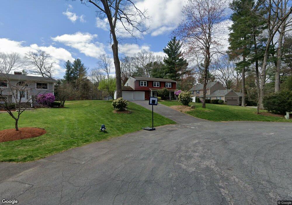
27 Lowe Cir Framingham, MA 01701
Nobscot NeighborhoodEstimated Value: $703,644 - $928,000
4
Beds
3
Baths
2,108
Sq Ft
$371/Sq Ft
Est. Value
About This Home
This home is located at 27 Lowe Cir, Framingham, MA 01701 and is currently estimated at $781,411, approximately $370 per square foot. 27 Lowe Cir is a home located in Middlesex County with nearby schools including Framingham High School and MetroWest Jewish Day School.
Create a Home Valuation Report for This Property
The Home Valuation Report is an in-depth analysis detailing your home's value as well as a comparison with similar homes in the area
Home Values in the Area
Average Home Value in this Area
Tax History
| Year | Tax Paid | Tax Assessment Tax Assessment Total Assessment is a certain percentage of the fair market value that is determined by local assessors to be the total taxable value of land and additions on the property. | Land | Improvement |
|---|---|---|---|---|
| 2025 | $7,495 | $627,700 | $273,700 | $354,000 |
| 2024 | $7,189 | $577,000 | $244,400 | $332,600 |
| 2023 | $6,884 | $525,900 | $218,200 | $307,700 |
| 2022 | $6,564 | $477,700 | $198,000 | $279,700 |
| 2021 | $6,407 | $456,000 | $190,300 | $265,700 |
| 2020 | $6,476 | $432,300 | $172,900 | $259,400 |
| 2019 | $6,515 | $423,600 | $172,900 | $250,700 |
| 2018 | $6,500 | $398,300 | $166,500 | $231,800 |
| 2017 | $6,372 | $381,300 | $161,600 | $219,700 |
| 2016 | $6,330 | $364,200 | $161,600 | $202,600 |
| 2015 | $6,205 | $348,200 | $161,900 | $186,300 |
Source: Public Records
Map
Nearby Homes
Your Personal Tour Guide
Ask me questions while you tour the home.