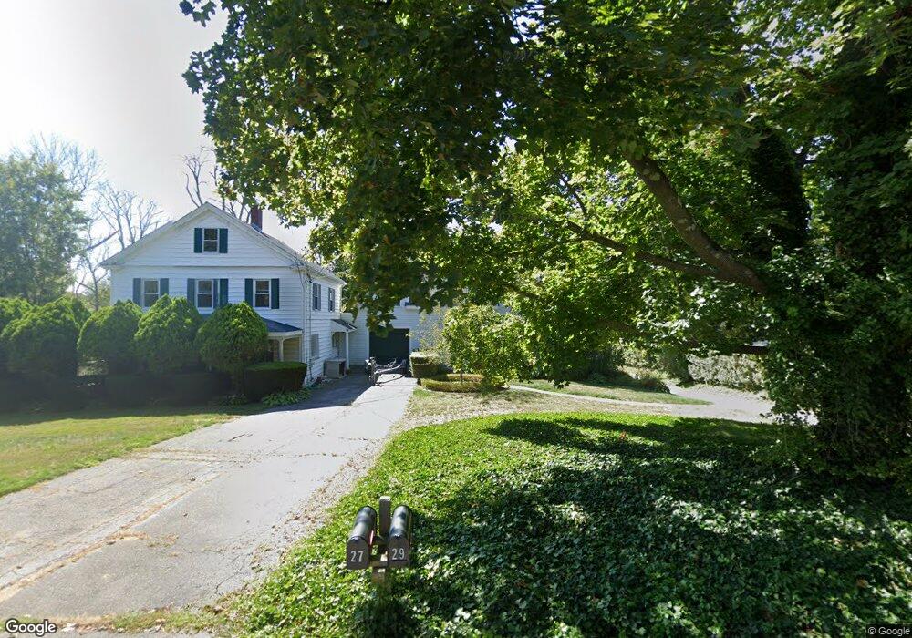
27 Mordecai Lincoln Rd Scituate, MA 02066
Estimated Value: $735,068 - $986,000
3
Beds
2
Baths
2,146
Sq Ft
$394/Sq Ft
Est. Value
About This Home
This home is located at 27 Mordecai Lincoln Rd, Scituate, MA 02066 and is currently estimated at $844,767, approximately $393 per square foot. 27 Mordecai Lincoln Rd is a home located in Plymouth County with nearby schools including Hatherly Elementary School, Lester J. Gates Middle School, and Scituate High School.
Ownership History
Date
Name
Owned For
Owner Type
Purchase Details
Closed on
Dec 12, 2022
Sold by
Amelang Todd D and Amelang Veronica
Bought by
27 Mlr Rt and Amelang
Current Estimated Value
Purchase Details
Closed on
Mar 30, 2021
Sold by
Amelang Irt and Amelang
Bought by
Amelang Todd D and Amelang Veronica D
Home Financials for this Owner
Home Financials are based on the most recent Mortgage that was taken out on this home.
Original Mortgage
$235,000
Interest Rate
3%
Mortgage Type
New Conventional
Purchase Details
Closed on
Aug 26, 2011
Sold by
Amelang Ruth B
Bought by
Ruth B Amelang Irt and Amelang
Create a Home Valuation Report for This Property
The Home Valuation Report is an in-depth analysis detailing your home's value as well as a comparison with similar homes in the area
Home Values in the Area
Average Home Value in this Area
Purchase History
| Date | Buyer | Sale Price | Title Company |
|---|---|---|---|
| 27 Mlr Rt | -- | None Available | |
| Amelang Todd D | -- | None Available | |
| Ruth B Amelang Irt | -- | -- | |
| Ruth B Amelang Irt | -- | -- |
Source: Public Records
Mortgage History
| Date | Status | Borrower | Loan Amount |
|---|---|---|---|
| Previous Owner | Amelang Todd D | $235,000 | |
| Previous Owner | Ruth B Amelang Irt | $100,000 | |
| Previous Owner | Ruth B Amelang Irt | $284,000 | |
| Previous Owner | Ruth B Amelang Irt | $200,000 |
Source: Public Records
Tax History Compared to Growth
Tax History
| Year | Tax Paid | Tax Assessment Tax Assessment Total Assessment is a certain percentage of the fair market value that is determined by local assessors to be the total taxable value of land and additions on the property. | Land | Improvement |
|---|---|---|---|---|
| 2025 | $5,628 | $563,400 | $0 | $563,400 |
| 2024 | $5,508 | $531,700 | $0 | $531,700 |
| 2023 | $5,610 | $497,200 | $0 | $497,200 |
| 2022 | $5,610 | $444,500 | $0 | $444,500 |
| 2021 | $5,569 | $417,800 | $0 | $417,800 |
| 2020 | $5,376 | $398,200 | $0 | $398,200 |
| 2019 | $6,319 | $459,900 | $0 | $459,900 |
| 2018 | $6,124 | $439,000 | $0 | $439,000 |
| 2017 | $12,649 | $897,700 | $288,800 | $608,900 |
| 2016 | $12,035 | $851,100 | $264,700 | $586,400 |
| 2015 | $10,992 | $839,100 | $252,700 | $586,400 |
Source: Public Records
Map
Nearby Homes
- 817 Country Way
- 26 Mordecai Lincoln Rd
- 392 S Main St
- 40 Brewster Rd
- 84 Booth Hill Rd
- 309 S Main St
- 16 3 Ring Rd
- 8 Trudys Ln
- 11 Forest Ln
- 9 Forest Ln Unit 9
- 7 Border St
- 112 Hollett St
- 70 Black Horse Ln
- 68 Black Horse Ln
- 212 S Main St
- 100 Pond St Unit 10
- 98 Black Horse Ln
- 9 Kyle Path
- 40 Pond St
- 73 Pond St
- 25 Mordecai Lincoln Rd
- 31 Mordecai Lincoln Rd Unit 33
- 23 Mordecai Lincoln Rd
- 21 Mordecai Lincoln Rd
- 37 Mordecai Lincoln Rd
- 19 Mordecai Lincoln Rd
- 1 Summit Ave
- 5 Bound Brook Ct Unit 2
- 5 Bound Brook Ct Unit . 4
- 5 Bound Brook Ct Unit 5E
- 5 Bound Brook Ct Unit 5D
- 30 Mordecai Lincoln Rd
- 806 Country Way
- 6 Bound Brook Ct Unit 1
- 810 Country Way
- 17 Mordecai Lincoln Rd
- 41 Mordecai Lincoln Rd
- 20 Mordecai Lincoln Rd
- 38 Mordecai Lincoln Rd
- 7 Summit Ave