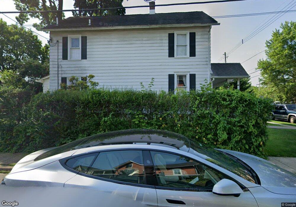
27 N Franklin St Doylestown, PA 18901
Estimated Value: $446,658 - $661,000
3
Beds
1
Bath
1,330
Sq Ft
$440/Sq Ft
Est. Value
About This Home
This home is located at 27 N Franklin St, Doylestown, PA 18901 and is currently estimated at $584,665, approximately $439 per square foot. 27 N Franklin St is a home located in Bucks County with nearby schools including Doyle El School, Lenape Middle School, and Central Bucks High School-West.
Ownership History
Date
Name
Owned For
Owner Type
Purchase Details
Closed on
Sep 12, 2025
Sold by
Bromm Charles A and Bromm Frederick A
Bought by
Bromm Karl and Bromm Anne Kathryn
Current Estimated Value
Purchase Details
Closed on
Nov 15, 2002
Sold by
Bromm Karl A and Bromm Anne Kathryn
Bought by
Bromm Charles A and Bromm Pauline J
Purchase Details
Closed on
Apr 15, 1997
Sold by
Wetherill George H
Bought by
Bromm Karl A and Bromm Anne Kathryn
Home Financials for this Owner
Home Financials are based on the most recent Mortgage that was taken out on this home.
Original Mortgage
$148,500
Interest Rate
6.5%
Purchase Details
Closed on
May 13, 1996
Sold by
Martinson Doris V and Hager Estella
Bought by
Wetherill George H
Home Financials for this Owner
Home Financials are based on the most recent Mortgage that was taken out on this home.
Original Mortgage
$106,500
Interest Rate
7.91%
Create a Home Valuation Report for This Property
The Home Valuation Report is an in-depth analysis detailing your home's value as well as a comparison with similar homes in the area
Home Values in the Area
Average Home Value in this Area
Purchase History
| Date | Buyer | Sale Price | Title Company |
|---|---|---|---|
| Bromm Karl | -- | None Listed On Document | |
| Bromm Charles A | -- | -- | |
| Bromm Karl A | $165,000 | -- | |
| Wetherill George H | $107,000 | -- |
Source: Public Records
Mortgage History
| Date | Status | Borrower | Loan Amount |
|---|---|---|---|
| Previous Owner | Bromm Karl A | $148,500 | |
| Previous Owner | Wetherill George H | $106,500 |
Source: Public Records
Tax History Compared to Growth
Tax History
| Year | Tax Paid | Tax Assessment Tax Assessment Total Assessment is a certain percentage of the fair market value that is determined by local assessors to be the total taxable value of land and additions on the property. | Land | Improvement |
|---|---|---|---|---|
| 2025 | $2,594 | $14,400 | $3,120 | $11,280 |
| 2024 | $2,594 | $14,400 | $3,120 | $11,280 |
| 2023 | $2,471 | $14,400 | $3,120 | $11,280 |
| 2022 | $2,437 | $14,400 | $3,120 | $11,280 |
| 2021 | $2,410 | $14,400 | $3,120 | $11,280 |
| 2020 | $2,384 | $14,400 | $3,120 | $11,280 |
| 2019 | $2,358 | $14,400 | $3,120 | $11,280 |
| 2018 | $2,329 | $14,400 | $3,120 | $11,280 |
| 2017 | $2,304 | $14,400 | $3,120 | $11,280 |
| 2016 | $2,304 | $14,400 | $3,120 | $11,280 |
| 2015 | -- | $14,400 | $3,120 | $11,280 |
| 2014 | -- | $14,400 | $3,120 | $11,280 |
Source: Public Records
Map
Nearby Homes
- 37 N Clinton St
- 130 N Clinton St
- 123 S Franklin St
- 83 S Hamilton St
- 195 Lafayette St
- 20 E Court St
- 69 E Oakland Ave
- 1 Barnes Ct
- 79 Hillside Ave
- 110 E Ashland St
- 146 N Church St
- 236 Green St
- 226 N Main St
- 155 E Oakland Ave
- 2-3 Aspen Way Unit 23
- 146 E Court St
- 9 Mill Creek Dr
- 403 S Main St Unit C202
- 403 S Main St Unit S201
- 89 Homestead Dr
- 23 N Franklin St
- 21 N Franklin St
- 33 N Franklin St
- 166 Wood St
- 176 Wood St
- 35 N Franklin St
- 161 W State St
- 164 Wood St
- 164 Wood St
- 170 Wood St
- 160 Wood St
- 39 N Franklin St
- 43 N Franklin St
- 16 N Franklin St Unit 301A
- 16 N Franklin St Unit S-115
- 16 N Franklin St
- 16 N Franklin St Unit 116-4
- 16 N Franklin St Unit 105-8
- 16 N Franklin St Unit 113-3
- 16 N Franklin St Unit 113-7