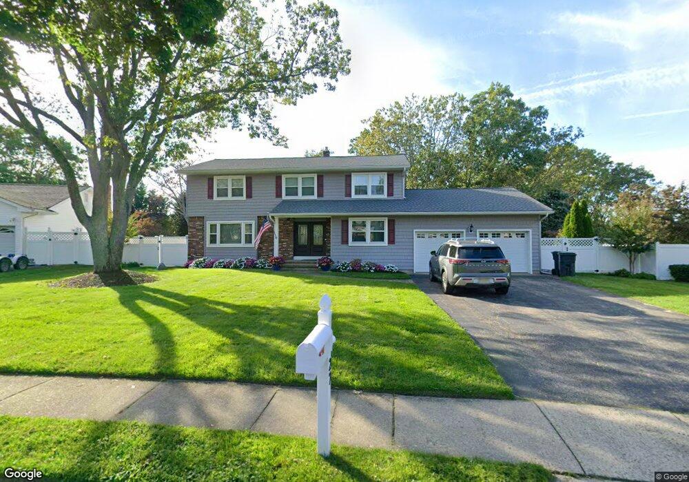
27 N Tunesbrook Dr Toms River, NJ 08753
Estimated Value: $684,987 - $740,000
4
Beds
3
Baths
3,568
Sq Ft
$200/Sq Ft
Est. Value
About This Home
This home is located at 27 N Tunesbrook Dr, Toms River, NJ 08753 and is currently estimated at $712,497, approximately $199 per square foot. 27 N Tunesbrook Dr is a home located in Ocean County with nearby schools including St Joseph Grade School and Donovan Catholic High School.
Ownership History
Date
Name
Owned For
Owner Type
Purchase Details
Closed on
Mar 3, 2004
Sold by
Masterson Bryon G
Bought by
Roemer Craig S and Roemer Lisa A
Current Estimated Value
Home Financials for this Owner
Home Financials are based on the most recent Mortgage that was taken out on this home.
Original Mortgage
$200,000
Outstanding Balance
$93,144
Interest Rate
5.62%
Mortgage Type
Purchase Money Mortgage
Estimated Equity
$619,353
Purchase Details
Closed on
Dec 11, 2000
Sold by
Tashjian Alice
Bought by
Masterson Bryon and Masterson Patricia
Home Financials for this Owner
Home Financials are based on the most recent Mortgage that was taken out on this home.
Original Mortgage
$214,000
Interest Rate
7.7%
Create a Home Valuation Report for This Property
The Home Valuation Report is an in-depth analysis detailing your home's value as well as a comparison with similar homes in the area
Home Values in the Area
Average Home Value in this Area
Purchase History
| Date | Buyer | Sale Price | Title Company |
|---|---|---|---|
| Roemer Craig S | $355,000 | -- | |
| Roemer Craig S | $355,000 | Lawyers Title Insurance Corp | |
| Masterson Bryon | $226,000 | -- | |
| Masterson Bryon | $226,000 | -- |
Source: Public Records
Mortgage History
| Date | Status | Borrower | Loan Amount |
|---|---|---|---|
| Open | Roemer Craig S | $200,000 | |
| Closed | Roemer Craig S | $200,000 | |
| Previous Owner | Masterson Bryon | $214,000 |
Source: Public Records
Tax History Compared to Growth
Tax History
| Year | Tax Paid | Tax Assessment Tax Assessment Total Assessment is a certain percentage of the fair market value that is determined by local assessors to be the total taxable value of land and additions on the property. | Land | Improvement |
|---|---|---|---|---|
| 2025 | $8,480 | $465,700 | $141,000 | $324,700 |
| 2024 | $8,061 | $465,700 | $141,000 | $324,700 |
| 2023 | $7,773 | $465,700 | $141,000 | $324,700 |
| 2022 | $7,773 | $465,700 | $141,000 | $324,700 |
| 2021 | $7,906 | $315,600 | $104,000 | $211,600 |
| 2020 | $7,871 | $315,600 | $104,000 | $211,600 |
| 2019 | $7,530 | $315,600 | $104,000 | $211,600 |
| 2018 | $7,429 | $315,600 | $104,000 | $211,600 |
| 2017 | $7,366 | $315,600 | $104,000 | $211,600 |
| 2016 | $7,174 | $315,600 | $104,000 | $211,600 |
| 2015 | $6,902 | $315,600 | $104,000 | $211,600 |
| 2014 | $6,571 | $315,600 | $104,000 | $211,600 |
Source: Public Records
Map
Nearby Homes
- 928 Goose Creek Rd
- 855 Derry Dr
- 1004 Sheila Dr
- 1016 Sheila Dr
- 918 Briar Ave
- 968 Goose Creek Rd
- 904 Nantucket Ct
- 1050 Sheila Dr
- 998 Bell St
- 883 Astoria Dr
- 977 Stafford Dr
- 348 Cedar Grove Rd
- 1013 Bay Ave
- 954 Vaughn Ave
- 613 Haifa Ct
- 1042 Roxbury Ln
- 308 Cedar Grove Rd
- 984 Westminster Dr
- 308 Tradewinds Ave
- 507 Sloop Ct
- 25 N Tunesbrook Dr
- 41 Redwood Dr
- 29 N Tunesbrook Dr
- 869 Goose Creek Rd
- 43 Redwood Dr
- 873 Goose Creek Rd
- 23 N Tunesbrook Dr
- 26 N Tunesbrook Dr
- 879 Goose Creek Rd
- 35 Redwood Dr
- 883 Goose Creek Rd
- 865 Goose Creek Rd
- 22 N Tunesbrook Dr
- 889 Goose Creek Rd
- 888 Derry Dr
- 40 Redwood Dr
- 38 Redwood Dr
- 42 Redwood Dr
- 33 Redwood Dr
- 886 Derry Dr