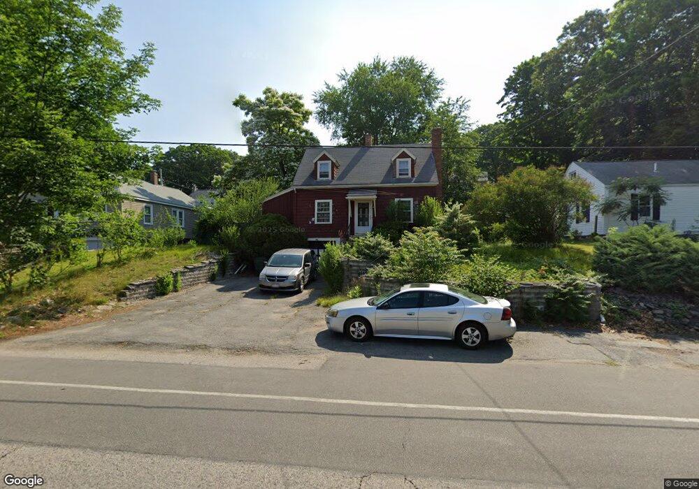
27 Pinehurst Ave Auburn, MA 01501
Stoneville NeighborhoodEstimated Value: $376,000 - $419,000
3
Beds
1
Bath
1,275
Sq Ft
$310/Sq Ft
Est. Value
About This Home
This home is located at 27 Pinehurst Ave, Auburn, MA 01501 and is currently estimated at $394,656, approximately $309 per square foot. 27 Pinehurst Ave is a home located in Worcester County with nearby schools including Auburn Senior High School and Shrewsbury Montessori School - Auburn Campus.
Ownership History
Date
Name
Owned For
Owner Type
Purchase Details
Closed on
Mar 27, 2015
Sold by
Campbell Jeffrey P and Campbell Jennifer B
Bought by
Campbell Jennifer B
Current Estimated Value
Purchase Details
Closed on
Oct 20, 1989
Sold by
Blais Shirley
Bought by
Skiest Erick
Home Financials for this Owner
Home Financials are based on the most recent Mortgage that was taken out on this home.
Original Mortgage
$101,700
Interest Rate
10.06%
Mortgage Type
Purchase Money Mortgage
Purchase Details
Closed on
Mar 29, 1988
Sold by
Hunt Andrew C
Bought by
Blais S A
Create a Home Valuation Report for This Property
The Home Valuation Report is an in-depth analysis detailing your home's value as well as a comparison with similar homes in the area
Home Values in the Area
Average Home Value in this Area
Purchase History
| Date | Buyer | Sale Price | Title Company |
|---|---|---|---|
| Campbell Jennifer B | -- | -- | |
| Skiest Erick | $113,000 | -- | |
| Blais S A | $55,113 | -- |
Source: Public Records
Mortgage History
| Date | Status | Borrower | Loan Amount |
|---|---|---|---|
| Previous Owner | Blais S A | $122,000 | |
| Previous Owner | Blais S A | $15,000 | |
| Previous Owner | Blais S A | $102,500 | |
| Previous Owner | Blais S A | $101,700 |
Source: Public Records
Tax History Compared to Growth
Tax History
| Year | Tax Paid | Tax Assessment Tax Assessment Total Assessment is a certain percentage of the fair market value that is determined by local assessors to be the total taxable value of land and additions on the property. | Land | Improvement |
|---|---|---|---|---|
| 2025 | $41 | $285,900 | $100,000 | $185,900 |
| 2024 | $3,953 | $264,800 | $94,500 | $170,300 |
| 2023 | $3,883 | $244,500 | $85,800 | $158,700 |
| 2022 | $3,566 | $212,000 | $81,100 | $130,900 |
| 2021 | $3,260 | $179,700 | $71,500 | $108,200 |
| 2020 | $3,157 | $175,600 | $71,500 | $104,100 |
| 2019 | $3,025 | $164,200 | $66,700 | $97,500 |
| 2018 | $2,823 | $153,100 | $62,300 | $90,800 |
| 2017 | $2,645 | $144,200 | $56,500 | $87,700 |
| 2016 | $2,569 | $142,000 | $58,400 | $83,600 |
| 2015 | $2,442 | $141,500 | $58,400 | $83,100 |
| 2014 | $2,377 | $137,500 | $55,700 | $81,800 |
Source: Public Records
Map
Nearby Homes
- 191 Boyce St
- 176 Boyce St
- 177 Boyce St
- 5 Commonwealth Ave
- 27 Havana Rd
- 25 Vinal St Unit 26
- 25 Vinal St Unit 29
- 25 Vinal St Unit 30
- 177 Oxford St N
- 22 Lanark St
- 315 Stafford St
- 170 Stafford St
- 19-20 Williams St
- 37 Highland St
- 1-9 Helens Way
- 31 Walsh Ave
- 83 Bryn Mawr Ave
- 13 Merchant St
- 1511 Main St Unit C405
- 1511 Main St Unit C306
- 25 Pinehurst Ave
- 29 Pinehurst Ave
- 22 Marilyn Dr
- 24 Marilyn Dr
- 31 Pinehurst Ave
- 26 Pinehurst Ave
- 28 Pinehurst Ave
- 24 Pinehurst Ave
- 18 Marilyn Dr
- 21 Pinehurst Ave
- 33 Pinehurst Ave
- 30 Pinehurst Ave
- 22 Pinehurst Ave
- 16 Marilyn Dr
- 25 Marilyn Dr
- 19 Pinehurst Ave
- 32 Pinehurst Ave
- 23 Marilyn Dr
- 20 Pinehurst Ave
- 14 Marilyn Dr