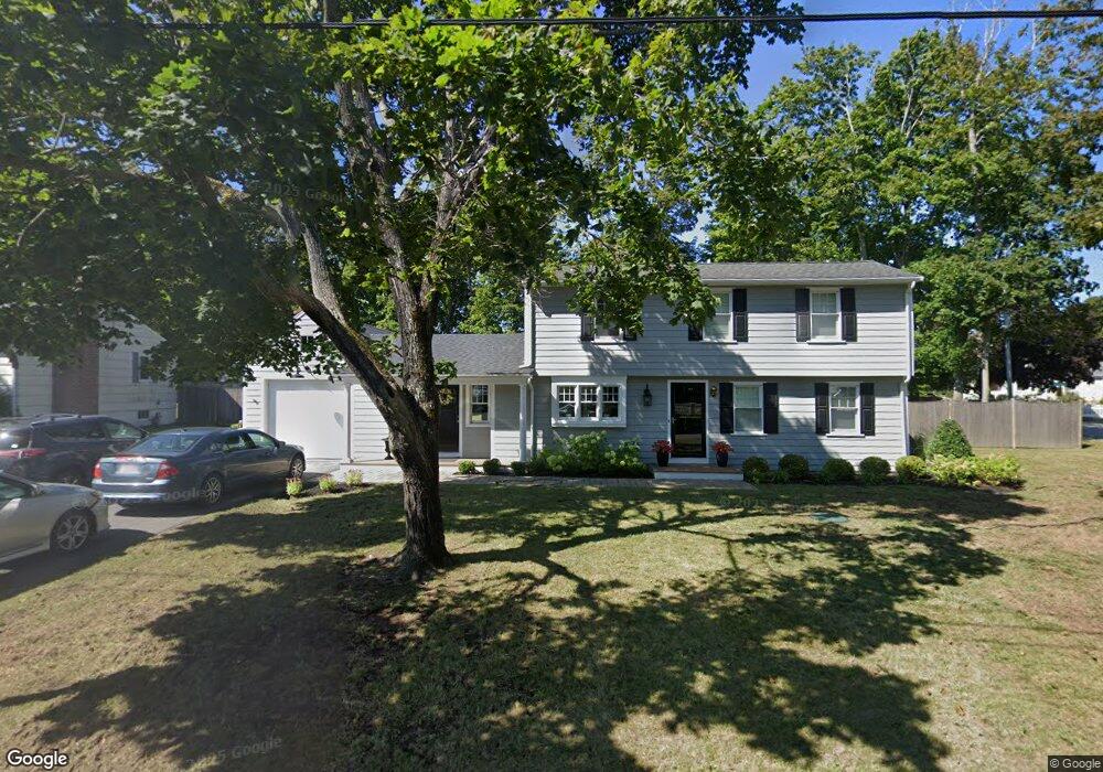
27 Poplar Ave Scituate, MA 02066
Estimated Value: $916,000 - $1,131,000
4
Beds
2
Baths
1,927
Sq Ft
$540/Sq Ft
Est. Value
About This Home
This home is located at 27 Poplar Ave, Scituate, MA 02066 and is currently estimated at $1,040,292, approximately $539 per square foot. 27 Poplar Ave is a home located in Plymouth County with nearby schools including Jenkins Elementary School, Lester J. Gates Middle School, and Scituate High School.
Ownership History
Date
Name
Owned For
Owner Type
Purchase Details
Closed on
Apr 11, 2025
Sold by
Donovan Patricia T
Bought by
Patricia Donovan Ret and Donovan
Current Estimated Value
Purchase Details
Closed on
Jun 25, 1993
Sold by
Park Jeanne C
Bought by
Donovan Leo W and Donovan Patricia T
Create a Home Valuation Report for This Property
The Home Valuation Report is an in-depth analysis detailing your home's value as well as a comparison with similar homes in the area
Home Values in the Area
Average Home Value in this Area
Purchase History
| Date | Buyer | Sale Price | Title Company |
|---|---|---|---|
| Patricia Donovan Ret | -- | None Available | |
| Donovan Leo W | $165,000 | -- |
Source: Public Records
Mortgage History
| Date | Status | Borrower | Loan Amount |
|---|---|---|---|
| Previous Owner | Donovan Leo W | $270,000 | |
| Previous Owner | Donovan Leo W | $60,000 | |
| Previous Owner | Donovan Leo W | $44,000 | |
| Previous Owner | Donovan Leo W | $8,439 |
Source: Public Records
Tax History Compared to Growth
Tax History
| Year | Tax Paid | Tax Assessment Tax Assessment Total Assessment is a certain percentage of the fair market value that is determined by local assessors to be the total taxable value of land and additions on the property. | Land | Improvement |
|---|---|---|---|---|
| 2025 | $8,868 | $887,700 | $464,900 | $422,800 |
| 2024 | $8,675 | $837,400 | $422,700 | $414,700 |
| 2023 | $8,178 | $768,700 | $384,200 | $384,500 |
| 2022 | $8,178 | $648,000 | $325,500 | $322,500 |
| 2021 | $6,733 | $505,100 | $310,000 | $195,100 |
| 2020 | $6,534 | $484,000 | $298,000 | $186,000 |
| 2019 | $6,286 | $457,500 | $279,500 | $178,000 |
| 2018 | $6,251 | $448,100 | $288,000 | $160,100 |
| 2017 | $5,928 | $420,700 | $266,700 | $154,000 |
| 2016 | $5,496 | $388,700 | $234,700 | $154,000 |
| 2015 | $4,952 | $378,000 | $224,000 | $154,000 |
Source: Public Records
Map
Nearby Homes
- 74 Tilden Rd
- 76 A Brook St
- 76 A Brook St Unit 1
- 50 First Parish Rd
- 91 Front St Unit 106
- 32 Barker Rd Unit 3
- 23 Sunset Rd
- 10 Benjamin Ln Unit 10
- 105 Turner Rd
- 23 Oceanside Dr
- 111 Elm St
- 115 Elm St
- 3 Grace Way Unit 3
- 1 Grace Way Unit 1
- 59 Greenfield Ln
- 30 Irving Rd
- 22 Kings Way
- 209 Hatherly Rd
- 2 Windward Ln
- 17 Bradford Ave
- 0 Tichnor Place
- 23 Poplar Ave
- 26 Poplar Ave
- 88 Beaver Dam Rd
- 88 Beaver Dam Rd
- 99 Beaver Dam Rd
- 22 Poplar Ave
- 94 Beaver Dam Rd
- 94 Beaver Dam Rd
- 94 Beaver Dam Rd Unit (Yearly)
- 19 Poplar Ave
- 3 Murphys Ln
- 3 Murphys Ln Unit 1
- 18 Poplar Ave
- 5 Tichnor Place
- 25 Linden Ave
- 8 Tichnor Place
- 15 Poplar Ave
- 103 Beaver Dam Rd
- 7 Murphys Ln