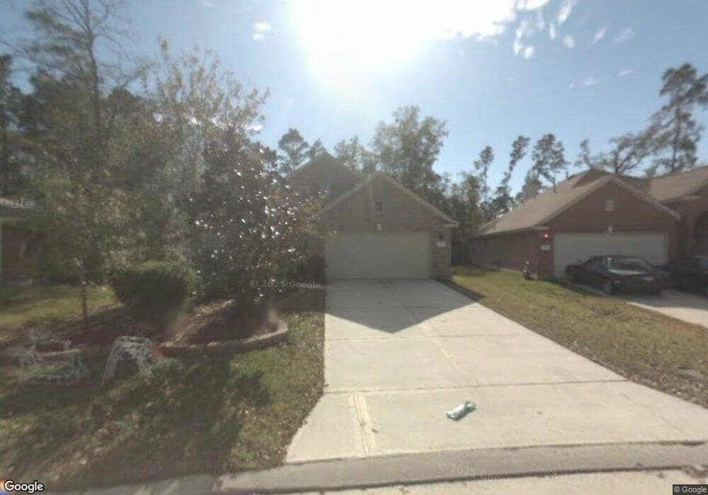
27 Rolling Ridge Ct Conroe, TX 77385
Harper's Landing NeighborhoodEstimated Value: $317,543 - $396,000
Studio
--
Bath
2,082
Sq Ft
$170/Sq Ft
Est. Value
About This Home
This home is located at 27 Rolling Ridge Ct, Conroe, TX 77385 and is currently estimated at $354,886, approximately $170 per square foot. 27 Rolling Ridge Ct is a home located in Montgomery County with nearby schools including Powell Elementary School, Collins Intermediate School, and Knox J High School.
Ownership History
Date
Name
Owned For
Owner Type
Purchase Details
Closed on
Dec 19, 2003
Sold by
Rh Of Texas Lp
Bought by
Flynn Steven C and Flynn Medea K
Current Estimated Value
Home Financials for this Owner
Home Financials are based on the most recent Mortgage that was taken out on this home.
Original Mortgage
$160,701
Outstanding Balance
$74,934
Interest Rate
5.97%
Mortgage Type
VA
Estimated Equity
$279,952
Purchase Details
Closed on
Oct 7, 2002
Sold by
Woodlands Land Dev Lp
Bought by
Flynn Steven C and Flynn Medea K
Create a Home Valuation Report for This Property
The Home Valuation Report is an in-depth analysis detailing your home's value as well as a comparison with similar homes in the area
Home Values in the Area
Average Home Value in this Area
Purchase History
| Date | Buyer | Sale Price | Title Company |
|---|---|---|---|
| Flynn Steven C | -- | -- | |
| Flynn Steven C | -- | -- |
Source: Public Records
Mortgage History
| Date | Status | Borrower | Loan Amount |
|---|---|---|---|
| Open | Flynn Steven C | $160,701 |
Source: Public Records
Tax History
| Year | Tax Paid | Tax Assessment Tax Assessment Total Assessment is a certain percentage of the fair market value that is determined by local assessors to be the total taxable value of land and additions on the property. | Land | Improvement |
|---|---|---|---|---|
| 2025 | $4,313 | $338,304 | -- | -- |
| 2024 | $3,893 | $307,549 | -- | -- |
| 2023 | $3,893 | $279,590 | $60,000 | $278,950 |
| 2022 | $5,399 | $254,170 | $60,000 | $0 |
| 2021 | $5,249 | $231,060 | $40,000 | $191,060 |
| 2020 | $5,357 | $221,080 | $40,000 | $181,080 |
| 2019 | $5,687 | $227,760 | $40,000 | $187,760 |
| 2018 | $4,671 | $215,320 | $40,000 | $175,320 |
| 2017 | $5,461 | $215,320 | $40,000 | $175,320 |
| 2016 | $5,216 | $205,660 | $40,000 | $165,660 |
| 2015 | $4,604 | $202,950 | $40,000 | $177,650 |
| 2014 | $4,604 | $184,500 | $40,000 | $144,500 |
Source: Public Records
Map
Nearby Homes
- 74 Wimberly Way
- 102 Wimberly Way
- 27 Harmony Hollow Ct
- 251 N Wimberly Way
- 9809 Wren Ct
- 16731 Foursquare Dr
- 174 N Wimberly Way
- 7 Raindance Ct
- 9838 Bobolink Dr
- 203 Fairwind Trail Dr
- 16820 Infield Ct
- 16758 N Blue Jay Dr
- 16937 Larkspur
- 9877 Lace Flower Way
- 16870 Blackberry Lily Ln
- 16771 N Rail Dr
- 16947 Hummingbird
- 171 S Delta Mill Cir
- 16751 N Rail Dr
- 16945 Scenic Knoll
- 23 Rolling Ridge Ct
- 31 Rolling Ridge Ct
- 91 Genesee Ridge Dr
- 19 Rolling Ridge Ct
- 95 Genesee Ridge Dr
- 22 Rolling Ridge Ct
- 15 Rolling Ridge Ct
- 99 Genesee Ridge Dr
- 14 Rolling Ridge Ct
- 86 Genesee Ridge Dr
- 62 Prairie Oak Dr
- 82 Genesee Ridge Dr
- 90 Genesee Ridge Dr
- 11 Rolling Ridge Ct
- 103 Genesee Ridge Dr
- 94 Genesee Ridge Dr
- 79 Genesee Ridge Dr
- 78 Genesee Ridge Dr
- 58 Prairie Oak Dr
- 98 Genesee Ridge Dr
Your Personal Tour Guide
Ask me questions while you tour the home.