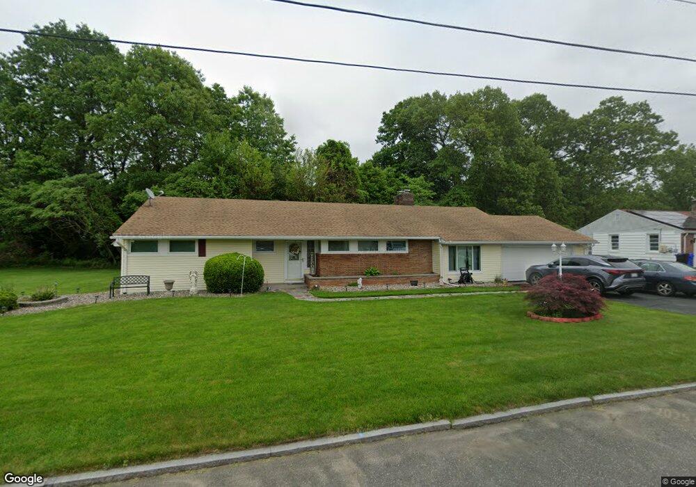
27 Terrace Ln Springfield, MA 01118
East Forest Park NeighborhoodEstimated Value: $338,000 - $392,000
3
Beds
3
Baths
1,340
Sq Ft
$266/Sq Ft
Est. Value
About This Home
This home is located at 27 Terrace Ln, Springfield, MA 01118 and is currently estimated at $356,173, approximately $265 per square foot. 27 Terrace Ln is a home located in Hampden County with nearby schools including Frank H. Freedman School, M Marcus Kiley Middle, and Springfield High School of Science and Technology.
Ownership History
Date
Name
Owned For
Owner Type
Purchase Details
Closed on
Nov 1, 2019
Sold by
Roswess Leroy A and Roswess Lorna
Bought by
Roswess Lorna
Current Estimated Value
Purchase Details
Closed on
Dec 2, 1993
Sold by
Share Elisse and Allinson Marc
Bought by
Roswess Leroy A and Roswess Lorna
Home Financials for this Owner
Home Financials are based on the most recent Mortgage that was taken out on this home.
Original Mortgage
$116,000
Interest Rate
6.69%
Mortgage Type
Purchase Money Mortgage
Create a Home Valuation Report for This Property
The Home Valuation Report is an in-depth analysis detailing your home's value as well as a comparison with similar homes in the area
Home Values in the Area
Average Home Value in this Area
Purchase History
| Date | Buyer | Sale Price | Title Company |
|---|---|---|---|
| Roswess Lorna | -- | None Available | |
| Roswess Leroy A | $122,500 | -- |
Source: Public Records
Mortgage History
| Date | Status | Borrower | Loan Amount |
|---|---|---|---|
| Previous Owner | Roswess Leroy A | $41,000 | |
| Previous Owner | Roswess Leroy A | $15,999 | |
| Previous Owner | Roswess Leroy A | $116,000 |
Source: Public Records
Tax History
| Year | Tax Paid | Tax Assessment Tax Assessment Total Assessment is a certain percentage of the fair market value that is determined by local assessors to be the total taxable value of land and additions on the property. | Land | Improvement |
|---|---|---|---|---|
| 2025 | $4,828 | $307,900 | $51,200 | $256,700 |
| 2024 | $4,694 | $292,300 | $51,200 | $241,100 |
| 2023 | $4,689 | $275,000 | $48,800 | $226,200 |
| 2022 | $4,041 | $214,700 | $48,800 | $165,900 |
| 2021 | $3,903 | $206,500 | $44,400 | $162,100 |
| 2020 | $3,693 | $189,100 | $44,400 | $144,700 |
| 2019 | $3,631 | $184,500 | $44,400 | $140,100 |
| 2018 | $3,546 | $180,200 | $44,400 | $135,800 |
| 2017 | $3,283 | $167,000 | $44,400 | $122,600 |
| 2016 | $3,207 | $163,100 | $44,400 | $118,700 |
| 2015 | $3,153 | $160,300 | $44,400 | $115,900 |
Source: Public Records
Map
Nearby Homes
- 37 Chesterfield Ave
- 647 Plumtree Rd
- 509 Plumtree Rd
- 101 Regal St
- 384 Abbott St
- 75 Gillette Cir
- 54 S Shore Dr
- 55 Old Farm Rd
- 30 W Hill Rd
- 7 Ashbrook St
- 744 Bradley Rd
- 55 Allen St
- 19 Manor Ct Unit 19
- 47 Hartford Terrace
- 49 Corcoran Blvd
- 236 Pondview Dr
- 79 Roosevelt Ave
- 125 Manor Ct Unit 125
- 81 W Crystal Brook Dr
- 170 Plumtree Rd
- 39 Terrace Ln
- 30 Terrace Ln
- 337 S Branch Pkwy
- 20 Terrace Ln
- 40 Terrace Ln
- 49 Terrace Ln
- 353 S Branch Pkwy
- 323 S Branch Pkwy
- 27 Briarwood Ave
- 50 Terrace Ln
- 17 Briarwood Ave
- 31 Briarwood Ave
- 311 S Branch Pkwy
- 359 S Branch Pkwy
- 59 Terrace Ln
- 39 Briarwood Ave
- 95 Briarwood Ave
- 47 Briarwood Ave
- 369 S Branch Pkwy
- 48 Gorman Ln
Your Personal Tour Guide
Ask me questions while you tour the home.