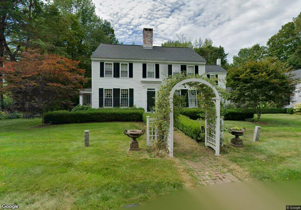
27 Thorndike Pond Rd Jaffrey, NH 03452
Estimated Value: $582,445 - $1,185,000
4
Beds
3
Baths
3,034
Sq Ft
$262/Sq Ft
Est. Value
About This Home
This home is located at 27 Thorndike Pond Rd, Jaffrey, NH 03452 and is currently estimated at $796,111, approximately $262 per square foot. 27 Thorndike Pond Rd is a home located in Cheshire County with nearby schools including Jaffrey Grade School, Conant Middle High School, and Conant High School.
Ownership History
Date
Name
Owned For
Owner Type
Purchase Details
Closed on
Jul 30, 2015
Sold by
Pedott Richard C
Bought by
Richard C Pedott Ret
Current Estimated Value
Purchase Details
Closed on
Mar 1, 2005
Sold by
Mclaughlin Peter S and Mclaughlin Jennifer B
Bought by
Pedott Richard C and Pedott Christine N
Home Financials for this Owner
Home Financials are based on the most recent Mortgage that was taken out on this home.
Original Mortgage
$320,000
Interest Rate
5.73%
Mortgage Type
Purchase Money Mortgage
Create a Home Valuation Report for This Property
The Home Valuation Report is an in-depth analysis detailing your home's value as well as a comparison with similar homes in the area
Home Values in the Area
Average Home Value in this Area
Purchase History
| Date | Buyer | Sale Price | Title Company |
|---|---|---|---|
| Richard C Pedott Ret | -- | -- | |
| Pedott Richard C | $400,000 | -- |
Source: Public Records
Mortgage History
| Date | Status | Borrower | Loan Amount |
|---|---|---|---|
| Previous Owner | Pedott Richard C | $320,000 |
Source: Public Records
Tax History Compared to Growth
Tax History
| Year | Tax Paid | Tax Assessment Tax Assessment Total Assessment is a certain percentage of the fair market value that is determined by local assessors to be the total taxable value of land and additions on the property. | Land | Improvement |
|---|---|---|---|---|
| 2024 | $12,241 | $373,200 | $47,000 | $326,200 |
| 2023 | $12,446 | $373,200 | $47,000 | $326,200 |
| 2022 | $11,562 | $373,200 | $47,000 | $326,200 |
| 2021 | $10,409 | $373,200 | $47,000 | $326,200 |
| 2020 | $10,274 | $373,200 | $47,000 | $326,200 |
| 2019 | $10,665 | $306,200 | $37,700 | $268,500 |
| 2018 | $10,105 | $306,200 | $37,700 | $268,500 |
| 2017 | $10,095 | $306,200 | $37,700 | $268,500 |
| 2016 | $10,105 | $306,200 | $37,700 | $268,500 |
| 2015 | $10,172 | $306,200 | $37,700 | $268,500 |
| 2014 | $9,748 | $330,989 | $63,350 | $267,639 |
| 2013 | -- | $330,989 | $63,350 | $267,639 |
Source: Public Records
Map
Nearby Homes
- 18 Roberts Dr Unit 1
- 65 Roberts Dr Unit 17
- 57 Roberts Dr Unit 19
- 13 Harkness Rd
- 52 Roberts Dr Unit 5
- 40 Roberts Dr Unit 3
- 60 Roberts Dr Unit 8
- 56 Roberts Dr Unit 7
- 49 Roberts Dr Unit 23
- 0 Roberts Dr Unit 5030097
- 199 Bryant Rd
- 122 Proctor Rd
- 14 Windy Fields Ln
- 75 Main St
- 11 Saint Jean St
- 40 Charlonne St
- 8 Cross St
- 220-13-2 Lot Mountain Rd
- 520 North St
- 24 Red Gate Rd
- 28 Thorndike Pond Rd
- 21 Thorndike Pond Rd
- 17 Thorndike Pond Rd
- 10 Blackberry Ln
- 36 Thorndike Pond Rd
- 12 Laban Ainsworth Way
- 10 Thorndike Pond Rd
- 20 Blackberry Ln
- 20 Meetinghouse Rd
- 43 Thorndike Pond Rd
- 12 Blackberry Ln
- 384 Main St
- 54 Thorndike Pond Rd
- 786 Gilmore Pond Rd
- 55 Thorndike Pond Rd
- 401 Main St
- 385 Main St
- 63 Thorndike Pond Rd
- 380 Main St
- 38 Blackberry Ln