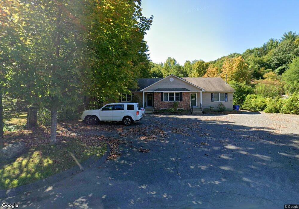
27 W Farms Rd Unit C Florence, MA 01062
Florence NeighborhoodEstimated Value: $216,000 - $296,000
1
Bed
1
Bath
770
Sq Ft
$326/Sq Ft
Est. Value
About This Home
This home is located at 27 W Farms Rd Unit C, Florence, MA 01062 and is currently estimated at $251,335, approximately $326 per square foot. 27 W Farms Rd Unit C is a home located in Hampshire County with nearby schools including Northampton High School, Calvary Baptist Christian School, and The Williston Northampton School.
Ownership History
Date
Name
Owned For
Owner Type
Purchase Details
Closed on
Nov 29, 2005
Sold by
Entis Paul
Bought by
Harp Reynaud L
Current Estimated Value
Home Financials for this Owner
Home Financials are based on the most recent Mortgage that was taken out on this home.
Original Mortgage
$152,950
Outstanding Balance
$84,403
Interest Rate
6.06%
Mortgage Type
Purchase Money Mortgage
Estimated Equity
$166,932
Purchase Details
Closed on
Jan 18, 2005
Sold by
Gagne Thomas A and Gagne Alexis M
Bought by
Entis Paul
Create a Home Valuation Report for This Property
The Home Valuation Report is an in-depth analysis detailing your home's value as well as a comparison with similar homes in the area
Home Values in the Area
Average Home Value in this Area
Purchase History
| Date | Buyer | Sale Price | Title Company |
|---|---|---|---|
| Harp Reynaud L | $161,000 | -- | |
| Harp Reynaud L | $161,000 | -- | |
| Harp Reynaud L | $161,000 | -- | |
| Entis Paul | $149,800 | -- | |
| Entis Paul | $149,800 | -- |
Source: Public Records
Mortgage History
| Date | Status | Borrower | Loan Amount |
|---|---|---|---|
| Open | Harp Reynaud L | $152,950 | |
| Closed | Harp Reynaud L | $152,950 |
Source: Public Records
Tax History Compared to Growth
Tax History
| Year | Tax Paid | Tax Assessment Tax Assessment Total Assessment is a certain percentage of the fair market value that is determined by local assessors to be the total taxable value of land and additions on the property. | Land | Improvement |
|---|---|---|---|---|
| 2025 | $3,014 | $216,400 | $0 | $216,400 |
| 2024 | $2,538 | $167,100 | $0 | $167,100 |
| 2023 | $2,520 | $159,100 | $0 | $159,100 |
| 2022 | $2,587 | $144,600 | $0 | $144,600 |
| 2021 | $2,392 | $137,700 | $0 | $137,700 |
| 2020 | $2,313 | $137,700 | $0 | $137,700 |
| 2019 | $2,658 | $153,000 | $0 | $153,000 |
| 2018 | $2,607 | $153,000 | $0 | $153,000 |
| 2017 | $2,554 | $153,000 | $0 | $153,000 |
| 2016 | $2,472 | $153,000 | $0 | $153,000 |
| 2015 | $2,417 | $153,000 | $0 | $153,000 |
| 2014 | $2,355 | $153,000 | $0 | $153,000 |
Source: Public Records
Map
Nearby Homes
- 0 W Farms Rd
- 832 Westhampton Rd
- 404 Sylvester Rd
- 20-11 Sylvester Rd
- 1260 Westhampton Rd
- 200 Easthampton Rd
- 39 Matthew Dr
- 815 Burts Pit Rd
- 262 Loudville Rd
- 98 Park Hill Rd
- 36 Torrey St
- 12 Nicols Way Unit 12
- 6 Nicols Way Unit 6
- 18 Nicols Way Unit 18
- 2 Mine Rd
- 723 Florence Rd
- 635 Florence Rd
- 75 Lead Mine Rd
- 225 Nonotuck St Unit C
- 37 Landy Ave
- 27 W Farms Rd Unit B
- 27 W Farms Rd Unit 3
- 27 W Farms Rd Unit 2
- 27 W Farms Rd Unit 1
- 27 W Farms Rd Unit A
- 27 W Farms Rd Unit D&E
- 35 W Farms Rd
- 15 W Farms Rd
- 15 W Farms Rd
- 15 W Farms Rd Unit C
- 9 W Farms Rd
- 18 W Farms Rd
- 34 W Farms Rd
- 18 W Farms Rd
- 1 Turkey Hill Rd
- 0 Sylvester Rd Unit 14121422
- 0 Sylvester Rd Unit 14121421
- 0 Sylvester Rd Unit 71897364
- 51 W Farms Rd
- 00 W Farms Rd