Estimated Value: $225,000 - $283,000
3
Beds
2
Baths
1,624
Sq Ft
$161/Sq Ft
Est. Value
About This Home
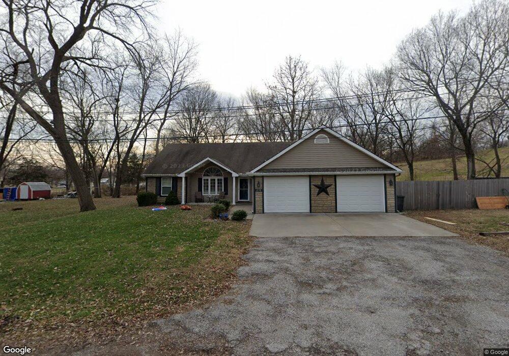
This home is located at 270 3rd St, Holt, MO 64048 and is currently estimated at $261,178, approximately $160 per square foot. 270 3rd St is a home located in Clay County with nearby schools including Kearney Junior High School, Kearney High School, and Northern Hills Christian Academy.
Ownership History
Date
Name
Owned For
Owner Type
Purchase Details
Closed on
Aug 30, 2023
Sold by
Myers-Spahr Kathy L
Bought by
Evans Chirsty L
Current Estimated Value
Purchase Details
Closed on
Oct 25, 2019
Sold by
Myers Kathy L
Bought by
Myers Kathy L and Evans Christy Lee
Purchase Details
Closed on
Mar 26, 2018
Sold by
Dray Lloyd D and Dray Sherrie
Bought by
Dray Shelton and Dray Erin
Purchase Details
Closed on
Mar 23, 2018
Sold by
Dray Shelton and Dray Erin
Bought by
Myers Kathy L
Purchase Details
Closed on
Apr 4, 2006
Sold by
Clifford Leon C
Bought by
Dray Shelton and Dray Erin
Home Financials for this Owner
Home Financials are based on the most recent Mortgage that was taken out on this home.
Original Mortgage
$93,600
Interest Rate
6.21%
Mortgage Type
Construction
Create a Home Valuation Report for This Property
The Home Valuation Report is an in-depth analysis detailing your home's value as well as a comparison with similar homes in the area
Home Values in the Area
Average Home Value in this Area
Purchase History
| Date | Buyer | Sale Price | Title Company |
|---|---|---|---|
| Evans Chirsty L | -- | None Listed On Document | |
| Evans Chirsty L | -- | None Listed On Document | |
| Myers Kathy L | -- | None Available | |
| Dray Shelton | -- | Mccaffree Short Title | |
| Myers Kathy L | -- | Mccaffree Short Title | |
| Dray Shelton | -- | Thomson Title Corporation |
Source: Public Records
Mortgage History
| Date | Status | Borrower | Loan Amount |
|---|---|---|---|
| Previous Owner | Dray Shelton | $93,600 |
Source: Public Records
Tax History
| Year | Tax Paid | Tax Assessment Tax Assessment Total Assessment is a certain percentage of the fair market value that is determined by local assessors to be the total taxable value of land and additions on the property. | Land | Improvement |
|---|---|---|---|---|
| 2025 | $2,341 | $36,290 | -- | -- |
| 2024 | $2,341 | $32,780 | -- | -- |
| 2023 | $2,241 | $32,780 | $0 | $0 |
| 2022 | $2,016 | $28,900 | $0 | $0 |
| 2021 | $2,018 | $28,899 | $1,425 | $27,474 |
| 2020 | $2,012 | $26,640 | $0 | $0 |
| 2019 | $2,015 | $26,640 | $0 | $0 |
Source: Public Records
Map
Nearby Homes
- 175 3rd St
- Lot 4 Arnold Park
- Lot 2 Arnold Park
- Lot 3 Arnold Park
- 610 Waters St
- 606 Water St
- 19412 Shanks Rd
- 19616 NE 190th St
- 7129 SE Cannon Ball Rd
- 3389 SE Old Barn Ln
- 6470 SE Horseshoe Dr
- 6721 SE Isley Dr
- 7341 SE Sycamore Dr
- 52 SE 208th St
- 0 Lot 3 Arnold Park Lot N A Unit HMS2572330
- 0 Lot 5 Arnold Park Lot N A Unit HMS2572371
- 5199 SE Fox Run Rd
- 22612 N Prestige Dr
- 887 201st St
- 5650 SE West Hwy
Your Personal Tour Guide
Ask me questions while you tour the home.