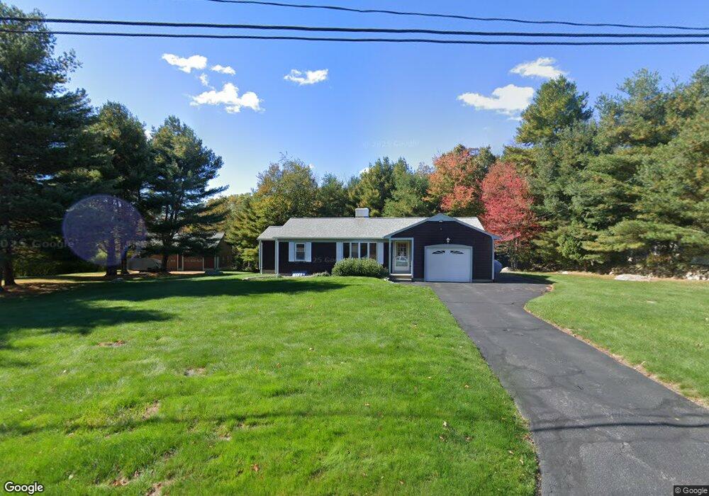
270 Chestnut St Rehoboth, MA 02769
Estimated Value: $473,426 - $534,000
2
Beds
1
Bath
1,182
Sq Ft
$425/Sq Ft
Est. Value
About This Home
This home is located at 270 Chestnut St, Rehoboth, MA 02769 and is currently estimated at $501,809, approximately $424 per square foot. 270 Chestnut St is a home located in Bristol County with nearby schools including Dighton-Rehoboth Regional High School and Highlander Charter Middle and High School.
Ownership History
Date
Name
Owned For
Owner Type
Purchase Details
Closed on
Jun 12, 1992
Sold by
Desorcy Henry Gerald and Desorcy Ruth Carol
Bought by
Misanda Timothy A and Benaot Lor4raiane E
Current Estimated Value
Create a Home Valuation Report for This Property
The Home Valuation Report is an in-depth analysis detailing your home's value as well as a comparison with similar homes in the area
Home Values in the Area
Average Home Value in this Area
Purchase History
| Date | Buyer | Sale Price | Title Company |
|---|---|---|---|
| Misanda Timothy A | $132,900 | -- |
Source: Public Records
Mortgage History
| Date | Status | Borrower | Loan Amount |
|---|---|---|---|
| Open | Misanda Timothy A | $200,000 | |
| Closed | Misanda Timothy A | $10,000 | |
| Closed | Misanda Timothy A | $96,260 | |
| Closed | Misanda Timothy A | $6,275 |
Source: Public Records
Tax History Compared to Growth
Tax History
| Year | Tax Paid | Tax Assessment Tax Assessment Total Assessment is a certain percentage of the fair market value that is determined by local assessors to be the total taxable value of land and additions on the property. | Land | Improvement |
|---|---|---|---|---|
| 2025 | $45 | $400,700 | $182,900 | $217,800 |
| 2024 | $4,230 | $372,400 | $182,900 | $189,500 |
| 2023 | $4,155 | $358,800 | $179,400 | $179,400 |
| 2022 | $4,123 | $325,400 | $171,200 | $154,200 |
| 2021 | $3,973 | $300,100 | $155,300 | $144,800 |
| 2020 | $3,819 | $291,100 | $155,300 | $135,800 |
| 2018 | $2,419 | $281,000 | $147,800 | $133,200 |
| 2017 | $3,235 | $257,600 | $147,800 | $109,800 |
| 2016 | $3,161 | $260,200 | $147,800 | $112,400 |
| 2015 | $2,989 | $242,800 | $140,700 | $102,100 |
| 2014 | $2,937 | $236,100 | $134,000 | $102,100 |
Source: Public Records
Map
Nearby Homes
- 42 Pleasant St
- 271 Chestnut St
- 38 Pleasant St
- 264 Chestnut St
- 263 Chestnut St
- 28 Pleasant St
- 1 Augusta Cir
- 258 Chestnut St
- 259 Chestnut St
- 23 Calisto Dr
- 5 Augusta Cir
- 46 Pleasant St
- 47 Pleasant St
- 19 Calisto Dr
- 53 Pleasant St
- 253 Chestnut St
- 253 Chestnut St Unit RIGHT
- 253 Chestnut St Unit LEFT
- 253 Chestnut St
- 255 Chestnut St