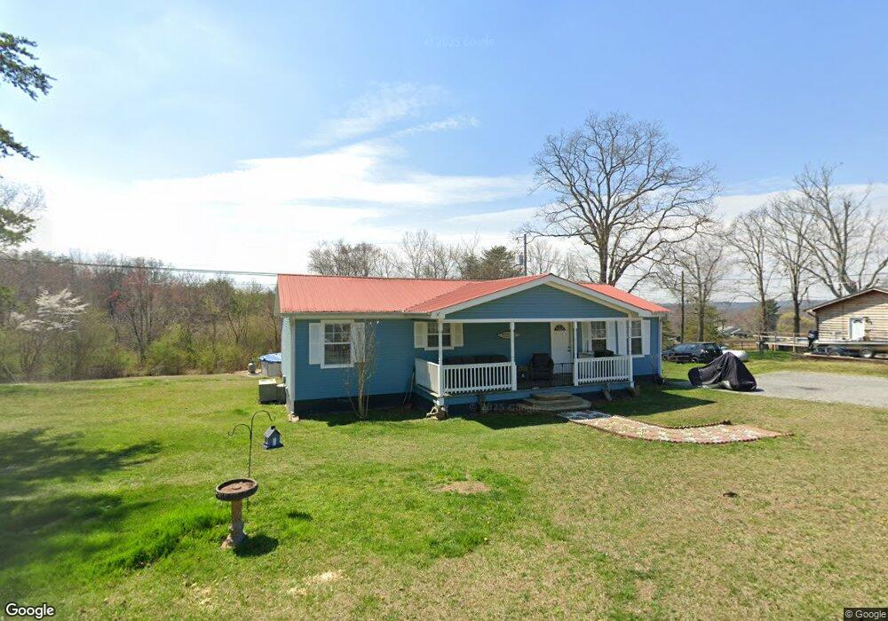
270 Cross Rd Dunlap, TN 37327
Cagle-Fredonia NeighborhoodEstimated Value: $203,696 - $245,000
3
Beds
2
Baths
1,200
Sq Ft
$187/Sq Ft
Est. Value
About This Home
This home is located at 270 Cross Rd, Dunlap, TN 37327 and is currently estimated at $223,924, approximately $186 per square foot. 270 Cross Rd is a home located in Sequatchie County with nearby schools including Griffith Elementary School, Sequatchie County Middle School, and Sequatchie County High School.
Ownership History
Date
Name
Owned For
Owner Type
Purchase Details
Closed on
Aug 3, 2012
Sold by
Tennessee Housing Developm
Bought by
Miles Joe T and Miles Connie S
Current Estimated Value
Purchase Details
Closed on
Dec 6, 2011
Sold by
Blasen Joshua M
Bought by
Tennessee Housing Development
Purchase Details
Closed on
Jul 3, 2006
Sold by
Lee Browning Robert
Bought by
Blasen Joshua M
Purchase Details
Closed on
Dec 7, 2005
Bought by
Browning Robert Lee Browning Jamie M
Purchase Details
Closed on
Apr 19, 2000
Sold by
Farley Marty S
Bought by
Robert Browning
Purchase Details
Closed on
Nov 3, 1989
Bought by
Farley Marty S
Create a Home Valuation Report for This Property
The Home Valuation Report is an in-depth analysis detailing your home's value as well as a comparison with similar homes in the area
Home Values in the Area
Average Home Value in this Area
Purchase History
| Date | Buyer | Sale Price | Title Company |
|---|---|---|---|
| Miles Joe T | $42,500 | -- | |
| Tennessee Housing Development | $42,500 | -- | |
| Blasen Joshua M | $74,057 | -- | |
| Browning Robert Lee Browning Jamie M | -- | -- | |
| Robert Browning | $61,000 | -- | |
| Farley Marty S | $2,000 | -- |
Source: Public Records
Tax History
| Year | Tax Paid | Tax Assessment Tax Assessment Total Assessment is a certain percentage of the fair market value that is determined by local assessors to be the total taxable value of land and additions on the property. | Land | Improvement |
|---|---|---|---|---|
| 2025 | $533 | $29,025 | $2,600 | $26,425 |
| 2024 | $533 | $29,025 | $2,600 | $26,425 |
| 2023 | $533 | $29,025 | $2,600 | $26,425 |
| 2022 | $445 | $18,225 | $1,575 | $16,650 |
| 2021 | $445 | $18,225 | $1,575 | $16,650 |
| 2020 | $445 | $18,225 | $1,575 | $16,650 |
| 2019 | $445 | $18,225 | $1,575 | $16,650 |
| 2018 | $445 | $18,225 | $1,575 | $16,650 |
| 2017 | $421 | $17,250 | $1,575 | $15,675 |
| 2016 | $477 | $18,575 | $2,700 | $15,875 |
| 2015 | $477 | $18,575 | $2,700 | $15,875 |
| 2014 | $477 | $18,575 | $2,700 | $15,875 |
Source: Public Records
Map
Nearby Homes
- 175 Twitty Rd
- 1211 Stooping Oak Rd W
- 13 Bear Wallow Rd
- Lot 13 Bear Wallow Rd
- 0 Echo Point Rd Unit 1525258
- 0 Echo Point Rd Unit 98
- 0 Echo Point Rd Unit RTC2921346
- 0 Echo Point Rd Unit 1515170
- 408 Sherman Rd
- 0 Fredonia Rd Unit 1240366
- 0 Saddleback Rd Unit 1526682
- 10 Laurel Brook Rd
- 481 Hitchcock Rd
- 60 Laurel Ridge
- 4 Tennessee 399
- 0 Woods Rd Unit RTC3042786
- 0 Woods Rd Unit 1523709
- Lot 6 Longview Ridge
- 13 N Greenfields Way
- Lot 11 Green Forest Rd
Your Personal Tour Guide
Ask me questions while you tour the home.