Estimated Value: $203,255 - $307,000
3
Beds
2
Baths
1,595
Sq Ft
$158/Sq Ft
Est. Value
About This Home
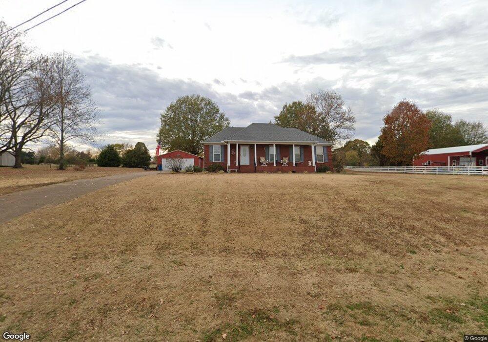
This home is located at 270 Cypress Rd, Alamo, TN 38001 and is currently estimated at $251,814, approximately $157 per square foot. 270 Cypress Rd is a home located in Crockett County with nearby schools including Alamo Elementary School.
Ownership History
Date
Name
Owned For
Owner Type
Purchase Details
Closed on
Jan 27, 2022
Sold by
Barrett and Nancy
Bought by
Barrett Nancy and Nichols Angela
Current Estimated Value
Purchase Details
Closed on
Feb 17, 2017
Sold by
Foust Logan H
Bought by
Barrett Murry and Barrett Nancy
Purchase Details
Closed on
Aug 19, 2013
Bought by
Foust Logan H
Purchase Details
Closed on
May 25, 2011
Sold by
Brown Lana
Bought by
Brown Bryan
Purchase Details
Closed on
Oct 3, 2002
Sold by
Rose Raymond
Bought by
Brown Bryan
Purchase Details
Closed on
Nov 16, 1998
Bought by
Rose Raymond J % Mary E Rose
Purchase Details
Closed on
Jul 2, 1998
Sold by
Beal Corey L
Bought by
Rose Mary E
Create a Home Valuation Report for This Property
The Home Valuation Report is an in-depth analysis detailing your home's value as well as a comparison with similar homes in the area
Home Values in the Area
Average Home Value in this Area
Purchase History
| Date | Buyer | Sale Price | Title Company |
|---|---|---|---|
| Barrett Nancy | -- | Lamb Randy S | |
| Barrett Murry | $131,000 | -- | |
| Foust Logan H | $126,900 | -- | |
| Brown Bryan | -- | -- | |
| Brown Bryan | $105,000 | -- | |
| Rose Raymond J % Mary E Rose | $66,300 | -- | |
| Rose Mary E | $99,500 | -- |
Source: Public Records
Tax History Compared to Growth
Tax History
| Year | Tax Paid | Tax Assessment Tax Assessment Total Assessment is a certain percentage of the fair market value that is determined by local assessors to be the total taxable value of land and additions on the property. | Land | Improvement |
|---|---|---|---|---|
| 2024 | -- | $44,125 | $3,250 | $40,875 |
| 2023 | $1,443 | $44,125 | $3,250 | $40,875 |
| 2022 | $1,459 | $44,125 | $3,250 | $40,875 |
| 2021 | $1,203 | $30,150 | $2,500 | $27,650 |
| 2020 | $780 | $30,150 | $2,500 | $27,650 |
| 2019 | $1,224 | $30,150 | $2,500 | $27,650 |
| 2018 | $1,238 | $30,500 | $2,500 | $28,000 |
| 2017 | $1,238 | $30,500 | $2,500 | $28,000 |
| 2016 | $1,144 | $30,500 | $2,500 | $28,000 |
| 2015 | $1,052 | $30,500 | $2,500 | $28,000 |
| 2014 | $1,052 | $28,833 | $0 | $0 |
Source: Public Records
Map
Nearby Homes
- 272 E Vine St
- 375 E Park St
- 484 E Main St
- 735 E Main St
- 588 E Church St
- 207 S Johnson St
- 0 Bells St S
- 120 W Lincoln St
- 73 W Lincoln St
- 87 Aaron Dr
- 220 S Branch St
- 109 S Burns St
- 316 N Bells St
- 348 N Bells St
- 492 Lee Cir
- 0 U S Highway 412
- 153 County Farm Rd
- 285 Pete Tinsley Rd
- 165 Harris Grove Cemetery Rd
- 0 Pete Tinsley Rd
- 261 Cypress Rd
- 281 Cypress Rd
- 232 Cypress Rd
- 225 Cypress Rd
- 301 Cypress Rd
- 161 Cypress Rd
- 331 Cypress Rd
- 387 Cypress Rd
- 148 Cypress Rd
- 114 Cypress Rd
- 121 Cypress Rd
- 92 Cypress Rd
- 99 Cypress Rd
- 88 Cypress Rd
- 71 Cypress Rd
- 139 Cypress Rd
- 132 Cypress Rd
- 116 Cypress Rd
- 168 Arlan Reason Rd
- 109 Cypress Rd