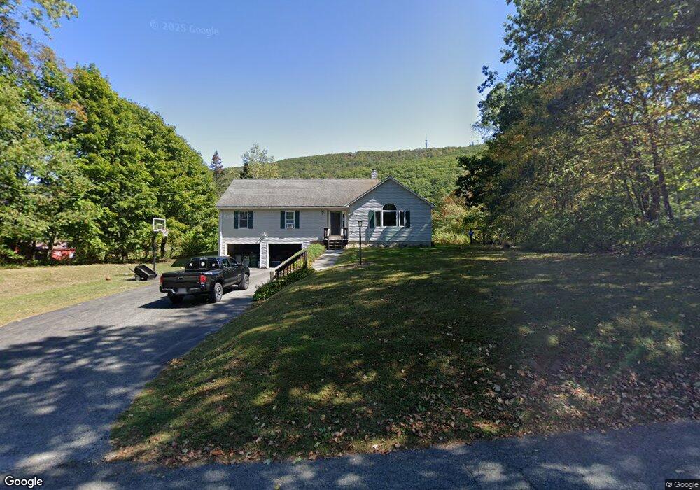
270 Daniels Rd North Adams, MA 01247
Estimated Value: $365,000 - $531,000
4
Beds
2
Baths
2,500
Sq Ft
$182/Sq Ft
Est. Value
About This Home
This home is located at 270 Daniels Rd, North Adams, MA 01247 and is currently estimated at $454,226, approximately $181 per square foot. 270 Daniels Rd is a home located in Berkshire County with nearby schools including Colegrove Park Elementary School and Drury High School.
Ownership History
Date
Name
Owned For
Owner Type
Purchase Details
Closed on
Mar 31, 2008
Sold by
Parrino Karen and Parrino Michael
Bought by
Bullett Aimee M and Bullett Brendan R
Current Estimated Value
Purchase Details
Closed on
Aug 13, 1997
Sold by
Pytko Tadeusz J and Pytko Ruth E
Bought by
Howland Adam D
Purchase Details
Closed on
Jul 15, 1996
Sold by
Meranti William E and Meranti Denise A
Bought by
Parrino Michael and Parrino Karen
Create a Home Valuation Report for This Property
The Home Valuation Report is an in-depth analysis detailing your home's value as well as a comparison with similar homes in the area
Home Values in the Area
Average Home Value in this Area
Purchase History
| Date | Buyer | Sale Price | Title Company |
|---|---|---|---|
| Bullett Aimee M | $262,000 | -- | |
| Howland Adam D | $70,000 | -- | |
| Parrino Michael | $16,000 | -- |
Source: Public Records
Mortgage History
| Date | Status | Borrower | Loan Amount |
|---|---|---|---|
| Open | Parrino Michael | $213,000 | |
| Closed | Parrino Michael | $35,500 |
Source: Public Records
Tax History Compared to Growth
Tax History
| Year | Tax Paid | Tax Assessment Tax Assessment Total Assessment is a certain percentage of the fair market value that is determined by local assessors to be the total taxable value of land and additions on the property. | Land | Improvement |
|---|---|---|---|---|
| 2025 | $6,766 | $404,900 | $53,300 | $351,600 |
| 2024 | $6,393 | $373,000 | $48,900 | $324,100 |
| 2023 | $6,234 | $352,800 | $48,900 | $303,900 |
| 2022 | $5,600 | $302,200 | $48,900 | $253,300 |
| 2021 | $5,207 | $279,800 | $45,200 | $234,600 |
| 2020 | $4,895 | $262,900 | $36,100 | $226,800 |
| 2019 | $4,594 | $240,400 | $33,400 | $207,000 |
| 2018 | $4,378 | $238,200 | $35,100 | $203,100 |
| 2017 | $4,168 | $235,900 | $34,700 | $201,200 |
| 2016 | $4,033 | $231,900 | $34,700 | $197,200 |
| 2015 | $3,937 | $235,900 | $34,700 | $201,200 |
Source: Public Records
Map
Nearby Homes
- 0 Oak Hill Unit 237953
- 2438 Mohawk Trail
- 667 & 669 E Main St
- 0 Beaver St
- 350 Mohawk Trail
- 921 Mohawk Trail
- 360 Mohawk Trail
- 83 Walker St
- 100 Autumn Dr
- 0 Mohawk Trail
- 0 Daniels Rd
- 54 Pine Hill Terrace
- 23-27 Gallup St
- 50 Gallup St
- 306 Union St
- 00 Mohawk Trail
- 26 Bradford St
- 67 Cherry St
- 30 Dover St
- 31 Dover St