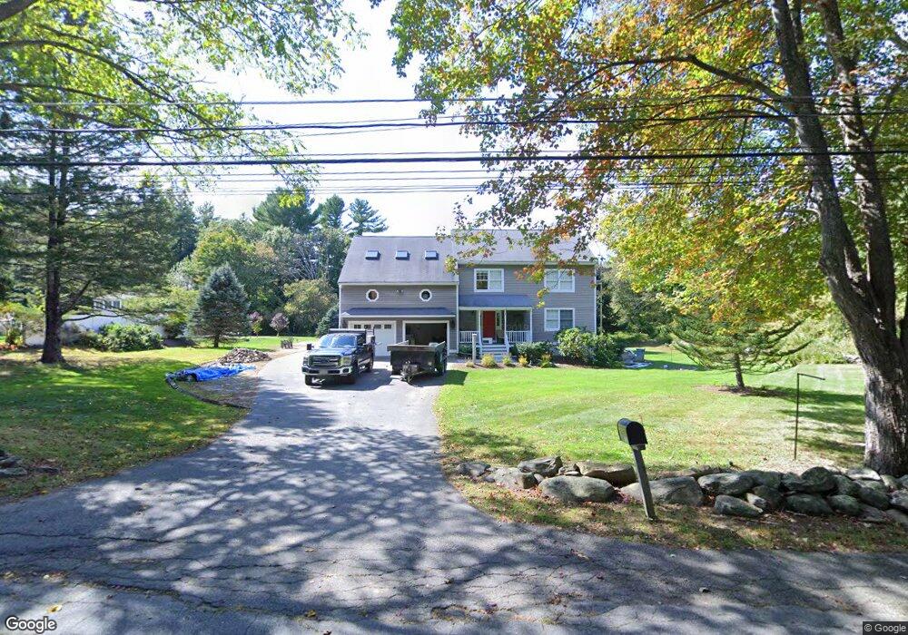
270 Littlefield Rd Boxborough, MA 01719
Estimated Value: $956,779 - $1,137,000
3
Beds
4
Baths
3,010
Sq Ft
$345/Sq Ft
Est. Value
About This Home
This home is located at 270 Littlefield Rd, Boxborough, MA 01719 and is currently estimated at $1,038,195, approximately $344 per square foot. 270 Littlefield Rd is a home located in Middlesex County with nearby schools including Acton-Boxborough Regional High School.
Ownership History
Date
Name
Owned For
Owner Type
Purchase Details
Closed on
Sep 11, 2018
Sold by
Mcgowan James B and Coss Robin
Bought by
Mcgowan Peter
Current Estimated Value
Purchase Details
Closed on
Mar 21, 2017
Sold by
Mcgowan James V
Bought by
Mcgowan James V and Mcgowan Peter
Purchase Details
Closed on
May 13, 2014
Sold by
Mcgowan James V and Mcgowan Frances E
Bought by
Mcgowan James and Mcgowan Frances E
Purchase Details
Closed on
Apr 14, 1975
Bought by
Mcgowan James and Mcgowan Frances
Create a Home Valuation Report for This Property
The Home Valuation Report is an in-depth analysis detailing your home's value as well as a comparison with similar homes in the area
Home Values in the Area
Average Home Value in this Area
Purchase History
| Date | Buyer | Sale Price | Title Company |
|---|---|---|---|
| Mcgowan Peter | -- | -- | |
| Mcgowan James V | -- | -- | |
| Mcgowan James | -- | -- | |
| Mcgowan James | -- | -- |
Source: Public Records
Tax History Compared to Growth
Tax History
| Year | Tax Paid | Tax Assessment Tax Assessment Total Assessment is a certain percentage of the fair market value that is determined by local assessors to be the total taxable value of land and additions on the property. | Land | Improvement |
|---|---|---|---|---|
| 2025 | $14,126 | $933,000 | $287,100 | $645,900 |
| 2024 | $13,067 | $871,700 | $275,500 | $596,200 |
| 2023 | $12,340 | $795,100 | $236,600 | $558,500 |
| 2022 | $11,910 | $683,700 | $236,600 | $447,100 |
| 2020 | $10,728 | $641,600 | $236,600 | $405,000 |
| 2019 | $10,535 | $641,600 | $236,600 | $405,000 |
| 2018 | $9,986 | $607,400 | $225,600 | $381,800 |
| 2017 | $9,980 | $593,700 | $225,600 | $368,100 |
| 2016 | $9,484 | $579,700 | $225,600 | $354,100 |
| 2015 | $9,184 | $551,600 | $203,100 | $348,500 |
| 2014 | $9,213 | $520,800 | $197,200 | $323,600 |
Source: Public Records
Map
Nearby Homes
- 417 Central St
- 4 Huron Rd
- 31 Mohawk Dr
- 62 Waite Rd
- 200 Newtown Rd
- 5 Elm St Unit 1
- 777 Depot Rd
- 4 Omega Way
- 134 Russet Ln
- 68 Macintosh Ln
- Lot 2 Strawberry Farm
- 19 Lincoln Dr
- 3 West Rd
- 27 Lincoln Dr
- 31 Springfield Dr
- 17 Cherry Ridge Rd
- 349 Arlington St
- 542 Massachusetts Ave
- 153 Tahattawan Rd
- 351 Burroughs Rd
- 252 Littlefield Rd
- 239 Littlefield Rd
- 232 Littlefield Rd
- 214 Littlefield Rd
- 265 Littlefield Rd
- 184 Littlefield Rd
- 170 Littlefield Rd
- 152 Littlefield Rd
- 394 Littlefield Rd
- 134 Littlefield Rd
- 35 Sargent Rd
- 420 Littlefield Rd
- 55 Sargent Rd
- 436 Littlefield Rd
- 36 Sargent Rd
- 444 Littlefield Rd
- 16 Depot Rd
- 460 Littlefield Rd
- 447 Littlefield Rd
- 0 Depot Rd