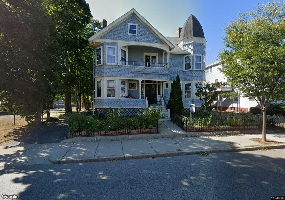
270 Winthrop St Unit 2 Winthrop, MA 02152
Downtown Winthrop NeighborhoodEstimated Value: $487,000 - $623,000
2
Beds
2
Baths
1,421
Sq Ft
$374/Sq Ft
Est. Value
About This Home
This home is located at 270 Winthrop St Unit 2, Winthrop, MA 02152 and is currently estimated at $530,941, approximately $373 per square foot. 270 Winthrop St Unit 2 is a home located in Suffolk County with nearby schools including William P. Gorman/Fort Banks Elementary School, Arthur T. Cummings Elementary School, and Winthrop Middle School.
Ownership History
Date
Name
Owned For
Owner Type
Purchase Details
Closed on
Mar 16, 2016
Sold by
Decarlo Robert J and Decarlo Valerie A
Bought by
Strickland Michael and Bennett Catherine T
Current Estimated Value
Home Financials for this Owner
Home Financials are based on the most recent Mortgage that was taken out on this home.
Original Mortgage
$294,500
Outstanding Balance
$233,636
Interest Rate
3.72%
Mortgage Type
New Conventional
Estimated Equity
$297,305
Purchase Details
Closed on
May 30, 2003
Sold by
Simonetti Mark and Simonetti Dolores
Bought by
Decarlo Robert J and Decarlo Valerie A
Home Financials for this Owner
Home Financials are based on the most recent Mortgage that was taken out on this home.
Original Mortgage
$280,200
Interest Rate
5.86%
Mortgage Type
Purchase Money Mortgage
Create a Home Valuation Report for This Property
The Home Valuation Report is an in-depth analysis detailing your home's value as well as a comparison with similar homes in the area
Home Values in the Area
Average Home Value in this Area
Purchase History
| Date | Buyer | Sale Price | Title Company |
|---|---|---|---|
| Strickland Michael | $310,000 | -- | |
| Decarlo Robert J | $295,000 | -- |
Source: Public Records
Mortgage History
| Date | Status | Borrower | Loan Amount |
|---|---|---|---|
| Open | Strickland Michael | $294,500 | |
| Previous Owner | Decarlo Robert J | $280,200 |
Source: Public Records
Tax History Compared to Growth
Tax History
| Year | Tax Paid | Tax Assessment Tax Assessment Total Assessment is a certain percentage of the fair market value that is determined by local assessors to be the total taxable value of land and additions on the property. | Land | Improvement |
|---|---|---|---|---|
| 2025 | $4,115 | $398,700 | $0 | $398,700 |
| 2024 | $3,984 | $382,300 | $0 | $382,300 |
| 2023 | $3,995 | $373,400 | $0 | $373,400 |
| 2022 | $4,152 | $353,100 | $0 | $353,100 |
| 2021 | $4,253 | $335,400 | $0 | $335,400 |
| 2020 | $4,105 | $325,300 | $0 | $325,300 |
| 2019 | $4,087 | $310,100 | $0 | $310,100 |
| 2018 | $4,115 | $290,600 | $0 | $290,600 |
| 2017 | $3,993 | $277,100 | $0 | $277,100 |
| 2016 | $4,065 | $264,500 | $0 | $264,500 |
| 2015 | $3,720 | $259,400 | $0 | $259,400 |
| 2014 | $3,686 | $236,600 | $0 | $236,600 |
Source: Public Records
Map
Nearby Homes
- 87 Hermon St
- 34 Fremont St
- 174 Winthrop St Unit 2
- 9 Atlantic St Unit 2
- 426 Winthrop St
- 9 Marshall St
- 10 Somerset Ave Unit 405
- 10 Somerset Ave Unit 403
- 10 Somerset Ave Unit 404
- 10 Somerset Ave Unit 408
- 10 Somerset Ave Unit 201
- 10 Somerset Ave Unit 211
- 10 Somerset Ave Unit 206
- 70 Edgehill Rd
- 441 Winthrop St
- 3 Buckthorn Terrace Unit 2
- 35 Somerset Ave Unit 6
- 50-52 Wilshire St
- 800 Governors Dr Unit 6
- 1100 Governors Dr Unit 6
- 270 Winthrop St Unit 3
- 270 Winthrop St
- 274 Winthrop St
- 263 Winthop St
- 278 Winthrop St
- 278 Winthrop St Unit 2
- 271 Winthrop St Unit 2
- 271 Winthrop St Unit 1
- 263 Winthrop St
- 257 Winthrop St
- 286 Winthrop St
- 41 Belcher St
- 249 Winthrop St Unit 5
- 37 Belcher St
- 11 George St
- 222 Nevada St Unit 2
- 31 Belcher St
- 247 Winthrop St
- 14 Wadsworth Ave
- 15 George St Unit 2