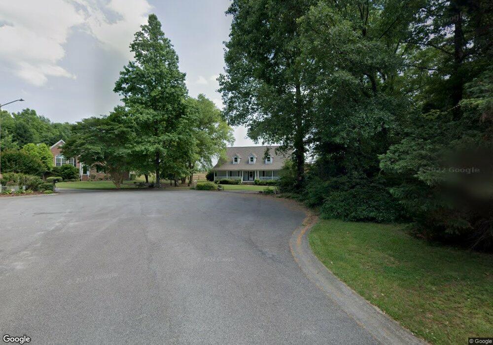
2700 Confederate Ridge Canton, GA 30115
Union Hill NeighborhoodEstimated Value: $515,000 - $617,390
4
Beds
3
Baths
3,163
Sq Ft
$182/Sq Ft
Est. Value
About This Home
This home is located at 2700 Confederate Ridge, Canton, GA 30115 and is currently estimated at $574,348, approximately $181 per square foot. 2700 Confederate Ridge is a home located in Cherokee County with nearby schools including Hickory Flat Elementary School, Rusk Middle School, and Sequoyah High School.
Ownership History
Date
Name
Owned For
Owner Type
Purchase Details
Closed on
Feb 21, 2024
Sold by
Schroeder Matthew
Bought by
Schroeder Danielle Nicole and Schroeder Matthew
Current Estimated Value
Purchase Details
Closed on
Dec 9, 2020
Sold by
Schroeder Matthew
Bought by
Schroeder Matthew and Schroeder Carolyn R
Purchase Details
Closed on
Aug 14, 2020
Sold by
Schroeder Carolyn
Bought by
Schroeder Matthew
Home Financials for this Owner
Home Financials are based on the most recent Mortgage that was taken out on this home.
Original Mortgage
$266,000
Interest Rate
2.9%
Mortgage Type
New Conventional
Purchase Details
Closed on
May 1, 1995
Sold by
Sears Ricky
Bought by
Schroeder Allen
Create a Home Valuation Report for This Property
The Home Valuation Report is an in-depth analysis detailing your home's value as well as a comparison with similar homes in the area
Home Values in the Area
Average Home Value in this Area
Purchase History
| Date | Buyer | Sale Price | Title Company |
|---|---|---|---|
| Schroeder Danielle Nicole | -- | -- | |
| Schroeder Matthew | -- | -- | |
| Schroeder Matthew | $280,000 | -- | |
| Schroeder Allen | $250,000 | -- |
Source: Public Records
Mortgage History
| Date | Status | Borrower | Loan Amount |
|---|---|---|---|
| Previous Owner | Schroeder Matthew | $266,000 | |
| Closed | Schroeder Allen | $0 |
Source: Public Records
Tax History
| Year | Tax Paid | Tax Assessment Tax Assessment Total Assessment is a certain percentage of the fair market value that is determined by local assessors to be the total taxable value of land and additions on the property. | Land | Improvement |
|---|---|---|---|---|
| 2025 | $5,465 | $208,108 | $40,800 | $167,308 |
| 2024 | $1,466 | $212,668 | $40,800 | $171,868 |
| 2023 | $1,230 | $216,828 | $40,800 | $176,028 |
| 2022 | $1,185 | $176,680 | $32,400 | $144,280 |
| 2021 | $1,114 | $132,240 | $26,000 | $106,240 |
| 2020 | $881 | $124,160 | $24,600 | $99,560 |
| 2019 | $865 | $120,080 | $23,200 | $96,880 |
| 2018 | $852 | $112,760 | $21,200 | $91,560 |
| 2017 | $867 | $277,300 | $21,200 | $89,720 |
| 2016 | $879 | $267,900 | $20,000 | $87,160 |
| 2015 | $907 | $267,300 | $20,000 | $86,920 |
| 2014 | $850 | $246,300 | $20,000 | $78,520 |
Source: Public Records
Map
Nearby Homes
- 310 Coppergate Ct
- 106 Wood Hollow Dr
- 316 Westfield Bend
- 441 Timberleaf Rd
- 242 Orchards Cir
- 1026 Cagle Creek Overlook
- 451 Timberleaf Rd
- 522 Edgewater Dr
- 514 Homestead Park Place
- 704 Hickory Hollow Walk
- 102 Fieldbrook Crossing
- 123 Idylwilde Way
- 303 Mcdaniel Place
- 112 Idylwilde Way
- 328 Mcdaniel Place
- 335 Mcdaniel Place
- 7618 Vaughn Rd
- 337 Mcdaniel Place
- 141 Fieldbrook Crossing
- 108 Autumn Glen Dr
- 2705 Confederate Ridge
- 1440 White Columns Blvd
- 1448 White Columns Blvd
- 2695 Confederate Ridge
- 1430 White Columns Blvd
- 1454 White Columns Blvd
- 1445 White Columns Blvd
- 1435 White Columns Blvd
- 1420 White Columns Blvd
- 1462 White Columns Blvd
- 1455 White Columns Blvd
- 1425 White Columns Blvd
- 1410 White Columns Blvd
- 1465 White Columns Blvd
- 604 Northside Way
- 603 Northside Way
- 608 Northside Way
- 607 Northside Way
- 611 Northside Way
- 607 Northside Way
Your Personal Tour Guide
Ask me questions while you tour the home.