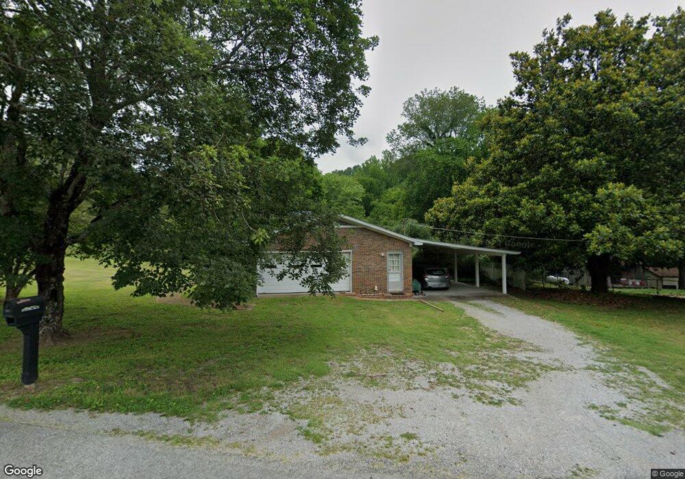
2700 Highway 31 A Pulaski, TN 38478
Estimated Value: $249,000 - $338,000
3
Beds
2
Baths
1,462
Sq Ft
$206/Sq Ft
Est. Value
About This Home
This home is located at 2700 Highway 31 A, Pulaski, TN 38478 and is currently estimated at $301,000, approximately $205 per square foot. 2700 Highway 31 A is a home located in Giles County with nearby schools including Richland Elementary School and Richland School.
Ownership History
Date
Name
Owned For
Owner Type
Purchase Details
Closed on
May 1, 2017
Sold by
Jett Jennifer Amanda
Bought by
Chee Amrk K and Young Sheila Tze Vui
Current Estimated Value
Home Financials for this Owner
Home Financials are based on the most recent Mortgage that was taken out on this home.
Original Mortgage
$144,337
Outstanding Balance
$120,176
Interest Rate
4.23%
Mortgage Type
FHA
Estimated Equity
$180,824
Purchase Details
Closed on
Dec 14, 2004
Sold by
Jett Douglas
Bought by
Jett Jennifer Amanda
Purchase Details
Closed on
Aug 22, 1975
Bought by
Jett Douglas M
Purchase Details
Closed on
Aug 19, 1975
Create a Home Valuation Report for This Property
The Home Valuation Report is an in-depth analysis detailing your home's value as well as a comparison with similar homes in the area
Home Values in the Area
Average Home Value in this Area
Purchase History
| Date | Buyer | Sale Price | Title Company |
|---|---|---|---|
| Chee Amrk K | $147,000 | Title And Escrow Llc | |
| Jett Jennifer Amanda | -- | -- | |
| Jett Douglas M | -- | -- | |
| -- | -- | -- |
Source: Public Records
Mortgage History
| Date | Status | Borrower | Loan Amount |
|---|---|---|---|
| Open | Chee Amrk K | $144,337 |
Source: Public Records
Tax History Compared to Growth
Tax History
| Year | Tax Paid | Tax Assessment Tax Assessment Total Assessment is a certain percentage of the fair market value that is determined by local assessors to be the total taxable value of land and additions on the property. | Land | Improvement |
|---|---|---|---|---|
| 2025 | $981 | $49,400 | $0 | $0 |
| 2024 | $981 | $49,400 | $3,450 | $45,950 |
| 2023 | $981 | $49,400 | $3,450 | $45,950 |
| 2022 | $981 | $49,400 | $3,450 | $45,950 |
| 2021 | $872 | $30,875 | $4,475 | $26,400 |
| 2020 | $872 | $30,875 | $4,475 | $26,400 |
| 2019 | $872 | $30,875 | $4,475 | $26,400 |
| 2018 | $872 | $30,875 | $4,475 | $26,400 |
| 2017 | $872 | $30,875 | $4,475 | $26,400 |
| 2016 | $886 | $29,825 | $3,000 | $26,825 |
| 2015 | $826 | $29,825 | $3,000 | $26,825 |
| 2014 | $827 | $29,832 | $0 | $0 |
Source: Public Records
Map
Nearby Homes
- 575 Haywood Creek Rd
- 215 Desperado Ave
- 216 Desperado Ave
- 202 Desperado Ave
- 117 Sun Rise Ridge
- 300 Milky Way Dr
- 257 Milky Way Dr
- 3 Haywood Creek Rd
- 1 Haywood Creek Rd
- 2 Haywood Creek Rd
- 5 Haywood Creek Rd
- 0 Shady Ln Unit RTC2914418
- 393 Jones Rd
- 215 Al Roman Rd
- 175 Birch Ln
- 2921 Clear Creek Rd
- 3345 Pigeon Roost Rd
- 1623 Industrial Loop Rd
- 1 Sleepy Hollow Rd
- 1 Ball Hollow Rd
- 209 Apache Cir
- 213 Apache Cir
- 203 Haywood Creek Rd
- 200 Apache Cir
- 200 Haywood Creek Rd
- 202 Apache Cir
- 211 Apache Cir
- 204 Apache Cir
- 206 Apache Cir
- 215 Apache Cir
- 207 Haywood Creek Rd
- 182 Sagewood Dr
- 208 Apache Cir
- 240 Haywood Creek Rd
- 217 Apache Cir
- 192 Sagewood Dr
- 212 Apache Cir
- 221 Apache Cir
- 218 Sagewood Dr
- 241 Haywood Creek Rd