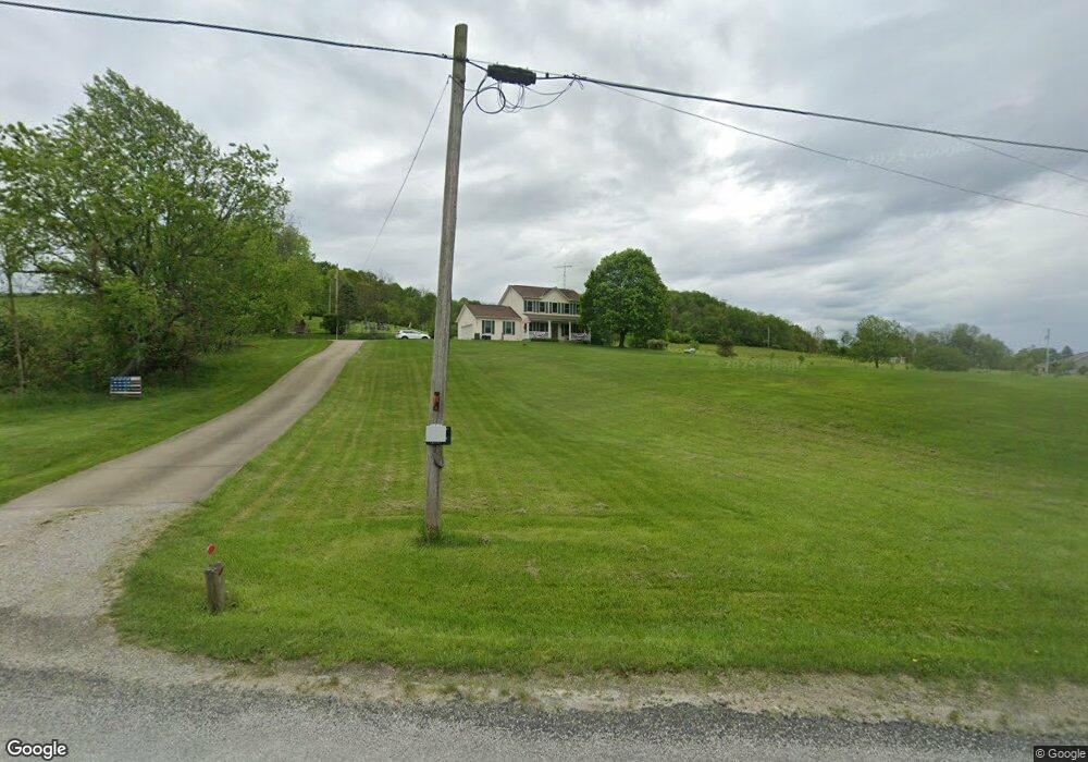
2700 Lower Bloomfield Rd New Concord, OH 43762
Estimated Value: $238,000 - $379,566
3
Beds
3
Baths
1,574
Sq Ft
$200/Sq Ft
Est. Value
About This Home
This home is located at 2700 Lower Bloomfield Rd, New Concord, OH 43762 and is currently estimated at $315,189, approximately $200 per square foot. 2700 Lower Bloomfield Rd is a home located in Muskingum County with nearby schools including New Concord Elementary School, Larry Miller Intermediate Elementary School, and East Muskingum Middle School.
Ownership History
Date
Name
Owned For
Owner Type
Purchase Details
Closed on
Aug 29, 1997
Sold by
Bing Mark A
Bought by
Price Randell S and Price Sharon R
Current Estimated Value
Home Financials for this Owner
Home Financials are based on the most recent Mortgage that was taken out on this home.
Original Mortgage
$11,504
Interest Rate
7.57%
Mortgage Type
New Conventional
Purchase Details
Closed on
Jun 5, 1997
Sold by
Bruner Land Co Inc
Bought by
Bing Mark A
Create a Home Valuation Report for This Property
The Home Valuation Report is an in-depth analysis detailing your home's value as well as a comparison with similar homes in the area
Home Values in the Area
Average Home Value in this Area
Purchase History
| Date | Buyer | Sale Price | Title Company |
|---|---|---|---|
| Price Randell S | $11,600 | -- | |
| Bing Mark A | $6,450 | -- |
Source: Public Records
Mortgage History
| Date | Status | Borrower | Loan Amount |
|---|---|---|---|
| Closed | Price Randell S | $11,504 |
Source: Public Records
Tax History Compared to Growth
Tax History
| Year | Tax Paid | Tax Assessment Tax Assessment Total Assessment is a certain percentage of the fair market value that is determined by local assessors to be the total taxable value of land and additions on the property. | Land | Improvement |
|---|---|---|---|---|
| 2024 | $2,853 | $87,045 | $11,970 | $75,075 |
| 2023 | $2,220 | $63,420 | $7,700 | $55,720 |
| 2022 | $2,173 | $63,420 | $7,700 | $55,720 |
| 2021 | $2,146 | $63,420 | $7,700 | $55,720 |
| 2020 | $1,922 | $55,125 | $6,685 | $48,440 |
| 2019 | $1,912 | $55,125 | $6,685 | $48,440 |
| 2018 | $1,805 | $55,125 | $6,685 | $48,440 |
| 2017 | $1,613 | $44,100 | $6,440 | $37,660 |
| 2016 | $1,616 | $44,100 | $6,440 | $37,660 |
| 2015 | $1,656 | $44,100 | $6,440 | $37,660 |
| 2013 | $1,775 | $44,100 | $6,440 | $37,660 |
Source: Public Records
Map
Nearby Homes
- 12985 John Glenn School Rd
- 112 Thompson Ave
- 0 Norfield Unit 5174011
- 0 Norfield Unit 5173946
- 8 E Main St
- 110 Cherry Ln
- 67 E Main St
- 1420 Glenn Hwy
- 0 Homestead Dr Unit 11611647
- 0 Homestead Dr Unit 5174212
- 0 Maple Ln
- 0 Rix Mills Rd
- Lot 18 & 19 Greenbriar Dr
- 61220 Kadon Dr
- 0 Bloomfield Rd
- 3029 Best Rd
- 135 S Moose Eye Rd
- 60040 Bliss Rd
- 3859 Mayfair Ln
- 6825 Barr Rd
- 2600 Lower Bloomfield Rd
- 2550 Lower Bloomfield Rd
- 2500 Lower Bloomfield Rd
- 2450 Lower Bloomfield Rd
- 0 Sunflower Rd Unit 2638733
- 0 Sunflower Rd Unit 2637705
- 0 Sunflower Rd Unit 2216677
- 0 Sunflower Rd Unit 211006703
- 3191 Lower Bloomfield Rd
- 2080 Peters Creek Rd
- 2096 Peters Creek Rd
- 2770 Friendship Dr
- 1995 Lower Bloomfield Rd
- 3280 Friendship Dr
- 4020 Lower Bloomfield Rd
- 2300 Peters Creek Rd
- 13005 Cedar Cir
- 13000 Ridgeview Dr
- 2860 Friendship Dr
- 12905 Ridgeview Dr