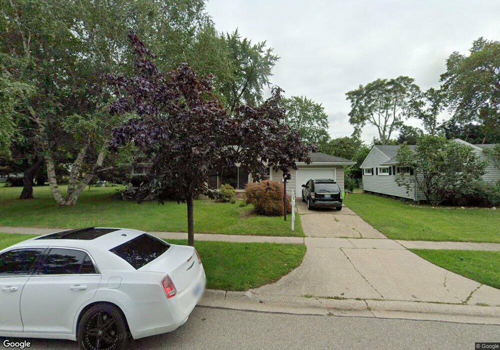
2700 Mason Ave Port Huron, MI 48060
Estimated Value: $61,000 - $317,000
--
Bed
--
Bath
--
Sq Ft
6,316
Sq Ft Lot
About This Home
This home is located at 2700 Mason Ave, Port Huron, MI 48060 and is currently estimated at $189,000. 2700 Mason Ave is a home located in St. Clair County with nearby schools including Michigamme Elementary School, Central Middle School, and Port Huron High School.
Ownership History
Date
Name
Owned For
Owner Type
Purchase Details
Closed on
Oct 31, 2014
Sold by
Frank Cheryl J
Bought by
Lewis Bonnie S
Current Estimated Value
Home Financials for this Owner
Home Financials are based on the most recent Mortgage that was taken out on this home.
Original Mortgage
$60,000
Outstanding Balance
$46,315
Interest Rate
4.21%
Mortgage Type
New Conventional
Estimated Equity
$142,685
Purchase Details
Closed on
Jun 19, 2013
Sold by
Frank Cheryl J and Frank Laura S
Bought by
Frank Cheryl J
Purchase Details
Closed on
Jul 29, 2009
Sold by
Frank Lyle F and Frank Shirley
Bought by
Frank Lyle F and Shirley Frank E
Create a Home Valuation Report for This Property
The Home Valuation Report is an in-depth analysis detailing your home's value as well as a comparison with similar homes in the area
Home Values in the Area
Average Home Value in this Area
Purchase History
| Date | Buyer | Sale Price | Title Company |
|---|---|---|---|
| Lewis Bonnie S | $105,000 | Attorneys Title Agency Llc | |
| Frank Cheryl J | -- | None Available | |
| Frank Lyle F | -- | None Available |
Source: Public Records
Mortgage History
| Date | Status | Borrower | Loan Amount |
|---|---|---|---|
| Open | Lewis Bonnie S | $60,000 |
Source: Public Records
Tax History Compared to Growth
Tax History
| Year | Tax Paid | Tax Assessment Tax Assessment Total Assessment is a certain percentage of the fair market value that is determined by local assessors to be the total taxable value of land and additions on the property. | Land | Improvement |
|---|---|---|---|---|
| 2025 | $129 | $3,300 | $0 | $0 |
| 2024 | $117 | $3,300 | $0 | $0 |
| 2023 | $111 | $4,200 | $0 | $0 |
| 2022 | $125 | $2,800 | $0 | $0 |
| 2021 | $123 | $2,800 | $0 | $0 |
| 2020 | $126 | $2,800 | $2,800 | $0 |
| 2019 | $251 | $6,200 | $0 | $0 |
| 2018 | $284 | $6,200 | $0 | $0 |
| 2017 | $253 | $6,200 | $0 | $0 |
| 2016 | $222 | $6,200 | $0 | $0 |
| 2015 | $201 | $6,200 | $6,200 | $0 |
| 2014 | $201 | $5,600 | $5,600 | $0 |
| 2013 | -- | $5,600 | $0 | $0 |
Source: Public Records
Map
Nearby Homes
- 2718 Electric Ave
- 2710 Electric Ave
- 1403 Catherine McAuley Dr
- 2704 Military St
- 2724 Military St
- 2815 Military St
- 2411 10th St
- 1414 Beard St
- 2444 Military St
- 823 Beard St
- 2430 Military St Unit 2434
- 2977 Military St
- 730 Jenkinson St
- 913 Tunnel St
- 3136 Military St
- 1112 Minnie St
- 1127 Minnie St
- 831 Bancroft St
- 1319 Minnie St
- 2109 Military St
- 2700 Mason Ave
- 2700 Mason Ave
- 2700 Mason Ave
- 2700 Mason Ave
- 2717 Electric Ave
- 2609 Electric Ave
- 1200 Thomson Ave
- 2713 Electric Ave
- 2723 Electric Ave
- 2707 Electric Ave
- 2703 Electric Ave
- 2739 Mason Ave
- 2743 Electric Ave
- 2746 Mason Ave
- 2752 Mason Ave
- 2747 Electric Ave
- 1217 Thomson Ave
- 1222 Thomson Ave
- 1222 Thomson Ave
- 2761 Mason Ave