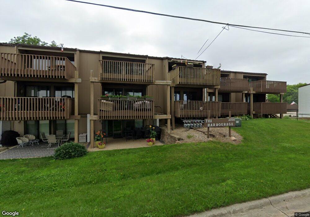
2700 N Shore Dr Unit Bldg F2 - Unit 25A Clear Lake, IA 50428
Estimated Value: $291,000 - $356,000
3
Beds
1
Bath
930
Sq Ft
$349/Sq Ft
Est. Value
About This Home
This home is located at 2700 N Shore Dr Unit Bldg F2 - Unit 25A, Clear Lake, IA 50428 and is currently estimated at $324,887, approximately $349 per square foot. 2700 N Shore Dr Unit Bldg F2 - Unit 25A is a home located in Cerro Gordo County.
Ownership History
Date
Name
Owned For
Owner Type
Purchase Details
Closed on
Aug 28, 2019
Sold by
Parkhurst Chris R and Parkhurst April M
Bought by
Richard Howard Bell Ret
Current Estimated Value
Purchase Details
Closed on
Sep 27, 2012
Sold by
Wingert Bruce A and Wingert Joann K
Bought by
Parkhurst Chris R and Parkhurst April M
Home Financials for this Owner
Home Financials are based on the most recent Mortgage that was taken out on this home.
Original Mortgage
$15,800
Interest Rate
3.35%
Mortgage Type
New Conventional
Purchase Details
Closed on
Jun 27, 2005
Sold by
Clark Dorothy V
Bought by
Orchard Josh and Orchard Sarah E
Home Financials for this Owner
Home Financials are based on the most recent Mortgage that was taken out on this home.
Original Mortgage
$15,750
Interest Rate
6.01%
Mortgage Type
Credit Line Revolving
Create a Home Valuation Report for This Property
The Home Valuation Report is an in-depth analysis detailing your home's value as well as a comparison with similar homes in the area
Home Values in the Area
Average Home Value in this Area
Purchase History
| Date | Buyer | Sale Price | Title Company |
|---|---|---|---|
| Richard Howard Bell Ret | $199,500 | -- | |
| Parkhurst Chris R | $158,000 | None Available | |
| Orchard Josh | $84,100 | -- | |
| Orchard Josh | $10,500 | None Available |
Source: Public Records
Mortgage History
| Date | Status | Borrower | Loan Amount |
|---|---|---|---|
| Previous Owner | Parkhurst Chris R | $15,800 | |
| Previous Owner | Orchard Josh | $15,750 | |
| Previous Owner | Orchard Josh | $84,000 |
Source: Public Records
Tax History Compared to Growth
Tax History
| Year | Tax Paid | Tax Assessment Tax Assessment Total Assessment is a certain percentage of the fair market value that is determined by local assessors to be the total taxable value of land and additions on the property. | Land | Improvement |
|---|---|---|---|---|
| 2024 | $3,482 | $252,990 | $90,000 | $162,990 |
| 2023 | $3,364 | $252,990 | $90,000 | $162,990 |
| 2022 | $3,202 | $210,330 | $70,000 | $140,330 |
| 2021 | $3,078 | $201,960 | $70,000 | $131,960 |
| 2020 | $3,078 | $183,670 | $70,000 | $113,670 |
| 2019 | $2,886 | $0 | $0 | $0 |
| 2018 | $2,734 | $0 | $0 | $0 |
| 2017 | $2,752 | $0 | $0 | $0 |
| 2016 | $2,690 | $0 | $0 | $0 |
| 2015 | $2,690 | $0 | $0 | $0 |
| 2014 | $2,682 | $0 | $0 | $0 |
| 2013 | $2,468 | $0 | $0 | $0 |
Source: Public Records
Map
Nearby Homes
- 2700 N Shore Dr Unit 305
- 2700 N Shore Dr Unit G27
- 2700 N Shore Dr Unit 505
- 2700 N Shore Dr Unit 405
- 2700 N Shore Dr Unit E1-16A
- 2700 N Shore Dr Unit L34
- 2700 N Shore Dr Unit E1-15A
- 2700 N Shore Dr Unit E15A
- 2700 N Shore Dr Unit 706
- 2700 N Shore Dr Unit 201
- 2700 N Shore Dr Unit 25 in Bldg. F-2
- 2700 N Shore Dr Unit F3-27
- 408 Orchard Ln
- 3512 N Shore Dr
- 204 Stonebrook Ct
- 3514 N Shore Dr
- 216 Stonebrook Ct
- 214 Stonebrook Ct
- 212 Stonebrook Ct
- 210 Stonebrook Ct
- 2700 N Shore Dr Unit O1
- 2700 N Shore Dr Unit O1
- 2700 N Shore Dr Unit O2
- 2700 N Shore Dr Unit O2
- 2700 N Shore Dr Unit O2
- 2700 N Shore Dr Unit N1
- 2700 N Shore Dr Unit N1
- 2700 N Shore Dr Unit N1
- 2700 N Shore Dr Unit N1
- 2700 N Shore Dr Unit N1
- 2700 N Shore Dr Unit N1
- 2700 N Shore Dr Unit N1
- 2700 N Shore Dr Unit M1
- 2700 N Shore Dr Unit M1
- 2700 N Shore Dr Unit M1
- 2700 N Shore Dr Unit M1
- 2700 N Shore Dr Unit M1
- 2700 N Shore Dr Unit M1
- 2700 N Shore Dr Unit M1
- 2700 N Shore Dr Unit M1