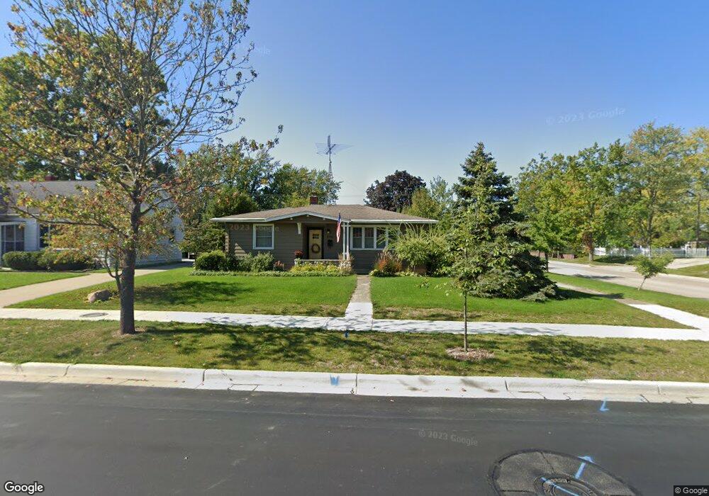
2700 Willa Dr Saint Joseph, MI 49085
Estimated Value: $256,000 - $267,610
3
Beds
1
Bath
1,200
Sq Ft
$217/Sq Ft
Est. Value
About This Home
This home is located at 2700 Willa Dr, Saint Joseph, MI 49085 and is currently estimated at $260,403, approximately $217 per square foot. 2700 Willa Dr is a home located in Berrien County with nearby schools including Upton Middle School, St. Joseph High School, and Bridge Academy of Southwest Michigan.
Ownership History
Date
Name
Owned For
Owner Type
Purchase Details
Closed on
Jun 16, 2022
Sold by
Hungerford Rebecca L
Bought by
Hungerford Rebecca L and Mckelley Ian Michael
Current Estimated Value
Purchase Details
Closed on
Jan 12, 2006
Sold by
Revocable Living Trust Agreement Of Lore
Bought by
Hungerford Rebecca L
Home Financials for this Owner
Home Financials are based on the most recent Mortgage that was taken out on this home.
Original Mortgage
$94,500
Interest Rate
6.5%
Mortgage Type
New Conventional
Purchase Details
Closed on
Feb 20, 1991
Create a Home Valuation Report for This Property
The Home Valuation Report is an in-depth analysis detailing your home's value as well as a comparison with similar homes in the area
Home Values in the Area
Average Home Value in this Area
Purchase History
| Date | Buyer | Sale Price | Title Company |
|---|---|---|---|
| Hungerford Rebecca L | -- | None Listed On Document | |
| Hungerford Rebecca L | $124,500 | None Available | |
| -- | -- | -- |
Source: Public Records
Mortgage History
| Date | Status | Borrower | Loan Amount |
|---|---|---|---|
| Previous Owner | Hungerford Rebecca L | $94,500 |
Source: Public Records
Tax History Compared to Growth
Tax History
| Year | Tax Paid | Tax Assessment Tax Assessment Total Assessment is a certain percentage of the fair market value that is determined by local assessors to be the total taxable value of land and additions on the property. | Land | Improvement |
|---|---|---|---|---|
| 2025 | $2,907 | $118,800 | $0 | $0 |
| 2024 | $2,820 | $113,200 | $0 | $0 |
| 2023 | $2,705 | $90,300 | $0 | $0 |
| 2022 | $2,582 | $86,600 | $0 | $0 |
| 2021 | $2,565 | $82,600 | $31,900 | $50,700 |
| 2020 | $2,531 | $79,000 | $0 | $0 |
| 2019 | $2,511 | $67,600 | $29,300 | $38,300 |
| 2018 | $2,469 | $67,600 | $0 | $0 |
| 2017 | $2,214 | $63,000 | $0 | $0 |
| 2016 | $2,214 | $60,200 | $0 | $0 |
| 2015 | $2,187 | $57,800 | $0 | $0 |
| 2014 | $2,180 | $59,500 | $0 | $0 |
Source: Public Records
Map
Nearby Homes
- 1100 Highland Ave
- 705 Columbia Ave
- 816 Saint Joseph Dr
- Parcel 2-B Niles Road M-63
- 2206 Morton Ave
- 2214 S State St Unit 107
- 1525 Moccasin Trail
- 0 Michigan 63
- 3711 Michigan 63
- 1189 Lydia Dr
- 2019 Sunset Dr
- 1510 Moccasin Trail
- 2108 Langley Ave
- 2816 Evergreen Dr
- 200 Lake St Unit 3C
- 200 Lake St Unit 4C
- 200 Lake St Unit 7A/8A
- 200 Lake St Unit 3B
- 315 Kingsley Ave
- 227 N Sunnybank Rd