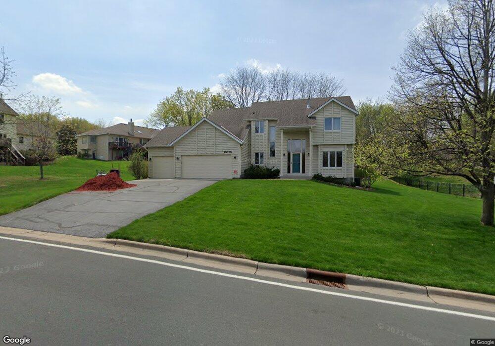
2705 Hayes Dr Burnsville, MN 55337
Estimated Value: $479,000 - $519,000
4
Beds
4
Baths
2,149
Sq Ft
$233/Sq Ft
Est. Value
About This Home
This home is located at 2705 Hayes Dr, Burnsville, MN 55337 and is currently estimated at $500,328, approximately $232 per square foot. 2705 Hayes Dr is a home located in Dakota County with nearby schools including Burnsville High School, Gateway STEM Academy, and Sunrise International Montessori School.
Ownership History
Date
Name
Owned For
Owner Type
Purchase Details
Closed on
May 28, 1996
Sold by
Thorson Homes In
Bought by
Bailey James W and Bailey Linda J
Current Estimated Value
Purchase Details
Closed on
Feb 12, 1996
Sold by
Sienna Corp
Bought by
Thorson Homes Inc
Create a Home Valuation Report for This Property
The Home Valuation Report is an in-depth analysis detailing your home's value as well as a comparison with similar homes in the area
Home Values in the Area
Average Home Value in this Area
Purchase History
| Date | Buyer | Sale Price | Title Company |
|---|---|---|---|
| Bailey James W | $223,653 | -- | |
| Thorson Homes Inc | $42,850 | -- |
Source: Public Records
Mortgage History
| Date | Status | Borrower | Loan Amount |
|---|---|---|---|
| Closed | Thorson Homes Inc | -- |
Source: Public Records
Tax History Compared to Growth
Tax History
| Year | Tax Paid | Tax Assessment Tax Assessment Total Assessment is a certain percentage of the fair market value that is determined by local assessors to be the total taxable value of land and additions on the property. | Land | Improvement |
|---|---|---|---|---|
| 2024 | $4,580 | $436,600 | $139,800 | $296,800 |
| 2023 | $4,580 | $432,400 | $140,000 | $292,400 |
| 2022 | $4,062 | $425,700 | $139,600 | $286,100 |
| 2021 | $4,114 | $377,900 | $121,400 | $256,500 |
| 2020 | $4,330 | $363,600 | $118,500 | $245,100 |
| 2019 | $4,389 | $368,400 | $112,800 | $255,600 |
| 2018 | $4,515 | $355,400 | $107,400 | $248,000 |
| 2017 | $4,219 | $354,500 | $102,300 | $252,200 |
| 2016 | $4,345 | $327,200 | $97,500 | $229,700 |
| 2015 | $4,103 | $315,593 | $92,231 | $223,362 |
| 2014 | -- | $311,342 | $90,443 | $220,899 |
| 2013 | -- | $288,452 | $82,056 | $206,396 |
Source: Public Records
Map
Nearby Homes
- 11017 27th Ave S
- 11115 Carver Ct
- 3108 Foxpoint Cir
- 11036 27th Ave S
- 3113 Chandler Ct
- 10934 Southview Dr
- 4165 Old Sibley Hwy
- 2001 Woods Ln
- 2177 Cool Stream Cir
- 11459 Galtier Dr
- 2007 E 115th St
- 11311 W River Hills Dr
- 1601 Raleigh Dr
- 4413 Slater Rd
- 3017 Mcleod St
- 4427 Cinnamon Ridge Cir
- 4425 Cinnamon Ridge Cir
- 4463 Cinnamon Ridge Cir
- 4370 Nicols Rd
- 2079 Garnet Ln
- 2701 Hayes Dr
- 10904 Chatham Ct S
- 10908 Chatham Ct S
- 10900 Chatham Ct S
- 10815 27th Ave S
- 10912 Chatham Ct S
- 2708 Hayes Dr
- 10811 27th Ave S
- 10816 Chatham Ct N
- 10823 27th Ave S
- 2800 Hayes Dr
- 10901 27th Ave S
- 10813 Chatham Ct N
- 2700 Hayes Dr
- 10909 Chatham Ct S
- 10913 Chatham Ct S
- 10812 Chatham Ct N
- 10901 Chatham Ct S
- 10905 Chatham Ct S
- 10916 Chatham Ct S