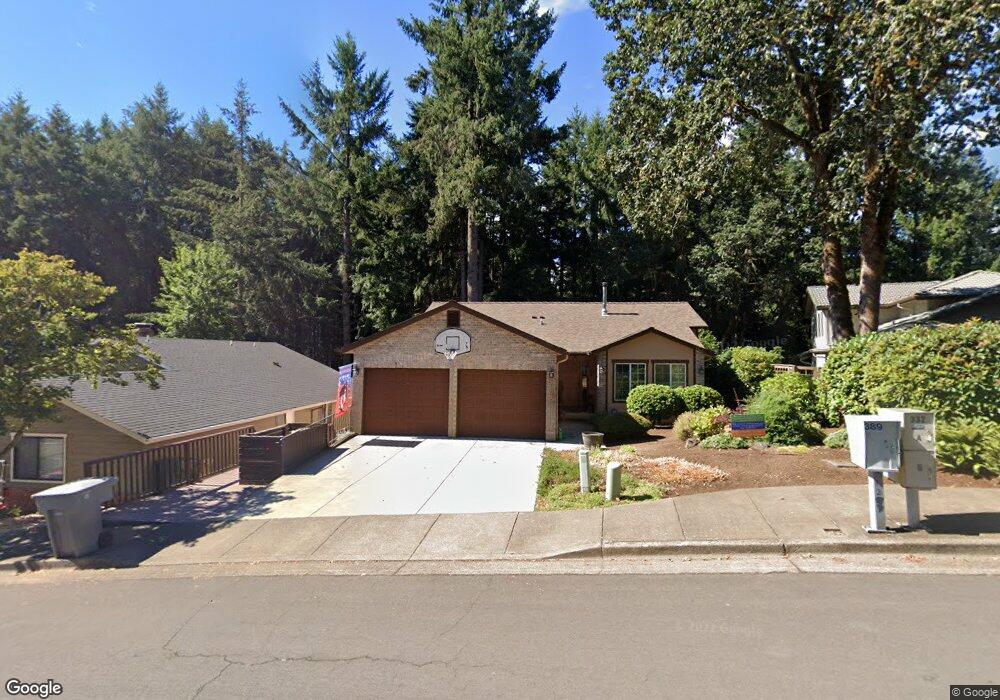
2705 NW Rolling Green Dr Corvallis, OR 97330
Northwest Corvallis NeighborhoodEstimated Value: $598,000 - $657,000
3
Beds
3
Baths
1,669
Sq Ft
$378/Sq Ft
Est. Value
About This Home
This home is located at 2705 NW Rolling Green Dr, Corvallis, OR 97330 and is currently estimated at $631,430, approximately $378 per square foot. 2705 NW Rolling Green Dr is a home located in Benton County with nearby schools including Letitia Carson Elementary School, Cheldelin Middle School, and Crescent Valley High School.
Ownership History
Date
Name
Owned For
Owner Type
Purchase Details
Closed on
May 15, 2012
Sold by
Whitney Barbara L and Lawson Barbara N
Bought by
Whitney Barbara L and Whitney Mark
Current Estimated Value
Home Financials for this Owner
Home Financials are based on the most recent Mortgage that was taken out on this home.
Original Mortgage
$75,500
Interest Rate
3.98%
Mortgage Type
New Conventional
Purchase Details
Closed on
Jul 20, 2002
Sold by
Lawson Hal A
Bought by
Lawson Barbara N
Create a Home Valuation Report for This Property
The Home Valuation Report is an in-depth analysis detailing your home's value as well as a comparison with similar homes in the area
Home Values in the Area
Average Home Value in this Area
Purchase History
| Date | Buyer | Sale Price | Title Company |
|---|---|---|---|
| Whitney Barbara L | -- | First American Title | |
| Lawson Barbara N | -- | Key Title Company |
Source: Public Records
Mortgage History
| Date | Status | Borrower | Loan Amount |
|---|---|---|---|
| Closed | Whitney Barbara L | $75,500 |
Source: Public Records
Tax History Compared to Growth
Tax History
| Year | Tax Paid | Tax Assessment Tax Assessment Total Assessment is a certain percentage of the fair market value that is determined by local assessors to be the total taxable value of land and additions on the property. | Land | Improvement |
|---|---|---|---|---|
| 2024 | $7,052 | $397,732 | -- | -- |
| 2023 | $6,640 | $386,148 | $0 | $0 |
| 2022 | $6,446 | $374,901 | $0 | $0 |
| 2021 | $6,233 | $363,982 | $0 | $0 |
| 2020 | $6,199 | $353,381 | $0 | $0 |
| 2019 | $5,713 | $343,088 | $0 | $0 |
| 2018 | $5,744 | $333,095 | $0 | $0 |
| 2017 | $5,313 | $323,393 | $0 | $0 |
| 2016 | $5,081 | $313,974 | $0 | $0 |
| 2015 | $4,980 | $304,829 | $0 | $0 |
| 2014 | $4,851 | $295,950 | $0 | $0 |
| 2012 | -- | $278,961 | $0 | $0 |
Source: Public Records
Map
Nearby Homes
- 2717 NW Rolling Green Dr
- 2024 NW Victory Ave
- 2034 NW Victory Ave
- 2044 NW Victory Ave
- 2054 NW Victory Ave
- 1583 NW Forestgreen Ave
- 2029 NW Century Dr
- 2039 NW Century Dr
- 2049 NW Century Dr
- 2059 NW Century Dr
- Lot 2 - 3004 Place
- 1524 NW Forestgreen Ave
- 2040 NW 23rd St
- 3007 NW Angelica Dr
- 1141 NW Charlemagne Place
- 1925 NW 14th St
- 2814 NW 29th St
- 0 NW Lester Ave
- 1919 & Next To NW Buchanan Ave
- 2941 NW Elmwood Dr
- 2701 NW Rolling Green Dr
- 2711 NW Rolling Green Dr
- 2697 NW Rolling Green Dr
- 2685 NW Rolling Green Dr
- 2714 NW Rolling Green Dr
- 2721 NW Rolling Green Dr
- 2605 NW Lupine Place
- 2673 NW Rolling Green Dr
- 2725 NW Rolling Green Dr
- 2616 NW Lupine Place
- 2735 NW Rolling Green Dr
- 2661 NW Rolling Green Dr
- 2621 NW Lupine Place
- 2743 NW Rolling Green Dr
- 2633 NW Lupine Place
- 2751 NW Rolling Green Dr
- 2748 NW Rolling Green Dr
- 2635 NW Rolling Green Dr
- 2640 NW Lupine Place
- 2647 NW Lupine Place