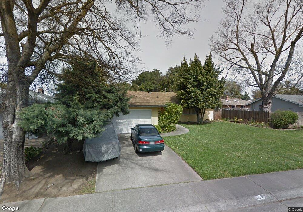
2705 W Swain Rd Stockton, CA 95207
Lincoln Village NeighborhoodEstimated Value: $433,000 - $477,000
3
Beds
2
Baths
1,366
Sq Ft
$331/Sq Ft
Est. Value
About This Home
This home is located at 2705 W Swain Rd, Stockton, CA 95207 and is currently estimated at $452,056, approximately $330 per square foot. 2705 W Swain Rd is a home located in San Joaquin County with nearby schools including Tully C. Knoles School, Sierra Middle School, and Lincoln High School.
Ownership History
Date
Name
Owned For
Owner Type
Purchase Details
Closed on
Nov 13, 2003
Sold by
Rice Vincent P and Estate Of Clifford A Rice Sr
Bought by
Barragan Jorge and Gonzalez Silvia
Current Estimated Value
Home Financials for this Owner
Home Financials are based on the most recent Mortgage that was taken out on this home.
Original Mortgage
$215,650
Outstanding Balance
$99,976
Interest Rate
6%
Mortgage Type
Purchase Money Mortgage
Estimated Equity
$352,080
Purchase Details
Closed on
Apr 10, 1996
Sold by
Rice Clifford A
Bought by
Rice Clifford A and Rice Aurora A
Home Financials for this Owner
Home Financials are based on the most recent Mortgage that was taken out on this home.
Original Mortgage
$85,926
Interest Rate
7.34%
Purchase Details
Closed on
Mar 22, 1996
Sold by
Rice Aurora A
Bought by
Rice Clifford A
Home Financials for this Owner
Home Financials are based on the most recent Mortgage that was taken out on this home.
Original Mortgage
$85,926
Interest Rate
7.34%
Create a Home Valuation Report for This Property
The Home Valuation Report is an in-depth analysis detailing your home's value as well as a comparison with similar homes in the area
Home Values in the Area
Average Home Value in this Area
Purchase History
| Date | Buyer | Sale Price | Title Company |
|---|---|---|---|
| Barragan Jorge | $227,000 | Chicago Title Co | |
| Rice Clifford A | -- | -- | |
| Rice Clifford A | -- | Fidelity National Title |
Source: Public Records
Mortgage History
| Date | Status | Borrower | Loan Amount |
|---|---|---|---|
| Open | Barragan Jorge | $215,650 | |
| Previous Owner | Rice Clifford A | $85,926 |
Source: Public Records
Tax History Compared to Growth
Tax History
| Year | Tax Paid | Tax Assessment Tax Assessment Total Assessment is a certain percentage of the fair market value that is determined by local assessors to be the total taxable value of land and additions on the property. | Land | Improvement |
|---|---|---|---|---|
| 2025 | $5,908 | $322,727 | $96,675 | $226,052 |
| 2024 | $5,738 | $316,400 | $94,780 | $221,620 |
| 2023 | $5,627 | $310,197 | $92,922 | $217,275 |
| 2022 | $5,234 | $304,115 | $91,100 | $213,015 |
| 2021 | $5,146 | $298,153 | $89,314 | $208,839 |
| 2020 | $5,111 | $295,097 | $88,399 | $206,698 |
| 2019 | $5,056 | $289,312 | $86,666 | $202,646 |
| 2018 | $4,948 | $283,640 | $84,967 | $198,673 |
| 2017 | $4,878 | $278,079 | $83,301 | $194,778 |
| 2016 | $4,159 | $247,000 | $74,000 | $173,000 |
| 2014 | $3,850 | $197,000 | $59,000 | $138,000 |
Source: Public Records
Map
Nearby Homes
- 2914 Prentiss Ct
- 2447 Calhoun Way
- 2922 Prentiss Ct
- 6415 Plymouth Rd
- 2935 Prentiss Ct Unit 1844
- 5734 Turtle Valley Dr
- 2921 Rutledge Ct
- 2252 Canyon Creek Dr
- 5713 Turtle Valley Dr
- 2421 Meadow Lake Dr
- 2252 W Benjamin Holt Dr
- 3102 W Swain Rd
- 2128 Canyon Creek Dr
- 6078 Carolina Cir
- 6406 Grigsby Place
- 5522 Teal Ct
- 5633 Brush Creek Dr
- 3115 Polk Way
- 2433 Pheasant Run Cir
- 5815 Morgan Place Unit 18
- 2715 W Swain Rd
- 2633 Porter Way
- 2635 W Swain Rd
- 2725 W Swain Rd
- 2629 Porter Way
- 2708 Douglas Rd
- 2735 W Swain Rd
- 2724 W Swain Rd
- 2623 Porter Way
- 2732 Douglas Rd
- 2640 Douglas Rd
- 2734 W Swain Rd
- 2706 W Swain Rd
- 2714 W Swain Rd
- 2644 W Swain Rd
- 2745 W Swain Rd
- 2611 W Swain Rd
- 2744 Douglas Rd Unit 30
- 2615 Porter Way
- 2634 W Swain Rd