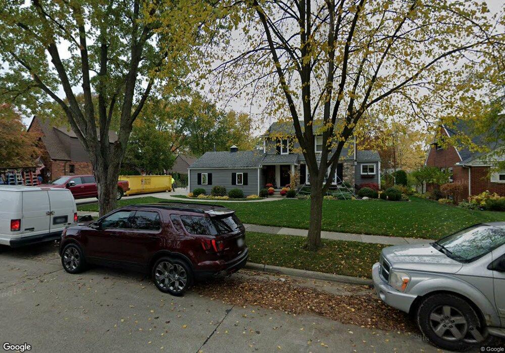
2706 Burnham Rd Royal Oak, MI 48073
Estimated Value: $521,000 - $903,000
3
Beds
2
Baths
1,412
Sq Ft
$485/Sq Ft
Est. Value
About This Home
This home is located at 2706 Burnham Rd, Royal Oak, MI 48073 and is currently estimated at $685,378, approximately $485 per square foot. 2706 Burnham Rd is a home located in Oakland County with nearby schools including Addams Elementary, Royal Oak Middle School, and Royal Oak High School.
Ownership History
Date
Name
Owned For
Owner Type
Purchase Details
Closed on
Sep 10, 2018
Sold by
Whitmore James W and Kerby Whitmore Laura A
Bought by
Whitmore James W and Kerby Whitmore Laura A
Current Estimated Value
Purchase Details
Closed on
Apr 25, 2013
Sold by
Whitmore James and Whitmore Laura A Kerby
Bought by
Whitmore James and Whitmore Laura A Kerby
Purchase Details
Closed on
Jan 10, 2013
Sold by
Whitmore James W
Bought by
Kerby Whitmore Laura A
Purchase Details
Closed on
Oct 5, 2011
Sold by
Sage Wilkinson Kathy and Alvin W Sage Trust
Bought by
Whitmore James W
Purchase Details
Closed on
Oct 1, 2004
Sold by
Sage Alwin W
Bought by
Alvin W Sage Trust
Create a Home Valuation Report for This Property
The Home Valuation Report is an in-depth analysis detailing your home's value as well as a comparison with similar homes in the area
Home Values in the Area
Average Home Value in this Area
Purchase History
| Date | Buyer | Sale Price | Title Company |
|---|---|---|---|
| Whitmore James W | -- | None Available | |
| Whitmore James | -- | Title Direct Llc | |
| Whitmore James | -- | Title Direct Llc | |
| Kerby Whitmore Laura A | -- | None Available | |
| Whitmore James W | $160,000 | Parks | |
| Alvin W Sage Trust | -- | None Available |
Source: Public Records
Tax History Compared to Growth
Tax History
| Year | Tax Paid | Tax Assessment Tax Assessment Total Assessment is a certain percentage of the fair market value that is determined by local assessors to be the total taxable value of land and additions on the property. | Land | Improvement |
|---|---|---|---|---|
| 2024 | $7,555 | $310,200 | $0 | $0 |
| 2022 | $8,927 | $283,330 | $0 | $0 |
| 2020 | $7,341 | $206,030 | $0 | $0 |
| 2018 | $8,927 | $190,660 | $0 | $0 |
| 2017 | $6,756 | $190,660 | $0 | $0 |
| 2015 | -- | $136,500 | $0 | $0 |
| 2014 | -- | $128,550 | $0 | $0 |
| 2011 | -- | $119,710 | $0 | $0 |
Source: Public Records
Map
Nearby Homes
- 2806 Shenandoah Dr
- 2826 Bembridge Rd
- 2804 Shenandoah Dr
- 2606 Benjamin Ave
- 2834 Bamlet Rd
- 2602 Trafford Rd
- 2925 Benjamin Ave
- 2614 Essex St
- 2403 Clawson Ave
- 3152 Parker Dr
- 2916 Clawson Ave
- 3025 Clawson Ave
- 2915 W 13 Mile Rd Unit 101
- 2915 W 13 Mile Rd Unit 301
- 2915 W 13 Mile Rd Unit 209
- 2915 W 13 Mile Rd Unit 308
- 3122 Benjamin Ave
- 2925 W 13 Mile Rd Unit 205
- 2925 W 13 Mile Rd Unit 405
- 2817 W 13 Mile Rd Unit 1
- 2698 Burnham Rd
- 2714 Burnham Rd
- 2803 Glenwood Rd
- 2690 Burnham Rd
- 2718 Burnham Rd
- 2735 Glenwood Rd
- 2807 Glenwood Rd
- 2733 Glenwood Rd
- 2691 Burnham Rd
- 2684 Burnham Rd
- 2726 Burnham Rd
- 2815 Glenwood Rd
- 2721 Glenwood Rd
- 2709 Aberdovey Dr
- 2732 Burnham Rd
- 2701 Aberdovey Dr
- 2674 Burnham Rd
- 2687 Burnham Rd
- 2819 Glenwood Rd
- 2719 Burnham Rd