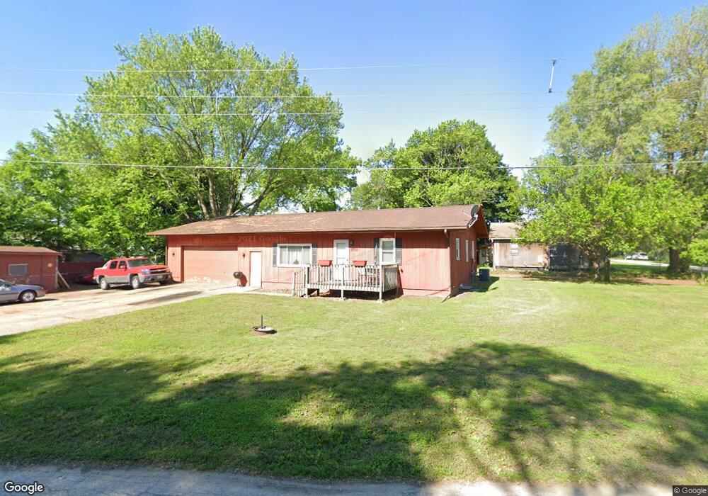
2708 Texas St Waterloo, IA 50702
Estimated Value: $152,000 - $185,000
3
Beds
2
Baths
1,224
Sq Ft
$133/Sq Ft
Est. Value
About This Home
This home is located at 2708 Texas St, Waterloo, IA 50702 and is currently estimated at $162,755, approximately $132 per square foot. 2708 Texas St is a home located in Black Hawk County with nearby schools including Kittrell Elementary School, Hoover Middle School, and West High School.
Ownership History
Date
Name
Owned For
Owner Type
Purchase Details
Closed on
Nov 9, 2007
Sold by
Droste Steven N and Droste Roxanne R
Bought by
Nuhanovic Aida
Current Estimated Value
Home Financials for this Owner
Home Financials are based on the most recent Mortgage that was taken out on this home.
Original Mortgage
$83,841
Outstanding Balance
$52,970
Interest Rate
6.44%
Mortgage Type
FHA
Estimated Equity
$109,785
Create a Home Valuation Report for This Property
The Home Valuation Report is an in-depth analysis detailing your home's value as well as a comparison with similar homes in the area
Home Values in the Area
Average Home Value in this Area
Purchase History
| Date | Buyer | Sale Price | Title Company |
|---|---|---|---|
| Nuhanovic Aida | $86,000 | Title Services |
Source: Public Records
Mortgage History
| Date | Status | Borrower | Loan Amount |
|---|---|---|---|
| Open | Nuhanovic Aida | $83,841 |
Source: Public Records
Tax History Compared to Growth
Tax History
| Year | Tax Paid | Tax Assessment Tax Assessment Total Assessment is a certain percentage of the fair market value that is determined by local assessors to be the total taxable value of land and additions on the property. | Land | Improvement |
|---|---|---|---|---|
| 2025 | $1,950 | $98,720 | $12,210 | $86,510 |
| 2024 | $1,950 | $100,130 | $12,210 | $87,920 |
| 2023 | $1,988 | $100,130 | $12,210 | $87,920 |
| 2022 | $1,934 | $99,420 | $12,210 | $87,210 |
| 2021 | $2,086 | $99,420 | $12,210 | $87,210 |
| 2020 | $2,048 | $100,680 | $6,110 | $94,570 |
| 2019 | $2,048 | $100,680 | $6,110 | $94,570 |
| 2018 | $2,050 | $100,680 | $6,110 | $94,570 |
| 2017 | $2,116 | $100,680 | $6,110 | $94,570 |
| 2016 | $2,086 | $100,680 | $6,110 | $94,570 |
| 2015 | $2,086 | $100,680 | $6,110 | $94,570 |
| 2014 | $2,126 | $100,680 | $6,110 | $94,570 |
Source: Public Records
Map
Nearby Homes
- 1309 Sheffield Ave
- 1933 Plymouth Ave
- 1742 Howard Ave
- 5599 Washington St
- Lot 1 Crossroads Blvd
- Lot 4 Crossroads Blvd
- Lot 3 Crossroads Blvd
- 1832 Patton Ave
- 1739 Patton Ave
- 444 Gladys St
- 406-408 Gladys St
- 1124 Oleson Rd
- 3420 Crown Ct Unit 3420
- 1664 Hawthorne Ave
- 1119 Kaplan Dr
- Lot 5 Crossroads
- 1727 Forest Ave
- Lot 6 Crossroads
- 1445 Hammond Ave
- 1201 Lyon Ave
- 2086 Locke Ave
- 2080 Locke Ave
- 2071 Howard Ave
- 2074 Locke Ave
- 2070 Locke Ave
- 2064 Locke Ave
- 2063 Howard Ave
- 2057 Howard Ave
- 2084 Howard Ave
- 1204 Sheffield Ave
- 2072 Howard Ave
- 2612 Texas St
- 1219 Sheffield Ave
- 1221 Sheffield Ave
- 1227 Sheffield Ave
- 1245 Sheffield Ave
- 2920 Texas St
- 2201 Easton Ave
- 1139 Sheffield Ave
- 2035 Plymouth Ave