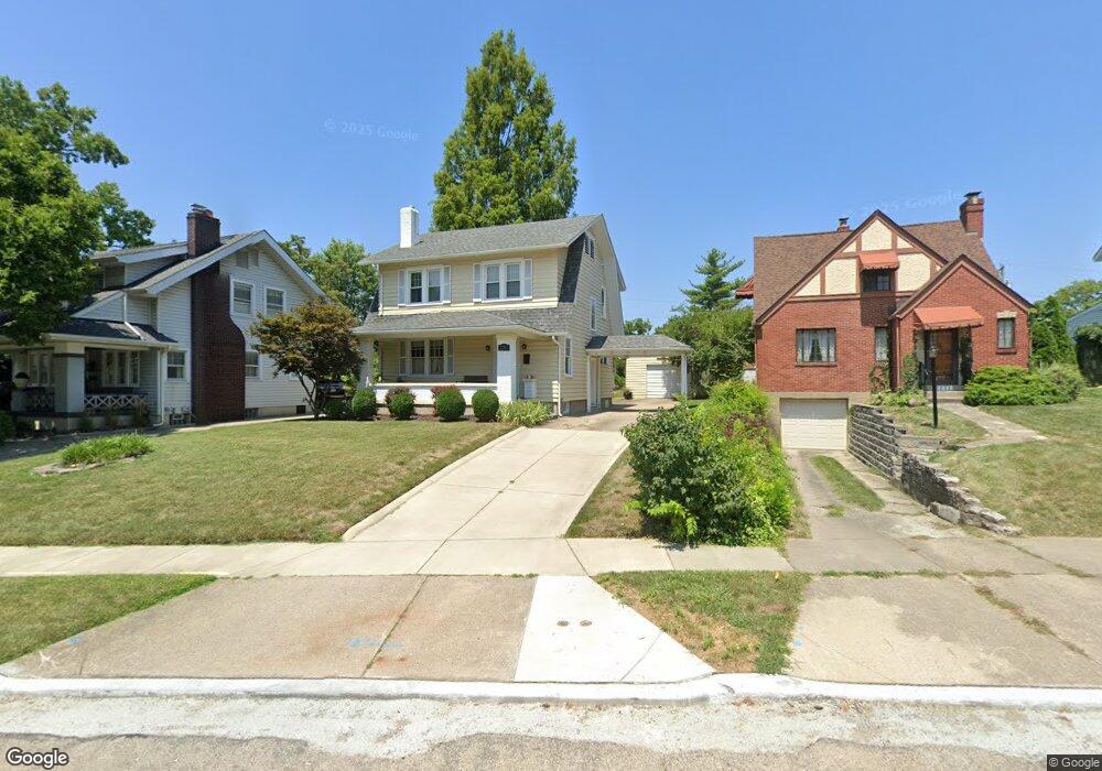
2709 Flemming Rd Middletown, OH 45042
Sunset-Park Place NeighborhoodEstimated Value: $226,970 - $279,000
3
Beds
1
Bath
1,806
Sq Ft
$138/Sq Ft
Est. Value
About This Home
This home is located at 2709 Flemming Rd, Middletown, OH 45042 and is currently estimated at $249,743, approximately $138 per square foot. 2709 Flemming Rd is a home located in Butler County with nearby schools including Wildwood Elementary School, Highview 6th Grade Center, and Middletown Middle School.
Ownership History
Date
Name
Owned For
Owner Type
Purchase Details
Closed on
Dec 30, 2009
Sold by
Overstreet Donald W and Overstreet Kathy L
Bought by
Moore Brandie
Current Estimated Value
Home Financials for this Owner
Home Financials are based on the most recent Mortgage that was taken out on this home.
Original Mortgage
$123,717
Outstanding Balance
$79,460
Interest Rate
4.84%
Mortgage Type
FHA
Estimated Equity
$170,283
Purchase Details
Closed on
Jun 14, 1994
Sold by
Mcnutt Timothy
Bought by
Donald W Overstreet
Home Financials for this Owner
Home Financials are based on the most recent Mortgage that was taken out on this home.
Original Mortgage
$89,300
Interest Rate
8.45%
Mortgage Type
New Conventional
Create a Home Valuation Report for This Property
The Home Valuation Report is an in-depth analysis detailing your home's value as well as a comparison with similar homes in the area
Home Values in the Area
Average Home Value in this Area
Purchase History
| Date | Buyer | Sale Price | Title Company |
|---|---|---|---|
| Moore Brandie | $126,000 | Attorney | |
| Donald W Overstreet | $94,000 | -- |
Source: Public Records
Mortgage History
| Date | Status | Borrower | Loan Amount |
|---|---|---|---|
| Open | Moore Brandie | $123,717 | |
| Previous Owner | Donald W Overstreet | $89,300 |
Source: Public Records
Tax History
| Year | Tax Paid | Tax Assessment Tax Assessment Total Assessment is a certain percentage of the fair market value that is determined by local assessors to be the total taxable value of land and additions on the property. | Land | Improvement |
|---|---|---|---|---|
| 2025 | $3,210 | $62,140 | $8,790 | $53,350 |
| 2024 | $3,210 | $62,140 | $8,790 | $53,350 |
| 2023 | $3,191 | $62,140 | $8,790 | $53,350 |
| 2022 | $2,427 | $41,760 | $8,790 | $32,970 |
| 2021 | $2,334 | $41,760 | $8,790 | $32,970 |
| 2020 | $2,431 | $41,760 | $8,790 | $32,970 |
| 2019 | $2,300 | $31,740 | $8,990 | $22,750 |
| 2018 | $2,002 | $31,740 | $8,990 | $22,750 |
| 2017 | $2,006 | $31,740 | $8,990 | $22,750 |
| 2016 | $1,809 | $27,410 | $8,990 | $18,420 |
| 2015 | $1,782 | $27,410 | $8,990 | $18,420 |
| 2014 | $2,304 | $27,410 | $8,990 | $18,420 |
| 2013 | $2,304 | $38,580 | $8,990 | $29,590 |
Source: Public Records
Map
Nearby Homes
- 2709 Elmo Place
- 608 Richardson Dr
- 308 Bellemonte St
- 2817 Moorman Place
- 611 Aberdeen Dr
- 705 Richardson Dr
- 2818 Shartle St
- 21 Kenwood Dr
- 2304 Flemming Rd
- 427 Mckinley St
- 2828 Shartle St
- 102 Franklin St
- 14 Santa fe Rd
- 2619 Central Ave
- 209 Monroe St
- 3108 Buttercup Ct
- 708 Auburn St
- 6800 Fielders Way
- 2119 Central Ave
- 3210 Wildwood Rd
- 2711 Flemming Rd
- 2801 Flemming Rd
- 2707 Flemming Rd
- 407 Glen Ln
- 409 Glen Ln
- 2803 Flemming Rd
- 2703 Flemming Rd
- 411 Glen Ln
- 2708 Elmo Place
- 2805 Flemming Rd
- 2714 Elmo Place
- 413 Glen Ln
- 2701 Flemming Rd
- 2807 Flemming Rd
- 318 Ardmore Dr
- 2708 Flemming Rd
- 415 Glen Ln
- 2706 Flemming Rd
- 316 Ardmore Dr
- 2800 Elmo Place
Your Personal Tour Guide
Ask me questions while you tour the home.