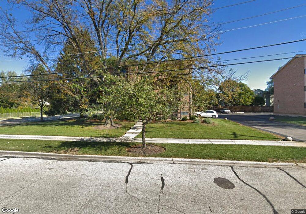
271 12th St Unit 7 Wheeling, IL 60090
Estimated Value: $178,000 - $184,500
2
Beds
--
Bath
6,156
Sq Ft
$30/Sq Ft
Est. Value
About This Home
This home is located at 271 12th St Unit 7, Wheeling, IL 60090 and is currently estimated at $182,125, approximately $29 per square foot. 271 12th St Unit 7 is a home located in Cook County with nearby schools including Eugene Field Elementary School, Jack London Middle School, and Wheeling High School.
Ownership History
Date
Name
Owned For
Owner Type
Purchase Details
Closed on
Oct 6, 2017
Sold by
Swanson Randall
Bought by
Swanson Randall D and Randall D Swanson Trust
Current Estimated Value
Purchase Details
Closed on
Jun 29, 1995
Sold by
R S Management Inc
Bought by
Swanson Randall
Home Financials for this Owner
Home Financials are based on the most recent Mortgage that was taken out on this home.
Original Mortgage
$48,000
Interest Rate
7.88%
Create a Home Valuation Report for This Property
The Home Valuation Report is an in-depth analysis detailing your home's value as well as a comparison with similar homes in the area
Home Values in the Area
Average Home Value in this Area
Purchase History
| Date | Buyer | Sale Price | Title Company |
|---|---|---|---|
| Swanson Randall D | -- | Attorney | |
| Swanson Randall | $60,000 | -- |
Source: Public Records
Mortgage History
| Date | Status | Borrower | Loan Amount |
|---|---|---|---|
| Closed | Swanson Randall | $48,000 |
Source: Public Records
Tax History
| Year | Tax Paid | Tax Assessment Tax Assessment Total Assessment is a certain percentage of the fair market value that is determined by local assessors to be the total taxable value of land and additions on the property. | Land | Improvement |
|---|---|---|---|---|
| 2025 | $3,914 | $14,695 | $2,131 | $12,564 |
| 2024 | $3,914 | $11,679 | $1,775 | $9,904 |
| 2023 | $3,733 | $11,679 | $1,775 | $9,904 |
| 2022 | $3,733 | $11,679 | $1,775 | $9,904 |
| 2021 | $2,697 | $7,278 | $473 | $6,805 |
| 2020 | $2,626 | $7,278 | $473 | $6,805 |
| 2019 | $2,669 | $8,145 | $473 | $7,672 |
| 2018 | $2,239 | $6,135 | $414 | $5,721 |
| 2017 | $2,193 | $6,135 | $414 | $5,721 |
| 2016 | $1,214 | $6,135 | $414 | $5,721 |
| 2015 | $1,445 | $6,677 | $1,006 | $5,671 |
| 2014 | $2,569 | $9,958 | $1,006 | $8,952 |
| 2013 | $2,352 | $9,958 | $1,006 | $8,952 |
Source: Public Records
Map
Nearby Homes
- 271 Northgate Pkwy Unit 1B
- 195 7th St
- 429 6th St
- 28 Legacy Ln
- 45 Prairie Park Dr Unit 501
- 21 Northfield Terrace Unit 21
- 127 N Wolf Rd Unit 60A
- 40 Prairie Park Dr Unit 707
- 100 Deborah Ln Unit 16A
- 231 E Wayne Place
- 178 Cindy Ln Unit 2
- 665 Cindy Ln
- 115 E Dundee Rd Unit 3N
- 920 Valley Stream Dr
- 190 N Milwaukee Ave Unit 3604
- 302 Linden Ln
- 928 Woodland Dr
- 0 Prague Ave
- 274 Prairie View Ln
- 325 Shadowbend Dr Unit 3B
- 271 12th St Unit D
- 271 12th St Unit 7
- 271 12th St Unit 7
- 271 12th St Unit 7
- 271 12th St Unit 7
- 271 12th St Unit 7
- 267 12th St Unit D
- 267 12th St Unit A
- 267 12th St Unit 6
- 267 12th St Unit 6
- 267 12th St Unit 6
- 267 12th St Unit 6
- 267 12th St Unit 6
- 267 12th St Unit F
- 267 12th St Unit 6F
- 267 12th St Unit C
- 267 12th St Unit 6E
- 270 11th St
- 270 11th St
- 270 11th St