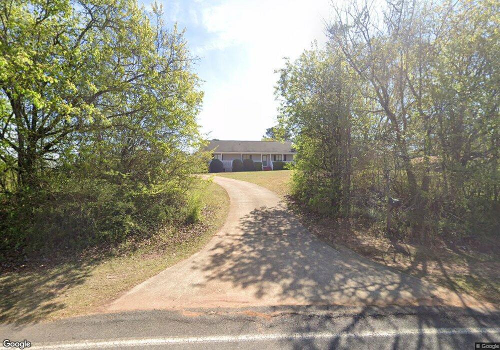
271 Abbottsford Rd Lagrange, GA 30240
Estimated Value: $186,000 - $287,000
3
Beds
2
Baths
1,456
Sq Ft
$157/Sq Ft
Est. Value
About This Home
This home is located at 271 Abbottsford Rd, Lagrange, GA 30240 and is currently estimated at $228,559, approximately $156 per square foot. 271 Abbottsford Rd is a home located in Troup County with nearby schools including Berta Weathersbee Elementary School, Whitesville Road Elementary School, and Long Cane Elementary School.
Ownership History
Date
Name
Owned For
Owner Type
Purchase Details
Closed on
Mar 1, 2005
Sold by
Jack P Brown
Bought by
Brown Jack P
Current Estimated Value
Purchase Details
Closed on
Dec 31, 2004
Sold by
Jack P Brown & Co Inc
Bought by
Brown Jack P
Purchase Details
Closed on
Jan 15, 2004
Sold by
Secretary Of Hud
Bought by
Jack P Brown & Co Inc
Purchase Details
Closed on
Jun 5, 2002
Sold by
Chase Manhattan Mortgage
Bought by
Secretary Of Hud
Purchase Details
Closed on
Jun 4, 2002
Sold by
Debbie Kenneth R and Debbie Smith
Bought by
Chase Manhattan Mortgage
Purchase Details
Closed on
Jan 27, 1997
Sold by
Pilgrim Wm
Bought by
Debbie Kenneth R and Debbie Smith
Purchase Details
Closed on
Jan 21, 1997
Sold by
William Pilgrim
Bought by
Pilgrim Wm
Purchase Details
Closed on
Oct 31, 1994
Sold by
William N Pilgrim
Bought by
William Pilgrim
Create a Home Valuation Report for This Property
The Home Valuation Report is an in-depth analysis detailing your home's value as well as a comparison with similar homes in the area
Purchase History
| Date | Buyer | Sale Price | Title Company |
|---|---|---|---|
| Brown Jack P | -- | -- | |
| Brown Jack P | -- | -- | |
| Jack P Brown & Co Inc | $53,000 | -- | |
| Secretary Of Hud | $69,000 | -- | |
| Chase Manhattan Mortgage | $69,000 | -- | |
| Debbie Kenneth R | -- | -- | |
| Pilgrim Wm | -- | -- | |
| William Pilgrim | -- | -- |
Source: Public Records
Tax History
| Year | Tax Paid | Tax Assessment Tax Assessment Total Assessment is a certain percentage of the fair market value that is determined by local assessors to be the total taxable value of land and additions on the property. | Land | Improvement |
|---|---|---|---|---|
| 2025 | $1,555 | $57,000 | $4,800 | $52,200 |
| 2024 | $1,321 | $48,440 | $4,800 | $43,640 |
| 2023 | $1,140 | $41,800 | $4,800 | $37,000 |
| 2022 | $1,102 | $39,480 | $4,800 | $34,680 |
| 2021 | $1,133 | $37,560 | $4,400 | $33,160 |
| 2020 | $1,133 | $37,560 | $4,400 | $33,160 |
| 2019 | $1,041 | $34,520 | $4,400 | $30,120 |
| 2018 | $958 | $31,760 | $4,400 | $27,360 |
| 2017 | $958 | $31,760 | $4,400 | $27,360 |
| 2016 | $937 | $31,062 | $4,428 | $26,634 |
| 2015 | $938 | $31,062 | $4,428 | $26,634 |
| 2014 | $898 | $29,660 | $4,428 | $25,232 |
| 2013 | -- | $31,563 | $4,428 | $27,135 |
Source: Public Records
Map
Nearby Homes
- 524 Williams Rd
- 511 Williams Rd
- 108 Stonebridge Ln
- 205 Long Cove Dr
- 163 Terri Rd
- 780 Sharman Rd
- 0 Leisure Cove Dr Unit 10619411
- 1100 County Road 442
- 15 Williams Ct
- 201 Lakeview Ct
- 109 Riverbluff Dr
- 101 Riverbluff Dr
- 106 Landings Way
- 104 Landings Way
- 226 Linda Ln
- 213 Linda Ln
- 40 River Point Dr
- 474 Newton Rd
- 104 Dogwood Point
- 104 Hidden Springs Dr
- 289 Abbottsford Rd
- 219 Abbottsford Rd
- 307 Abbottsford Rd
- 278 Abbottsford Rd
- 220 Abbottsford Rd
- 198 Thompson Rd
- 349 Abbottsford Rd
- 137 Abbottsford Rd
- 126 Abbottsford Rd
- 78 Thompson Rd
- 189 Thompson Rd
- 169 Thompson Rd
- 115 Abbottsford Rd
- 5511 Roanoke Rd
- 269 Thompson Rd
- 87 Abbottsford Rd
- 131 Thompson Rd
- 410 Abbottsford Rd
- 5375 Roanoke Rd
- 5525 Roanoke Rd
Your Personal Tour Guide
Ask me questions while you tour the home.